MyTopo
Brookville Pennsylvania US Topo Map
Couldn't load pickup availability
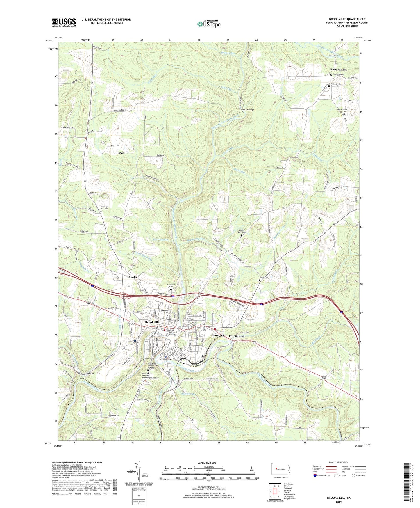
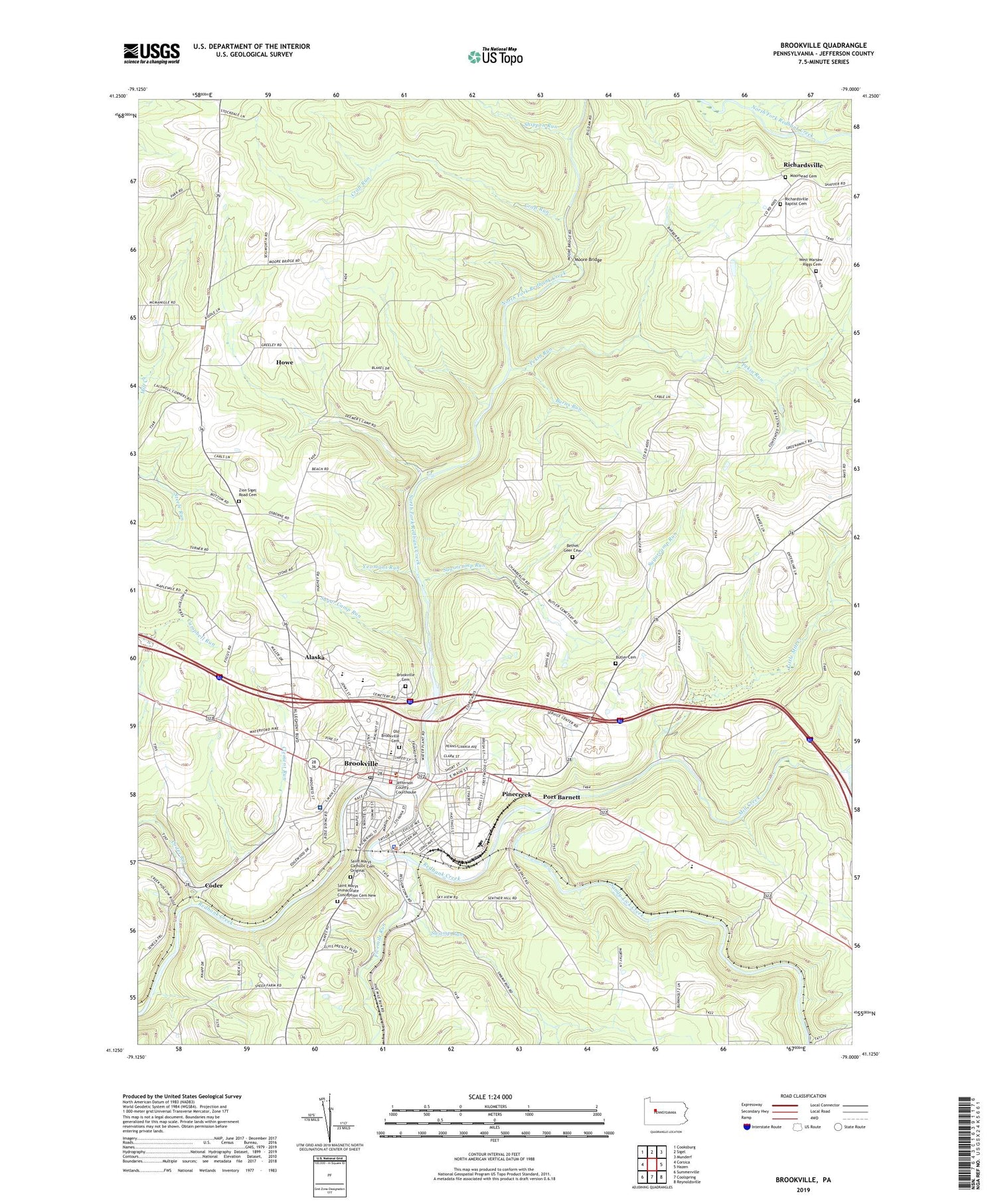
2019 topographic map quadrangle Brookville in the state of Pennsylvania. Scale: 1:24000. Based on the newly updated USGS 7.5' US Topo map series, this map is in the following counties: Jefferson. The map contains contour data, water features, and other items you are used to seeing on USGS maps, but also has updated roads and other features. This is the next generation of topographic maps. Printed on high-quality waterproof paper with UV fade-resistant inks.
Quads adjacent to this one:
West: Corsica
Northwest: Cooksburg
North: Sigel
Northeast: Munderf
East: Hazen
Southeast: Reynoldsville
South: Coolspring
Southwest: Summerville
Contains the following named places: Alaska, Bethel Church, Bethel Geer Cemetery, Borough of Brookville, Brookville, Brookville Borough Police Department, Brookville Cemetery, Brookville Hospital, Brookville Junior Senior High School, Brookville Post Office, Brookville Reservoir, Brookville Volunteer Fire Company Station 2, Brookville Waterworks Dam, Burns Run, Butler Cemetery, Calvary Church, Clement Run, Coder, Coder Run, Craft Run, Crate School, Fivemile Run, Free Church, Grace Church, Green School, Hall School, Hickory Grove Elementary School, Howe, Jefferson County EMS Station 90, Jefferson County Sheriff's Office, Kirkman Church, Laurel Run, Little Mill Creek, Longview School, Matthews School, Mill Creek, Miller School, Moore Bridge, Moorhead Cemetery, North Fork Redbank Creek, Northside East School, Northside West School, Oaks School, Old Brookville Cemetery, Pekin Run, Pine Creek Volunteer Fire Department Station 10, Pinecreek, Pinecreek Elementary School, Port Barnett, Red Lick Run, Richardsville, Richardsville Baptist Cemetery, Russell School, Saint Marys Catholic Cemetery Original, Saint Marys Church, Saint Marys Immaculate Conception Cemetery New, Sandy Lick Creek, Shippen Run, South Bulgar, South Sulger, Steele Run, Sugar Camp Run, Sugarcamp Run, Swamp Run, Township of Pine Creek, Township of Rose, West Warsaw - Riggs Cemetery, Yeomans Run, Zion Church, Zion Sigel Road Cemetery, ZIP Code: 15825