MyTopo
Hazen Pennsylvania US Topo Map
Couldn't load pickup availability
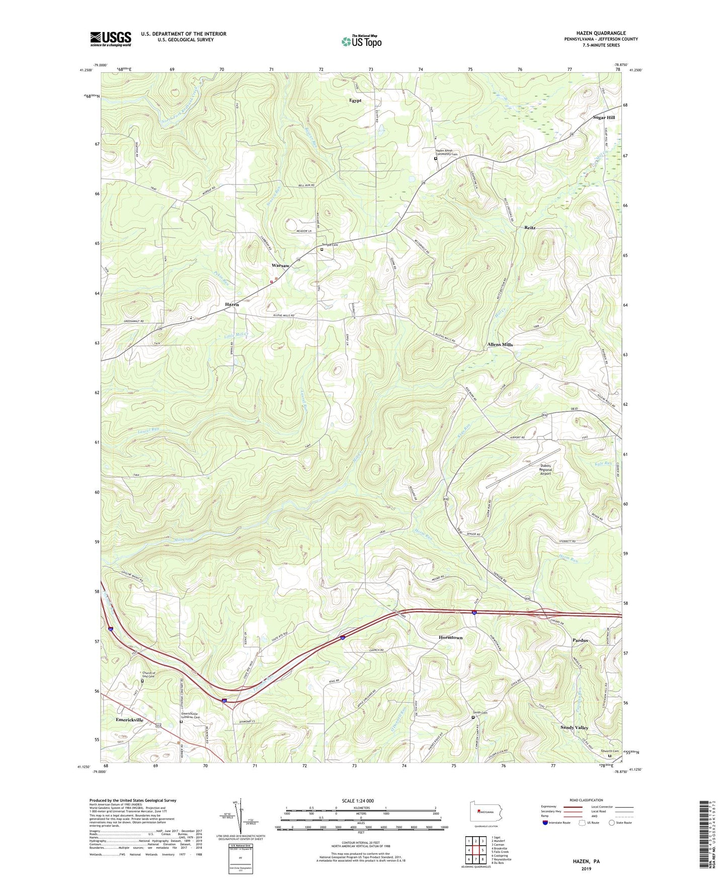
2023 topographic map quadrangle Hazen in the state of Pennsylvania. Scale: 1:24000. Based on the newly updated USGS 7.5' US Topo map series, this map is in the following counties: Jefferson. The map contains contour data, water features, and other items you are used to seeing on USGS maps, but also has updated roads and other features. This is the next generation of topographic maps. Printed on high-quality waterproof paper with UV fade-resistant inks.
Quads adjacent to this one:
West: Brookville
Northwest: Sigel
North: Munderf
Northeast: Carman
East: Falls Creek
Southeast: Du Bois
South: Reynoldsville
Southwest: Coolspring
This map covers the same area as the classic USGS quad with code o41078b8.
Contains the following named places: Allen School, Allen Station, Allens Mills, Beaver Run, Bower School, Britten School, Church of God Cemetery, Dubois Regional Airport, Egypt, Emerickville, Emerickville Lutheran Cemetery, Epworth Cemetery, Hazen, Hazen Amish Community Cemetery, Horm Run, Horm Run School, Hormtown, Jefferson County, Keys Run, Mason School, McAninch School, McIntosh School, Mile Hill School, Morrison School, North Sulger, Pardus, Raught School, Reitz, Saint Pauls Church, Sandy Valley, Sandy Valley Post Office, Smith Cemetery, Snyder School, Sugar Hill, Sugar Hill Station, Sulger, Temple Cemetery, Township of Warsaw, Warsaw, Warsaw School, Warsaw Township Volunteer Fire Company Station 15, Wray School