MyTopo
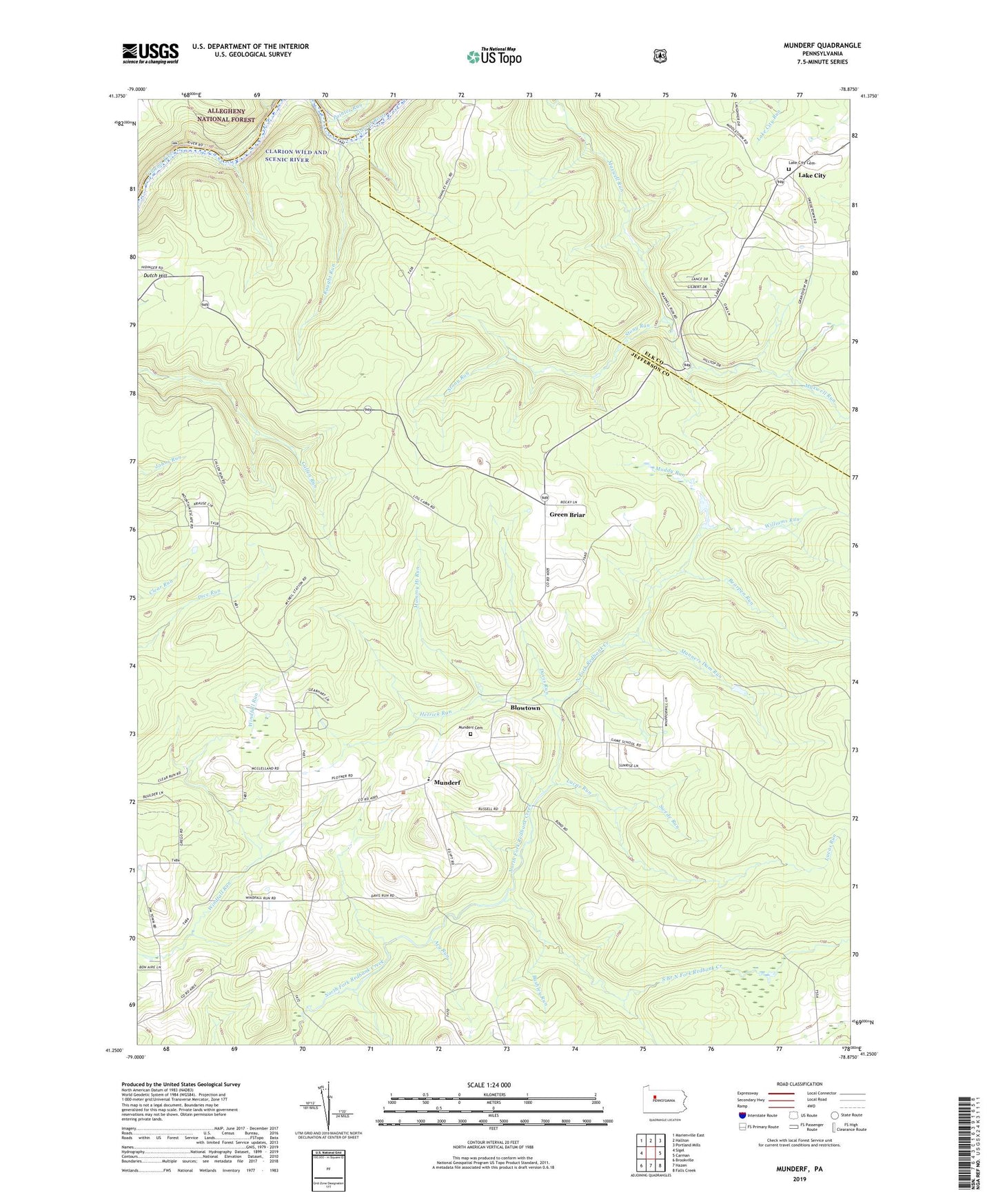
Munderf Pennsylvania US Topo Map
Couldn't load pickup availability
Also explore the Munderf Forest Service Topo of this same quad for updated USFS data
2023 topographic map quadrangle Munderf in the state of Pennsylvania. Scale: 1:24000. Based on the newly updated USGS 7.5' US Topo map series, this map is in the following counties: Jefferson, Elk. The map contains contour data, water features, and other items you are used to seeing on USGS maps, but also has updated roads and other features. This is the next generation of topographic maps. Printed on high-quality waterproof paper with UV fade-resistant inks.
Quads adjacent to this one:
West: Sigel
Northwest: Marienville East
North: Hallton
Northeast: Portland Mills
East: Carman
Southeast: Falls Creek
South: Hazen
Southwest: Brookville
This map covers the same area as the classic USGS quad with code o41078c8.
Contains the following named places: Acy Run, Bearpen Run, Beaver Meadow Run, Blowtown, Bushley Run, Callen Run Trail, Chicken Run, Clyde Run, Daugherty Run, Davis Run, Dixon Corner, Dutch Hill, Dutch Hill School, Green Briar, Hays Lookout Tower, Hetrick Run, Lake City, Lake City Cemetery, Lake City School, Lucas Run, Mammy Hi Run, Manners Dam Run, McFadden Trail, Muddy Run, Munderf, Munderf Cemetery, Munderf Trail, Painter Run, Raught Run, Schoffner Corner, Seneca Run, South Branch North Fork Redbank Creek, State Game Lands Number 54, Stony Run, Swede Run, Township of Polk, Truman Trail, Williams Run