MyTopo
Chaneysville Pennsylvania US Topo Map
Couldn't load pickup availability
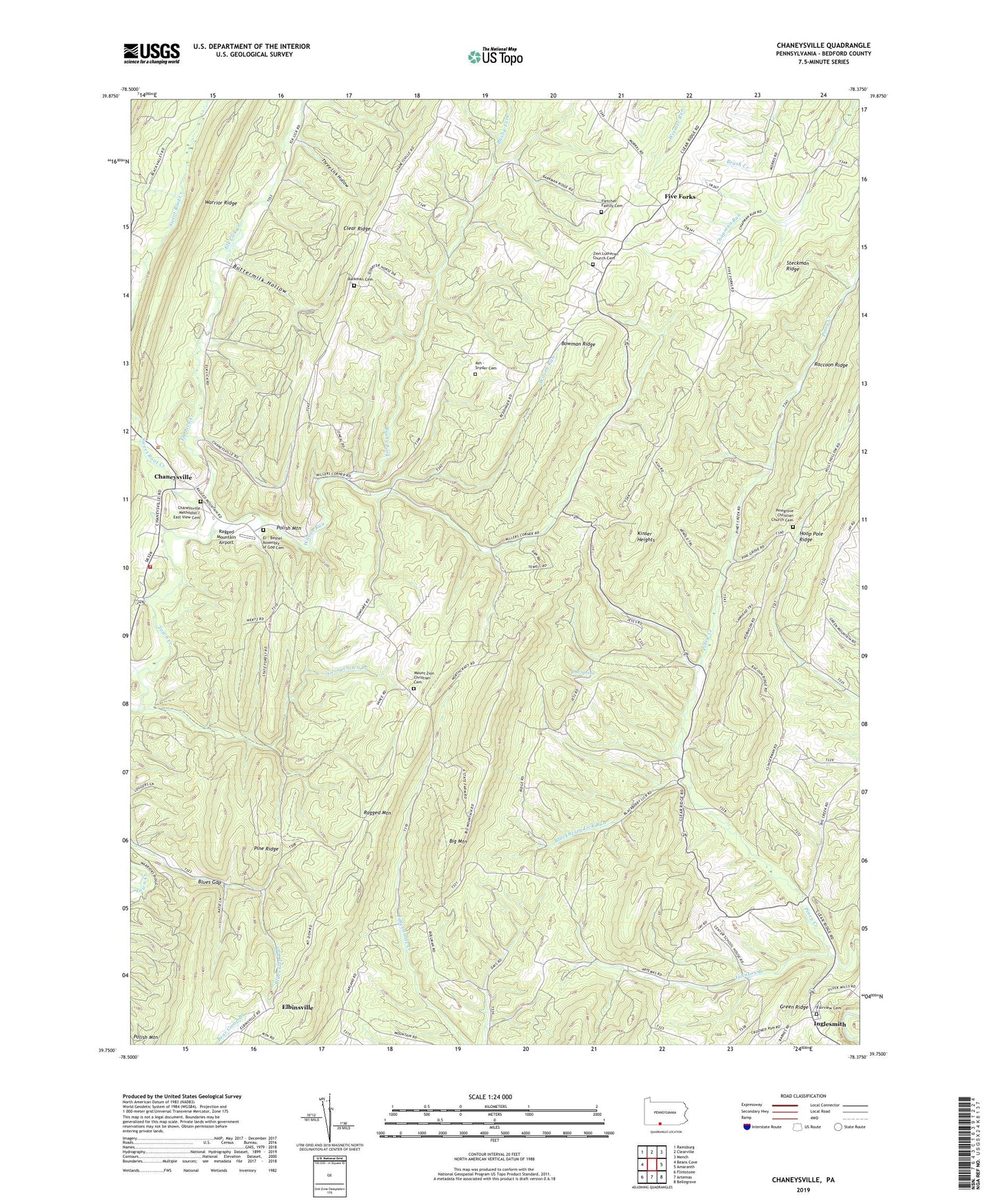
2019 topographic map quadrangle Chaneysville in the state of Pennsylvania. Scale: 1:24000. Based on the newly updated USGS 7.5' US Topo map series, this map is in the following counties: Bedford. The map contains contour data, water features, and other items you are used to seeing on USGS maps, but also has updated roads and other features. This is the next generation of topographic maps. Printed on high-quality waterproof paper with UV fade-resistant inks.
Quads adjacent to this one:
West: Beans Cove
Northwest: Rainsburg
North: Clearville
Northeast: Mench
East: Amaranth
Southeast: Bellegrove
South: Artemas
Southwest: Flintstone
Contains the following named places: Ash - Snyder Cemetery, Barkman Cemetery, Barkman School, Bethel Church, Big Mountain, Big Mountain Trail, Blackberry Lick Run, Blues Gap, Bowman Ridge, Bowman Ridge Trail, Bowman Trail, Browning Trail, Bushy Fork, Buttermilk Hollow, Center School, Chaneysville, Chaneysville Methodist Cemetery, Chaneysville Volunteer Fire Company - Station 39, Clear Ridge, Conrad School, Dickens Trail, El - Bethel Assembly of God Cemetery, Elbinsville, Elk Lick Creek, Fairview Cemetery, Fairview Church, Fisher Trail, Five Forks, Fletcher Family Cemetery, Fletcher School, Gabriel Trail, Georgetown Branch, Green Point, Heifer Lick Trail, Inglesmith, Johnson Branch, Kinser Heights, Lawhead Trail, Lebanon Church, Lester Trail, Millers Corners, Mount Zion, Mount Zion Christian Cemetery, Mount Zion Church, Parcell, Pennsylvania Conservation and Natural Resources District 2 Headquarters, Pine Grove Church, Pine Ridge, Pine Ridge Natural Area, Pinegrove Christian Church Cemetery, Piney Creek, Piney Lick School, Polish Mountain Trail, Ragged Mountain Airport, Ragged Mountain Trail, Red Pine Trail, Rob Spring, Roscoe Trail, Silas Trail, Smith Trail, Steckman Ridge, Stoney Lick School, Sweet Root Creek, Sweet Root Picnic Area, Sweet Root Run, Tewell Run, Three Lick Hollow, Township of Mann, Wilson Run, Zion Church, Zion Lutheran Church Cemetery, ZIP Codes: 15535, 17211