MyTopo
Rainsburg Pennsylvania US Topo Map
Couldn't load pickup availability
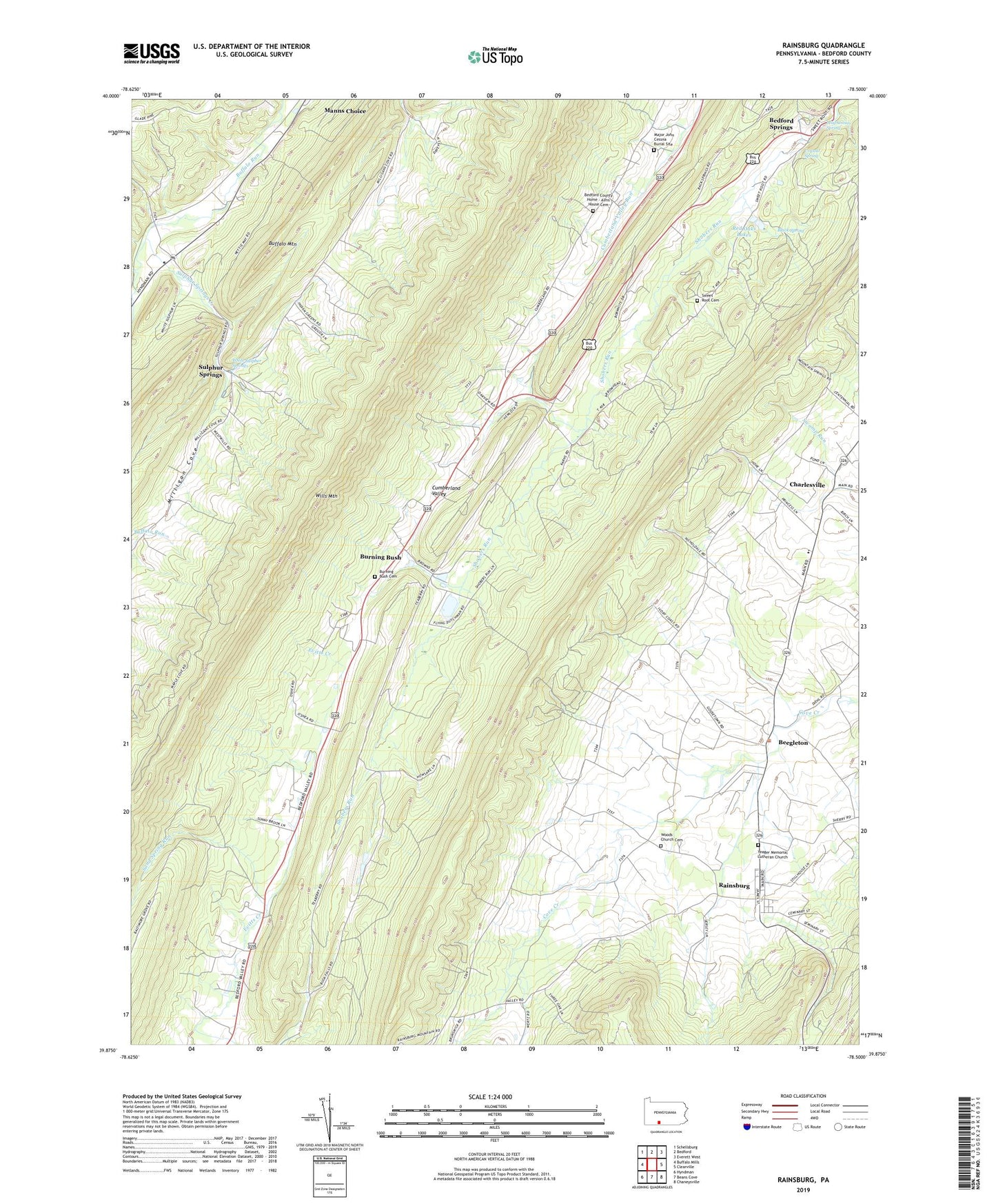
2023 topographic map quadrangle Rainsburg in the state of Pennsylvania. Scale: 1:24000. Based on the newly updated USGS 7.5' US Topo map series, this map is in the following counties: Bedford. The map contains contour data, water features, and other items you are used to seeing on USGS maps, but also has updated roads and other features. This is the next generation of topographic maps. Printed on high-quality waterproof paper with UV fade-resistant inks.
Quads adjacent to this one:
West: Buffalo Mills
Northwest: Schellsburg
North: Bedford
Northeast: Everett West
East: Clearville
Southeast: Chaneysville
South: Beans Cove
Southwest: Hyndman
This map covers the same area as the classic USGS quad with code o39078h5.
Contains the following named places: Bedford County Home Cemetery, Bedford Springs, Bedford Valley Church, Beegleton, Black Spring, Borough of Rainsburg, Burning Bush, Burning Bush Cemetery, Charlesville, Cove Church, Crystal Spring, Cumberland Valley, James School, Magnesium Spring, Major John Cessna Burial Site, McFerron School, Milligan Cove, Pender School, Rainsburg, Red Oaks Lakes, Sand Spring Run, Sulfur Springs Station, Sulphur Springs, Sulphur Springs Creek, Sulphur Springs Post Office, Sweet Root Cemetery, Teaberry School, Township of Colerain, Wertz School, White Sulpher Springs, Woods Church Cemetery, Yeager Church, Yeager Memorial Lutheran Church, ZIP Code: 15522