MyTopo
Clearfield Pennsylvania US Topo Map
Couldn't load pickup availability
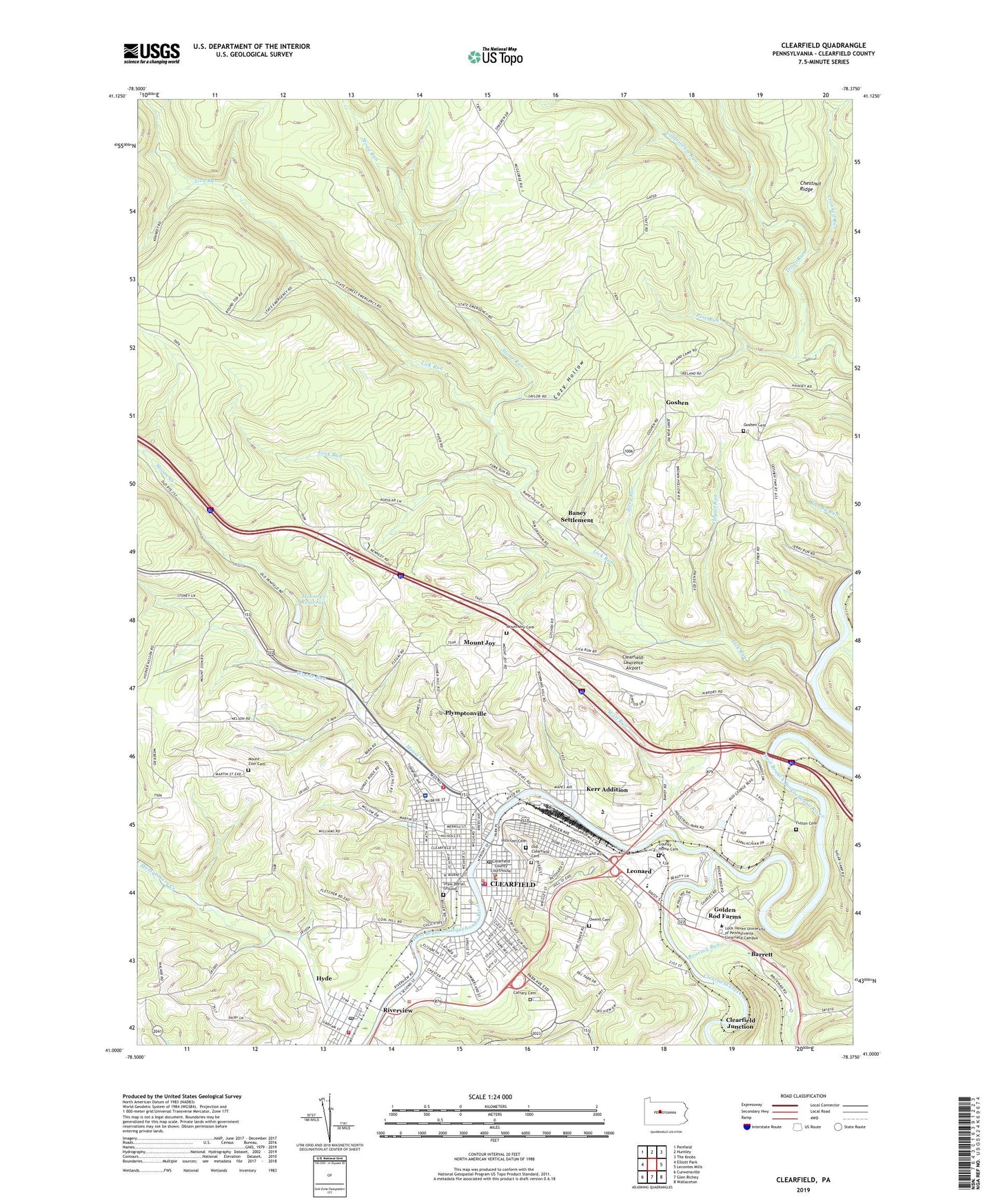
2019 topographic map quadrangle Clearfield in the state of Pennsylvania. Scale: 1:24000. Based on the newly updated USGS 7.5' US Topo map series, this map is in the following counties: Clearfield. The map contains contour data, water features, and other items you are used to seeing on USGS maps, but also has updated roads and other features. This is the next generation of topographic maps. Printed on high-quality waterproof paper with UV fade-resistant inks.
Quads adjacent to this one:
West: Elliott Park
Northwest: Penfield
North: Huntley
Northeast: The Knobs
East: Lecontes Mills
Southeast: Wallaceton
South: Glen Richey
Southwest: Curwensville
Contains the following named places: Baney Settlement, Barrett, Borough of Clearfield, Calvary Cemetery, Clearfield, Clearfield Area High School, Clearfield Area Middle School, Clearfield Borough Police Department, Clearfield County, Clearfield County Sheriff's Office, Clearfield Creek, Clearfield Emergency Medical Services - Station 1, Clearfield Junction, Clearfield Junior High School, Clearfield Post Office, Clearfield Volunteer Fire Department - Station 1, Clearfield-Lawrence Airport, Coldstream Run, County Home Cemetery, Cozy Hollow, Crooked Run, Devils Run, Flegals Run, Fork Run, Fourth Ward School, Fulton Cemetery, Golden Rod Farms, Goshen, Goshen Cemetery, Goshen Church, Goshen School, Hillcrest Cemetery, Hillsdale School, Hyde, Hyde Census Designated Place, Hyde Post Office, Hyde Volunteer Fire Company Station 6, Jerry Run, Kerr Addition, Lawrence Township Volunteer Fire Company Station 5, Leonard, Leonard Elementary School, Lick Run, Montgomery Creek, Moose Creek, Moose Creek Reservoir, Moose Creek Reservoir Dam, Mount Joy, Mount Joy Cemetery, Mount Zion, Mount Zion Cemetery, Old Clearfield Cemetery, Owens Cemetery, Paradise, Penn Highlands Clearfield Hospital, Pine Run, Plymptonville, Plymptonville Census Designated Place, Plymptonville Elementary School, Plymtonville, Riverview, Roaring Run, Saint Francis School, Shaw Burial Ground, State Game Lands Number 90, Stone Run, Third Ward Elementary School, Third Ward Hose Company, Third Ward School, Township of Lawrence, WCPA-AM (Clearfield), Williams Dale School, Wolf Run, Wolf Run School, Woods Run, WPSX-TV (Clearfield), WQYX-FM (Clearfield), ZIP Codes: 16830, 16843