MyTopo
Glen Richey Pennsylvania US Topo Map
Couldn't load pickup availability
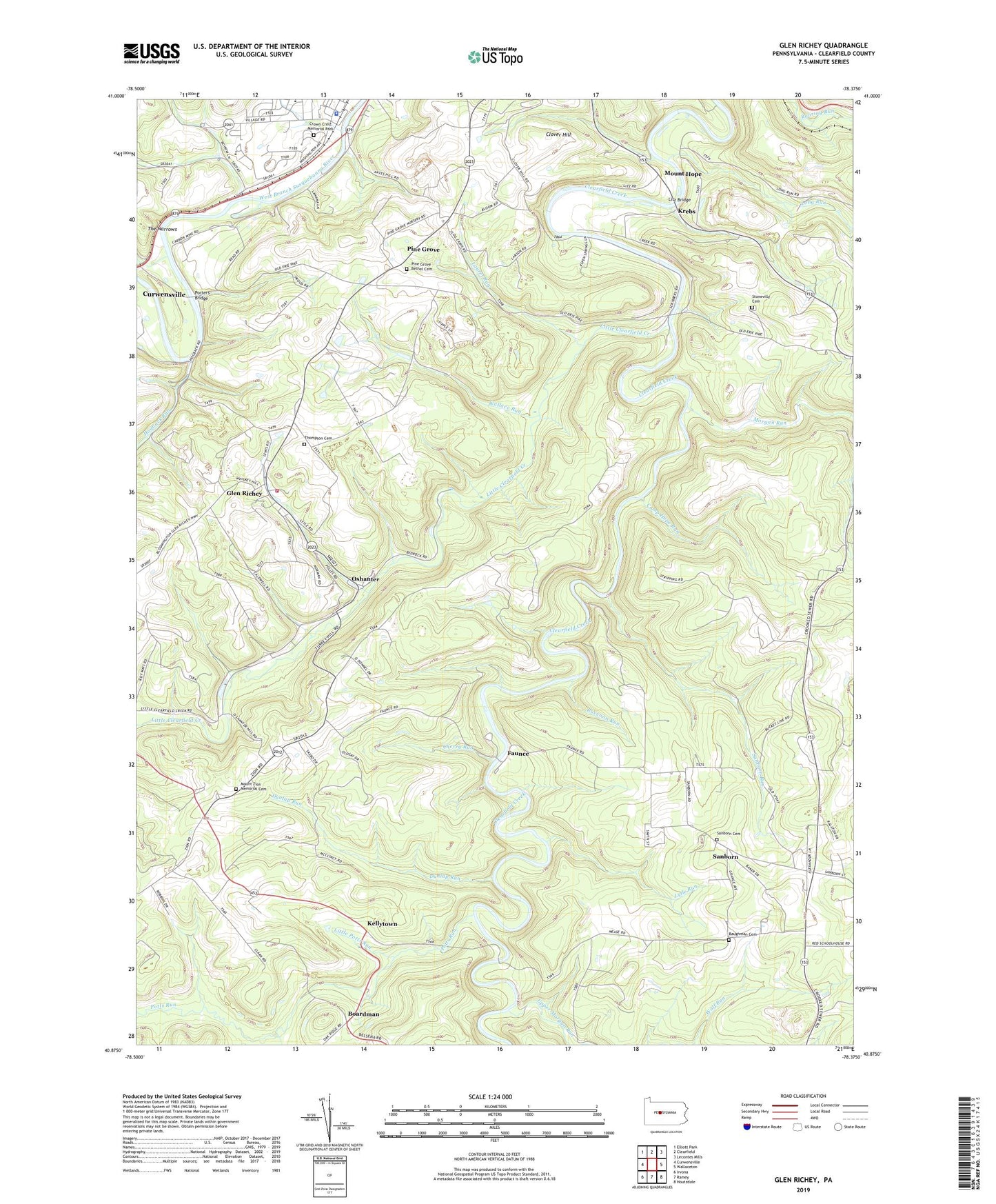
2023 topographic map quadrangle Glen Richey in the state of Pennsylvania. Scale: 1:24000. Based on the newly updated USGS 7.5' US Topo map series, this map is in the following counties: Clearfield. The map contains contour data, water features, and other items you are used to seeing on USGS maps, but also has updated roads and other features. This is the next generation of topographic maps. Printed on high-quality waterproof paper with UV fade-resistant inks.
Quads adjacent to this one:
West: Curwensville
Northwest: Elliott Park
North: Clearfield
Northeast: Lecontes Mills
East: Wallaceton
Southeast: Houtzdale
South: Ramey
Southwest: Irvona
This map covers the same area as the classic USGS quad with code o40078h4.
Contains the following named places: Baughman Cemetery, Believers Tabernacle Apostolic Church, Bethlehem School, Boardman, Camp Hope Run, Centre Grove Church, Centre School, Cherry Run, Clearfield and Curwensville Country Club, Clearfield Area High School, Clover Hill, Crown Crest Memorial Park, Develing, Dimeling, Dunlap Run, Evergreen School, Faunce, Glen Richey, Hartshorn Run, Hogback Run, Jeffries, Jeffries Church, Jeffries School, Kellytown, Krebs, Laurel Run, Lawrence Township Police Department, Lawrence Township Volunteer Fire Company Station 7, Little Clearfield Creek, Little Potts Run, Litz Bridge, Long Run, Lytle Run, Mitchells, Morgan Run, Mount Hope, Mount Zion Memorial Cemetery, Mount Zion Methodist Church, New Birth Church, Oshaniter Post Office, Oshanter, Pine Grove, Pine Grove Bethel Cemetery, Pleasant Ridge School, Porters Bridge, Potts Run, Raccoon Run, Sanborn, Sanborn Cemetery, Sanborn Church of God, Sanborn Run, Sanborn United Methodist Church, Stoneville Cemetery, Stonville, Susquehanna Bridge, The Narrows, Thompson Cemetery, Township of Knox, Turkey Hill School, Upper Morgan Run, Wallace Run, ZIP Codes: 16837, 16855, 16863