MyTopo
Curwensville Pennsylvania US Topo Map
Couldn't load pickup availability
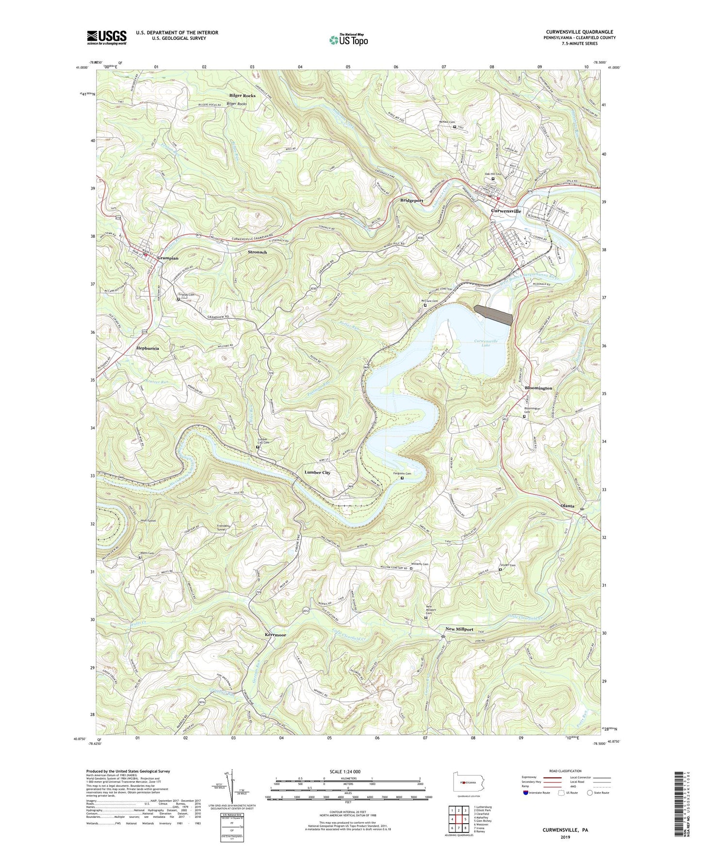
2023 topographic map quadrangle Curwensville in the state of Pennsylvania. Scale: 1:24000. Based on the newly updated USGS 7.5' US Topo map series, this map is in the following counties: Clearfield. The map contains contour data, water features, and other items you are used to seeing on USGS maps, but also has updated roads and other features. This is the next generation of topographic maps. Printed on high-quality waterproof paper with UV fade-resistant inks.
Quads adjacent to this one:
West: Mahaffey
Northwest: Luthersburg
North: Elliott Park
Northeast: Clearfield
East: Glen Richey
Southeast: Ramey
South: Irvona
Southwest: Westover
This map covers the same area as the classic USGS quad with code o40078h5.
Contains the following named places: Anderson Creek, B and W Junction Station, Belfast Number 2 Mine Station, Benjamin Number 7 Mine Station, Big Run, Bilger Rocks, Bilger Run, Bloomington, Bloomington Cemetery, Borough of Curwensville, Borough of Grampian, Borough of Lumber City, Bridgeport, Caldwell School, Campbell Run, Carson Run, CB Junction Station, Curry School, Curwensville, Curwensville Dam, Curwensville Lake, Curwensville Post Office, Curwensville Rescue Hose and Ladder Ambulance Service, Curwensville Rescue Hose and Ladder Fire Company, Curwensville State Park, Fenton Run, Ferguson Cemetery, Friends Cemetery, Friendship Tunnel, Gazzam Run, Good, Grampian, Grampian - Penn - Bloom Volunteer Fire Company Station 9, Grampian Post Office, Grandview Golf Course, Hepburnia, Hiles Run, Hoyt Tunnel, Hughey Run, Irvin Park, Kerrmoor, Kratzer Run, Locust Ridge School, Lumber City, Lumber City Cemetery, McClure Cemetery, McNaul Cemetery, Millikens Station, New Millport, New Millport Cemetery, New Millport Post Office, Oak Hill Cemetery, Oakland School, Olanta, Olanta Post Office, Passmore Run, Porter Run, Rowles, Rowles Station, Salem Church, Shannon Smokeless Mine Station, Snyder Cemetery, Stronach, Summit Ridge School, Township of Ferguson, Township of Pike, Watts Cemetery, Watts Creek, Williams Cemetery, Zion Church, ZIP Code: 16833