MyTopo
Lecontes Mills Pennsylvania US Topo Map
Couldn't load pickup availability
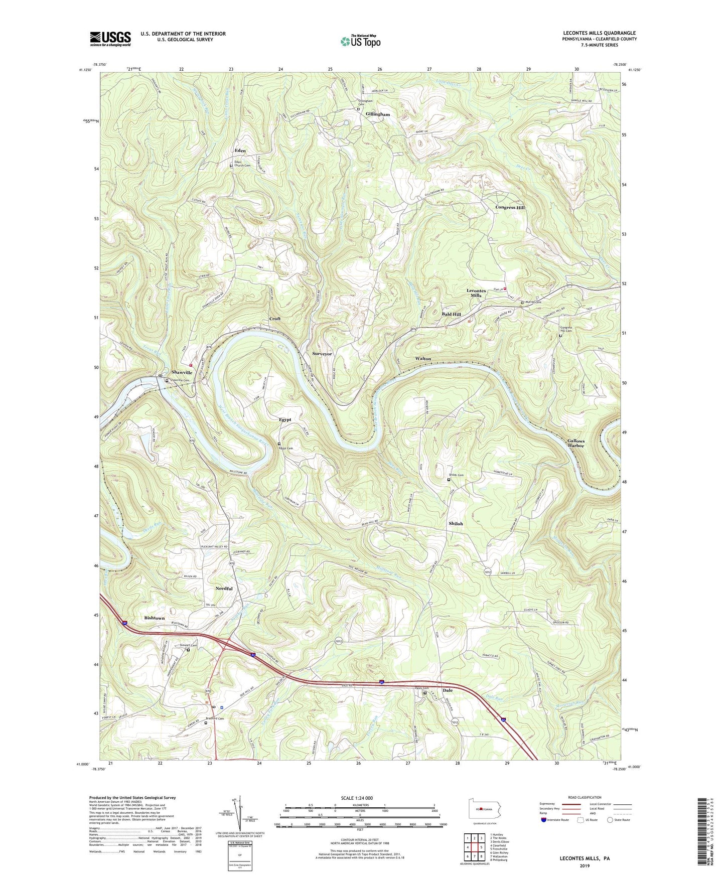
2023 topographic map quadrangle Lecontes Mills in the state of Pennsylvania. Scale: 1:24000. Based on the newly updated USGS 7.5' US Topo map series, this map is in the following counties: Clearfield. The map contains contour data, water features, and other items you are used to seeing on USGS maps, but also has updated roads and other features. This is the next generation of topographic maps. Printed on high-quality waterproof paper with UV fade-resistant inks.
Quads adjacent to this one:
West: Clearfield
Northwest: Huntley
North: The Knobs
Northeast: Devils Elbow
East: Frenchville
Southeast: Philipsburg
South: Wallaceton
Southwest: Glen Richey
This map covers the same area as the classic USGS quad with code o41078a3.
Contains the following named places: Abes Run, Bald Hill, Bald Hill Run, Bald Hill Station, Bear Run, Bishtown, Bloody Run, Bradford Cemetery, Bradford Church, Congress Hill, Congress Hill Cemetery, Congress Hill School, Coudley, Croft, Dale, Dale Church, Dale Run, Dale School, Dales Cemetery, Eden, Eden Church Cemetery, Egypt, Egypt Cemetery, Egypt Church, Gallows Harbor, Gillingham, Gillingham Cemetery, Girard Elementary School, Goshen Elementary School, Goshen Township Volunteer Fire Company Station 44, Gray, Hamilton Heliport, Independence School, Jackson School, Lecontes Mills, Lecontes Mills Volunteer Fire Company Station 21, Little Deer Creek, Little Surveyor Run, Little Trout Run, Millstone Run, Moravian Run, Mount Sinai School, Murray Cemetery, Needful, Pennsylvania State Police Troop C Clearfield Station, Pleasant Hill School, Pleasant Valley Church, Shawviille Post Office, Shawville, Shawville Cemetery, Shiloh, Shiloh Cemetery, Stewart Cemetery, Stump Lick Run, Sulphur Run, Surveyor, Surveyor Run, Township of Bradford, Trout Run, Walton, Watson School, Woodland Post Office, ZIP Code: 16881