MyTopo
Coalport Pennsylvania US Topo Map
Couldn't load pickup availability
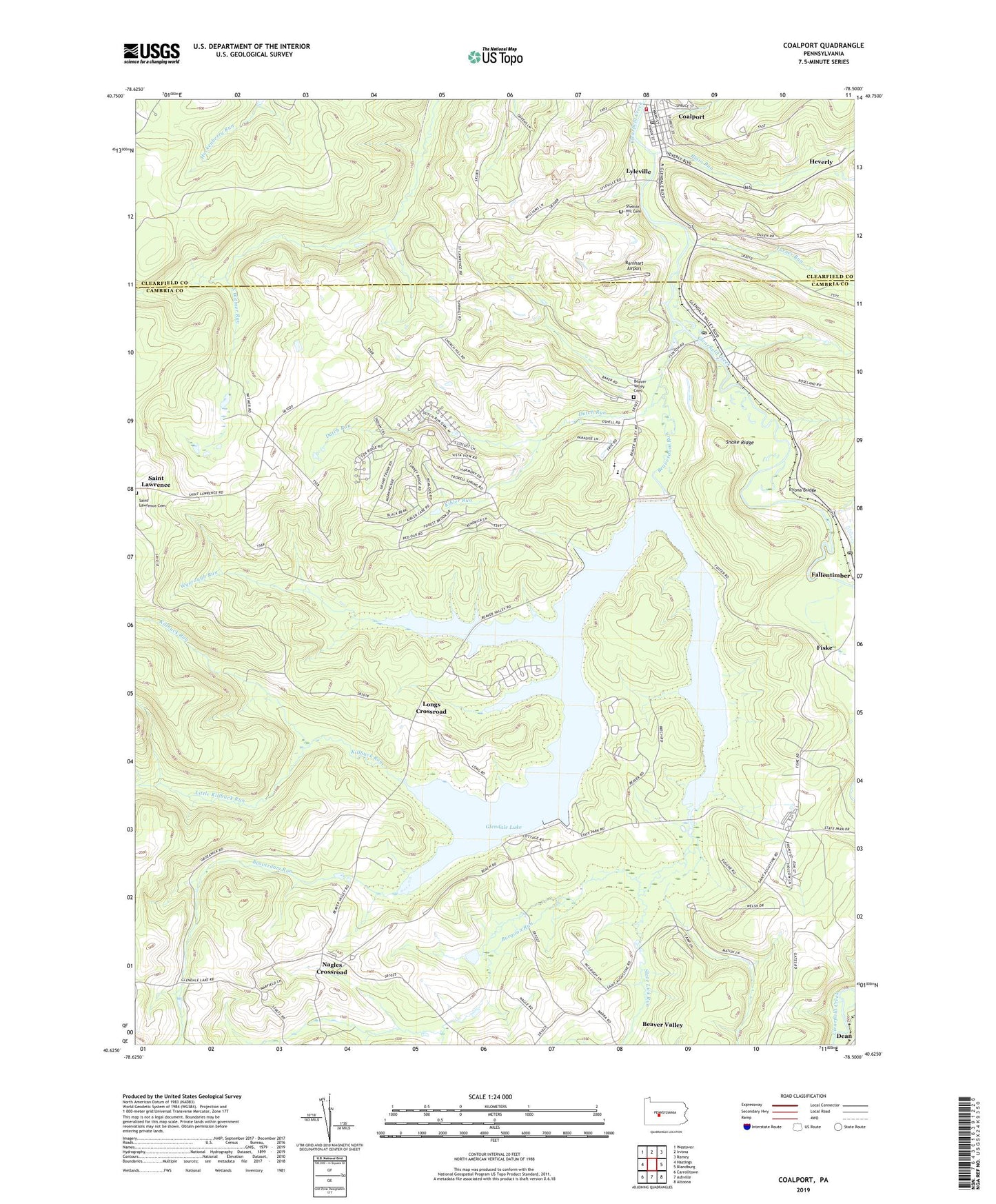
2023 topographic map quadrangle Coalport in the state of Pennsylvania. Scale: 1:24000. Based on the newly updated USGS 7.5' US Topo map series, this map is in the following counties: Cambria, Clearfield. The map contains contour data, water features, and other items you are used to seeing on USGS maps, but also has updated roads and other features. This is the next generation of topographic maps. Printed on high-quality waterproof paper with UV fade-resistant inks.
Quads adjacent to this one:
West: Hastings
Northwest: Westover
North: Irvona
Northeast: Ramey
East: Blandburg
Southeast: Altoona
South: Ashville
Southwest: Carrolltown
This map covers the same area as the classic USGS quad with code o40078f5.
Contains the following named places: Barnhart Airport, Beaver Valley, Beaver Valley Cemetery, Beaverdam Run, Blain Run, Borough of Coalport, Burgoon Run, Coalport, Coalport Post Office, Dutch Run, Fallentimber Post Office, Fiske, Flinton, Flinton Post Office, Glendale Dam, Glendale Lake, Glendale Volunteer Fire Department Engine Company Station 28, Heverly, Irvona Bridge, Kibler Run, Killbuck Run, Little Killbuck Run, Longs Crossroad, Lyleville, Nagles Crossroad, Prince Gallitzin State Park, Saint Lawrence Cemetery, Shelton Hill Cemetery, Slate Lick Run, Snake Ridge, State Game Lands Number 108, State Game Lands Number 120, Township of Chest, Township of White, Turner Run, Wyerough Run, ZIP Codes: 16640, 16668