MyTopo
Westover Pennsylvania US Topo Map
Couldn't load pickup availability
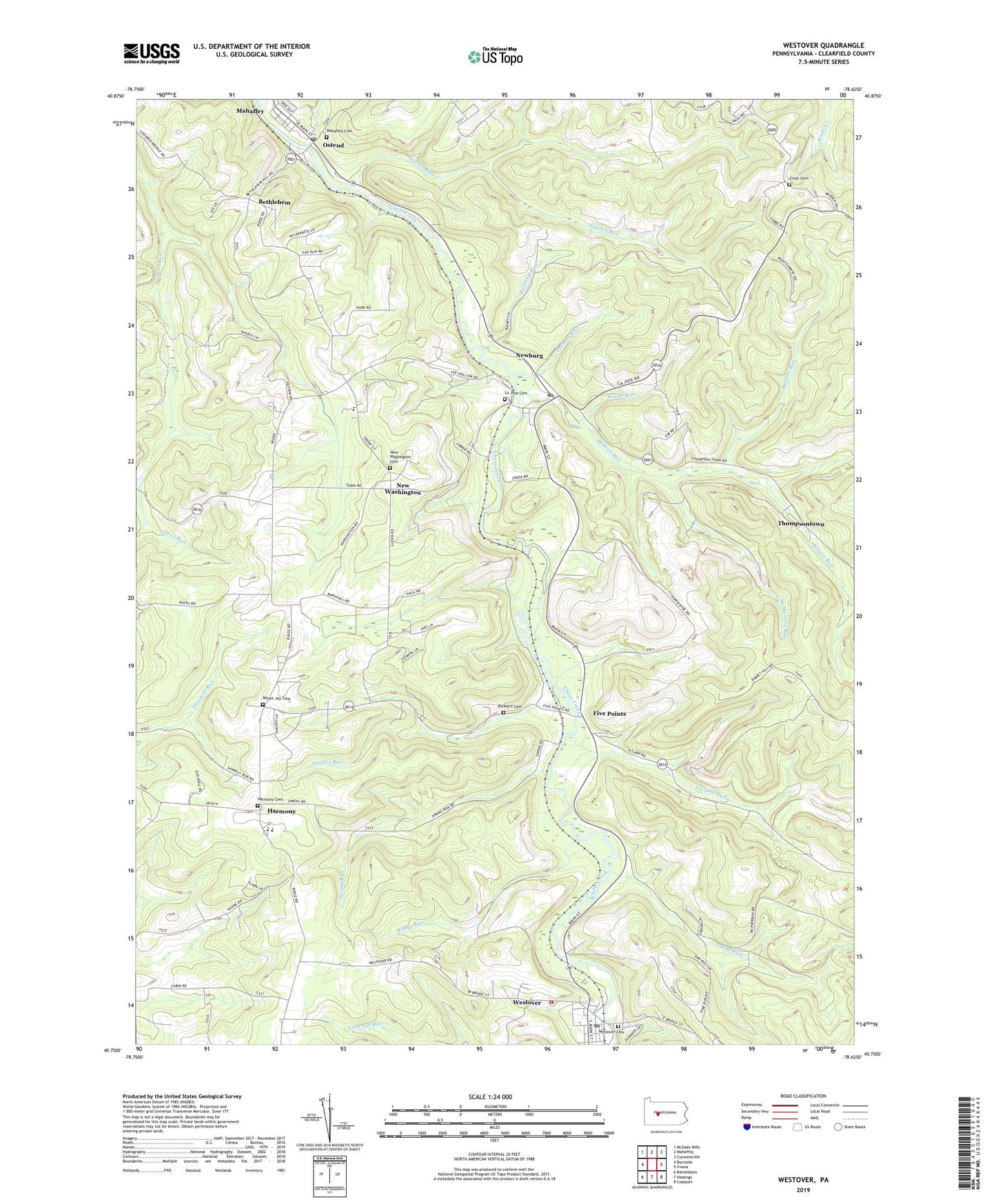
2023 topographic map quadrangle Westover in the state of Pennsylvania. Scale: 1:24000. Based on the newly updated USGS 7.5' US Topo map series, this map is in the following counties: Clearfield. The map contains contour data, water features, and other items you are used to seeing on USGS maps, but also has updated roads and other features. This is the next generation of topographic maps. Printed on high-quality waterproof paper with UV fade-resistant inks.
Quads adjacent to this one:
West: Burnside
Northwest: McGees Mills
North: Mahaffey
Northeast: Curwensville
East: Irvona
Southeast: Coalport
South: Hastings
Southwest: Barnesboro
This map covers the same area as the classic USGS quad with code o40078g6.
Contains the following named places: Barrett Run, Benjamin Heliport, Benjamin Number 3 Mine Station, Benjamin Number 6 Mine Station, Bethlehem, Borough of Mahaffey, Borough of New Washington, Borough of Newburg, Cross Cemetery, Crossroads School, Deer Run School, Dunkard Cemetery, Five Points, Harmony, Harmony Cemetery, Harmony School, Herd School, Kings Run, La Jose Cemetery, La Jose Post Office, La Jose Station, LaJose Junction Station, Mahaffey, Mahaffey Cemetery, Mahaffey Community Ambulance Service Station 29, Mahaffey Junction Station, Mahaffey Post Office, Mahaffey Racetrack, McMasters Run, Mount Joy Cemetery, Mount Joy Church, Mount Zion Church, New Washington, New Washington Cemetery, Newburg, North Camp Run, Ostend, Pine Run, Rattling Run, Snyder Run, Spring Run, Thompsontown, Township of Chest, Tuckers Run, Westover, Westover Area Volunteer Fire Company Station 45, Westover Cemetery, Westover Post Office, Wilson Run, Wood School, Woods Run, ZIP Codes: 15753, 16692