MyTopo
Cobham Pennsylvania US Topo Map
Couldn't load pickup availability
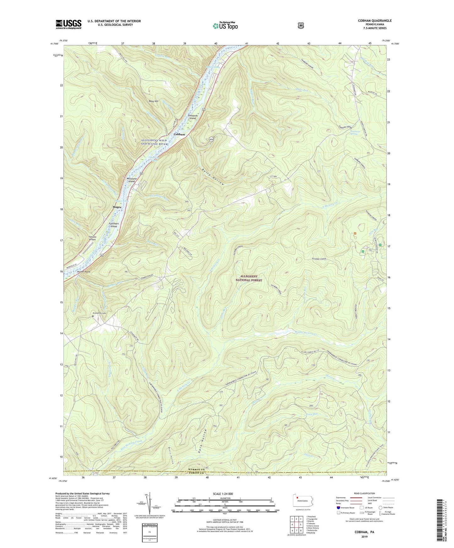
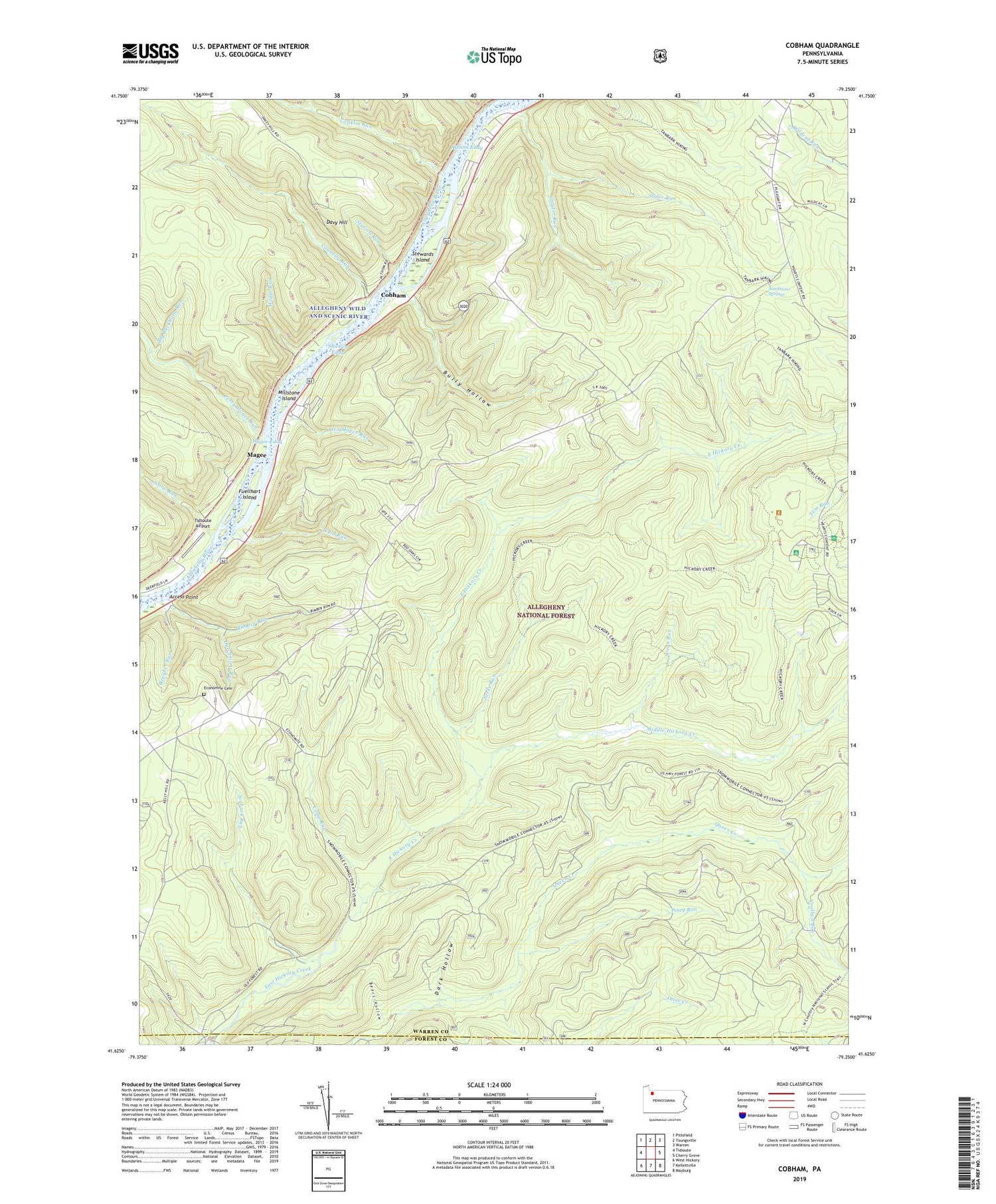
2019 topographic map quadrangle Cobham in the state of Pennsylvania. Scale: 1:24000. Based on the newly updated USGS 7.5' US Topo map series, this map is in the following counties: Warren, Forest. The map contains contour data, water features, and other items you are used to seeing on USGS maps, but also has updated roads and other features. This is the next generation of topographic maps. Printed on high-quality waterproof paper with UV fade-resistant inks.
Quads adjacent to this one:
West: Tidioute
Northwest: Pittsfield
North: Youngsville
Northeast: Warren
East: Cherry Grove
Southeast: Mayburg
South: Kellettville
Southwest: West Hickory
Contains the following named places: Access Point, Alex Magee Run, Althom Eddy, Baugher Run, Beers Hollow, Big Buckhorn Run, Bimber Corners, Bimber Run, Bully Hollow, Camp Run, Coalbed Run, Cobham, Cobham School, Conklin Run, Connelly Run, Coon Run, Dark Hollow, Davy Hill, Dutchmans Run, Fuellhart Island, Gillis, Hague Run, Harmonson Corners, Hearts Content Recreation Site, Hickory Creek Trail, Hickory Creek Wilderness, Izenbrown Corners, Jacks Run, Jacks Trail, Jaybuck Run, Limestone Cemetery, Little Run, Long Hollow Picnic Area, Magee, Magee Eddy, Magee Trail, McKean Corners, McKean School, Middle Hickory Creek, Millstone Island, Perry Magee Run, Piney Run, Plank Road School, Queen, Queen Creek, Sandstone Springs, Sandstone Springs Picnic Ground, Shanley Eddy, Slater Run, Slater Run Trail, Snow Run, South Slater Run, State Game Lands Number 29, State Game Lands Number 86, Station Run, Stewards Island, Tanbark Trail, Tidioute Airport, Township of Limestone, Township of Watson, Waid Run, Watson School, Wheeler Fire Tower, ZIP Code: 16351