MyTopo
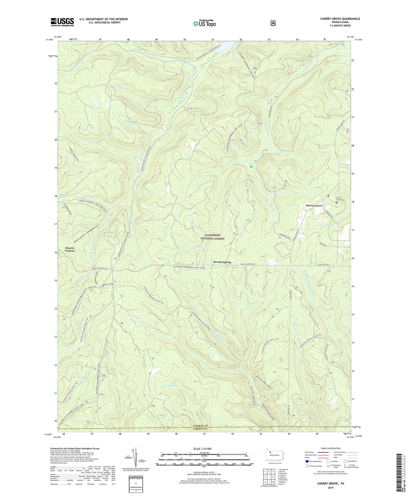
Cherry Grove Pennsylvania US Topo Map
Couldn't load pickup availability
Also explore the Cherry Grove Forest Service Topo of this same quad for updated USFS data
2023 topographic map quadrangle Cherry Grove in the state of Pennsylvania. Scale: 1:24000. Based on the newly updated USGS 7.5' US Topo map series, this map is in the following counties: Warren, Forest. The map contains contour data, water features, and other items you are used to seeing on USGS maps, but also has updated roads and other features. This is the next generation of topographic maps. Printed on high-quality waterproof paper with UV fade-resistant inks.
Quads adjacent to this one:
West: Cobham
Northwest: Youngsville
North: Warren
Northeast: Clarendon
East: Sheffield
Southeast: Lynch
South: Mayburg
Southwest: Kellettville
This map covers the same area as the classic USGS quad with code o41079f2.
Contains the following named places: Adams Run, Allegheny Fish Hatchery, Cherry Grove, Cherry Grove Cemetery, Cherry Grove School, Cherry Grove Volunteer Fire Department, Conklin Run, Davis Run, Dunham Siding, Hearts Content, Hermit Spring, Jones Run, Minister Valley Trail, Otter Branch, Rams Horn Spring, Shaw Run, Slater Run, Tom Run, Township of Cherry Grove, Vandergriff Corners, Wildcat Run