MyTopo
Pittsfield Pennsylvania US Topo Map
Couldn't load pickup availability
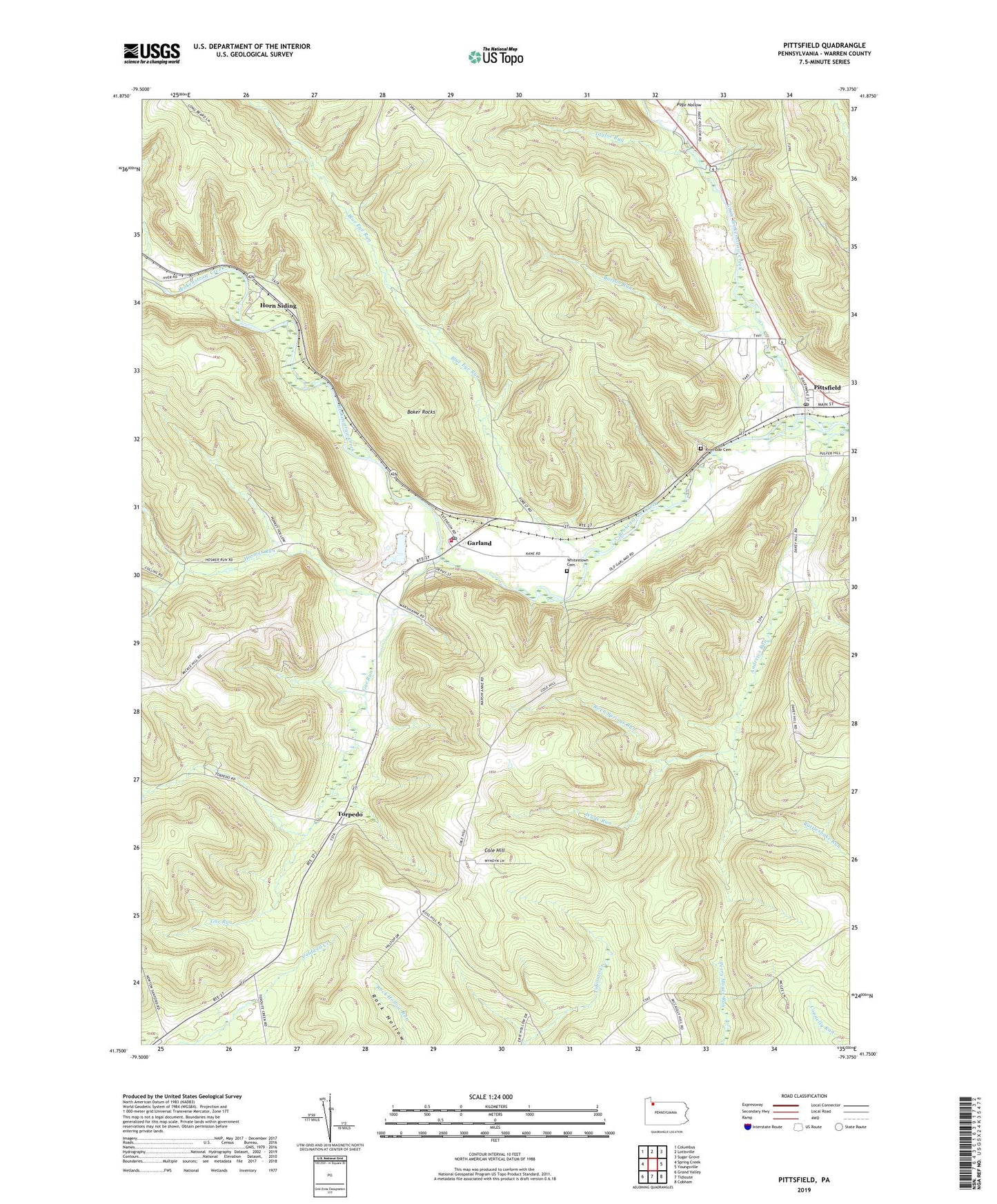
2023 topographic map quadrangle Pittsfield in the state of Pennsylvania. Scale: 1:24000. Based on the newly updated USGS 7.5' US Topo map series, this map is in the following counties: Warren. The map contains contour data, water features, and other items you are used to seeing on USGS maps, but also has updated roads and other features. This is the next generation of topographic maps. Printed on high-quality waterproof paper with UV fade-resistant inks.
Quads adjacent to this one:
West: Spring Creek
Northwest: Columbus
North: Lottsville
Northeast: Sugar Grove
East: Youngsville
Southeast: Cobham
South: Tidioute
Southwest: Grand Valley
This map covers the same area as the classic USGS quad with code o41079g4.
Contains the following named places: Andrews Run, Andrews Run School, Baker Rocks, Barton Run, Birch Springs Run, Blue Eye Run, Bull Run, Cole Hill, Cole Hill School, Gar Run, Garland, Garland Post Office, Garland Volunteer Fire Department Station 65, Horn Siding, Hosmer Run, Little Brokenstraw Creek, Nelson School, Newton Station, Page Hollow, Pittsfield, Pittsfield Post Office, Quarry, Rattlesnake Run, Riverside Cemetery, Ross Hill Corners, State Game Lands Number 143, Taylor Run, Tirol, Torpedo, Township of Pittsfield, Wade Run, Whitestown Cemetery, ZIP Codes: 16340, 16416