MyTopo
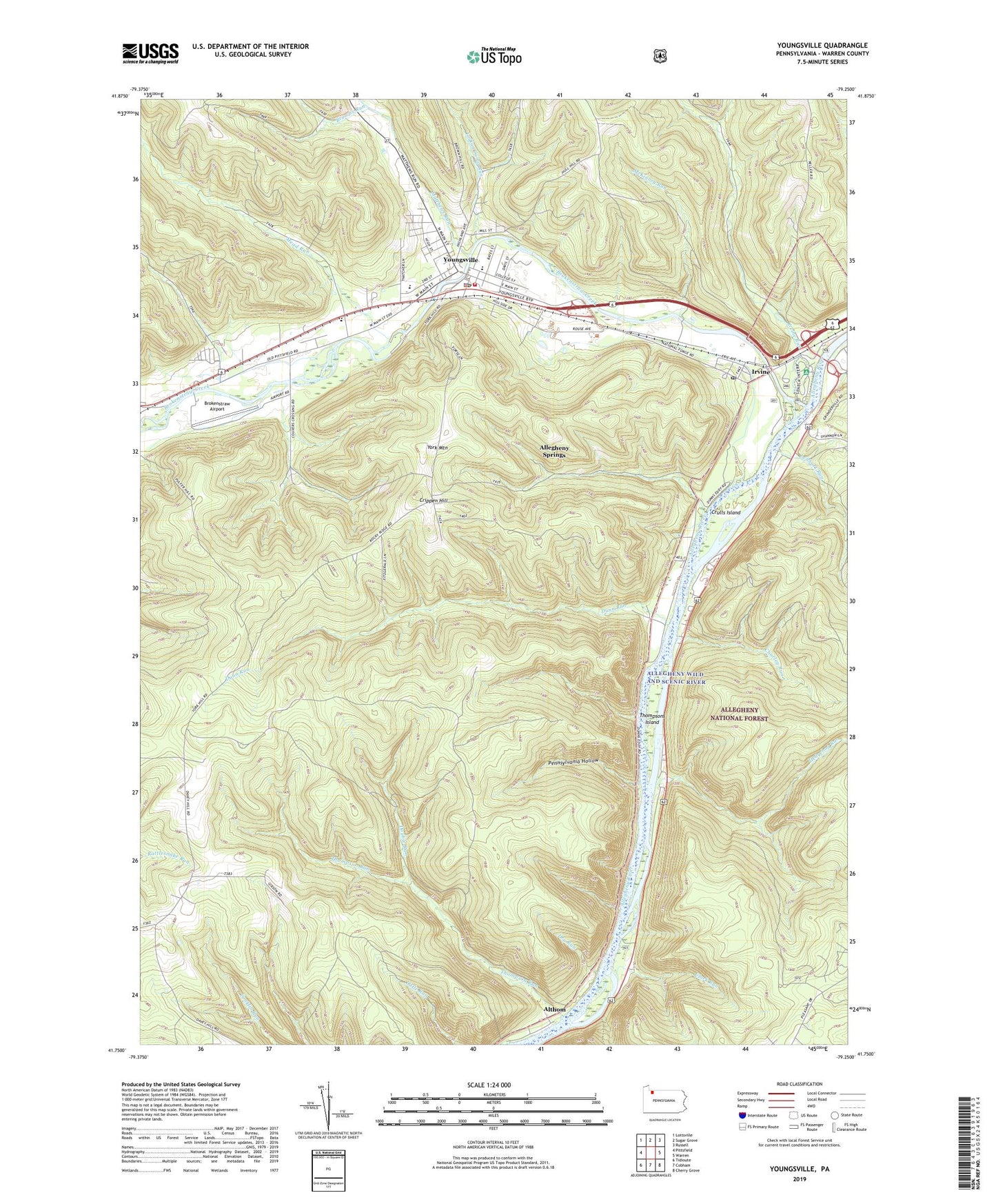
Youngsville Pennsylvania US Topo Map
Couldn't load pickup availability
Also explore the Youngsville Forest Service Topo of this same quad for updated USFS data
2023 topographic map quadrangle Youngsville in the state of Pennsylvania. Scale: 1:24000. Based on the newly updated USGS 7.5' US Topo map series, this map is in the following counties: Warren. The map contains contour data, water features, and other items you are used to seeing on USGS maps, but also has updated roads and other features. This is the next generation of topographic maps. Printed on high-quality waterproof paper with UV fade-resistant inks.
Quads adjacent to this one:
West: Pittsfield
Northwest: Lottsville
North: Sugar Grove
Northeast: Russell
East: Warren
Southeast: Cherry Grove
South: Cobham
Southwest: Tidioute
This map covers the same area as the classic USGS quad with code o41079g3.
Contains the following named places: Allegheny Islands Wilderness, Allegheny Springs, Althom, Anders Run, Borough of Youngsville, Brokenstraw Airport, Brokenstraw Creek, Browns Run, Buckaloons Recreation Area, Charley Run, Clark Run, Clark Trail, Crippen Hill, Crulls Island, Davey Hill School, Davy Hill Church, Double Run, Dry Run, Dunn Run, Hedgehog Run, Hedgehog Trail, Hull Hill School, Indian Camp Run, Irvine, Irvine Post Office, Irvine Run, Irvineton Station, Lenhart Run, Lukens School, Matthews Run, McKinney Run, Mead Run, N E Forest Experimental Station, Pennsylvania Hollow, Saint Lukes Church, Stone Ridge, Thompson Run, Thompsons Island, Thompsons Station, Township of Brokenstraw, Warren County, Wilder Field, Yankeebush School, York Mountain, Youngsville, Youngsville Borough Police Department, Youngsville Elementary School, Youngsville Post Office, Youngsville Volunteer Fire Department, Youngville High School, ZIP Codes: 16329, 16371