MyTopo
Columbus Pennsylvania US Topo Map
Couldn't load pickup availability
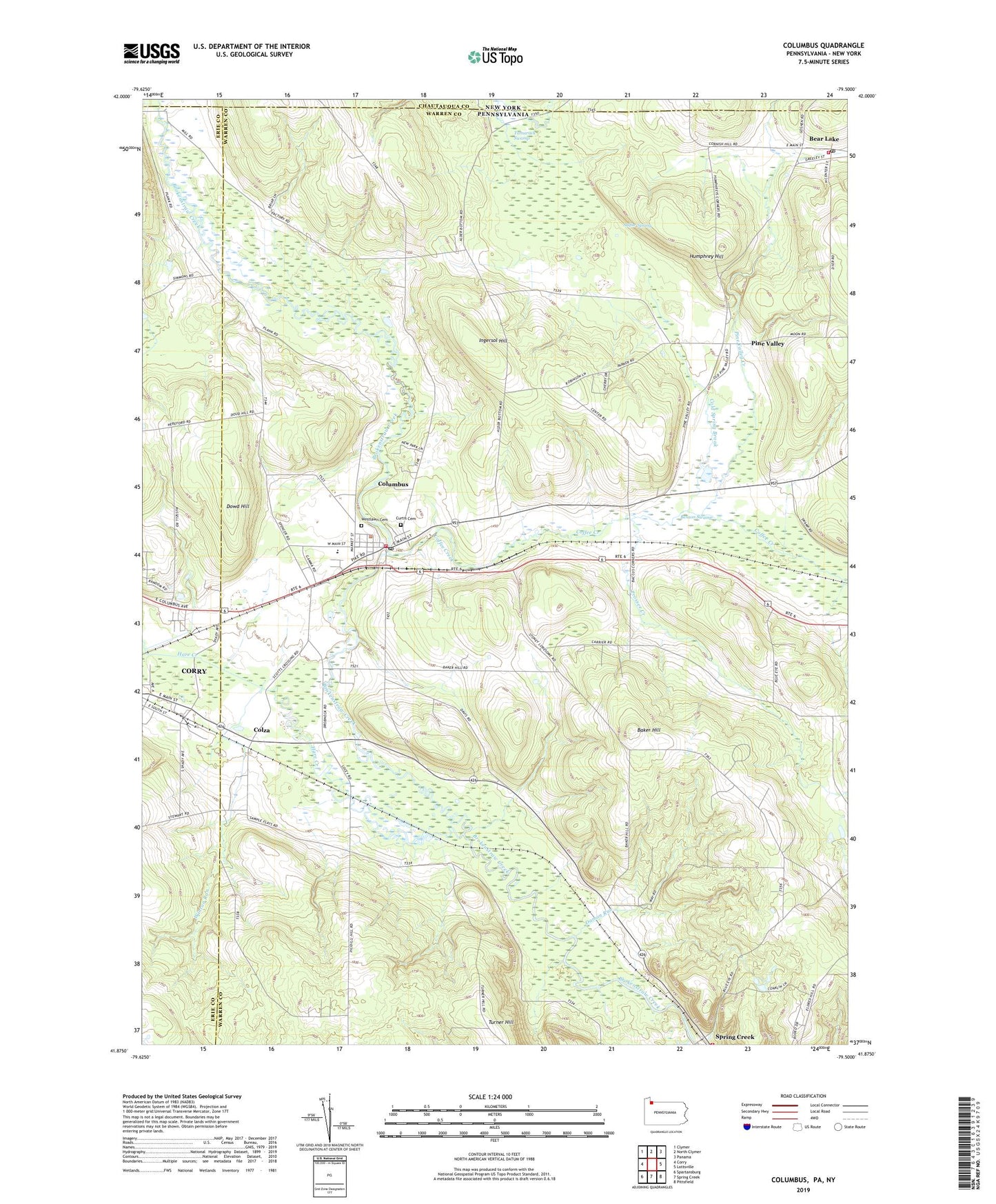
2019 topographic map quadrangle Columbus in the states of Pennsylvania, New York. Scale: 1:24000. Based on the newly updated USGS 7.5' US Topo map series, this map is in the following counties: Warren, Erie, Chautauqua. The map contains contour data, water features, and other items you are used to seeing on USGS maps, but also has updated roads and other features. This is the next generation of topographic maps. Printed on high-quality waterproof paper with UV fade-resistant inks.
Quads adjacent to this one:
West: Corry
Northwest: Clymer
North: North Clymer
Northeast: Panama
East: Lottsville
Southeast: Pittsfield
South: Spring Creek
Southwest: Spartansburg
Contains the following named places: Backus Corners, Baker Hill, Barney Carrier Corners, Bear Lake, Bear Lake Post Office, Bear Lake Volunteer Fire Department, Benson Swamp, Blue Eye School, Borough of Bear Lake, Coffee Creek, Cold Spring Brook, Columbus, Columbus Census Designated Place, Columbus Post Office, Columbus Volunteer Fire Department, Colza, Corry Country Club, Damon Run, David Curtis Cemetery, Dewey Corners, Doane School, Dowd Hill, Hare Creek, Hudson School, Humphrey Hill, Humphreys Corners, Ingersol Hill, Jacob Kerinsky Corners, John Pondell Corners, Mather Park, Picadilli School, Pine Valley, Pine Valley Creek, Prosser Creek, Sample Corners, Sample Flats School, Scotts Crossing, Spring Creek, State Game Lands Number 197, State Game Lands Number 263, State Game Lands Number 291, State Game Lands Number 306, Sulfur Spring, Tamarack Swamp, Township of Columbus, Turner Hill, Valley Central Farm, Weber School, Westlawn Cemetery, Wilbur Crossing, Winton Run, ZIP Code: 16405