MyTopo
Lottsville Pennsylvania US Topo Map
Couldn't load pickup availability
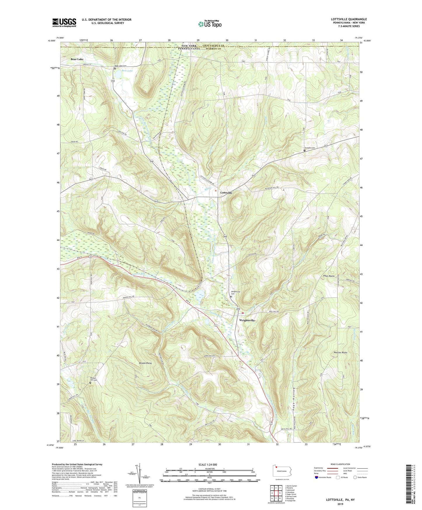
2023 topographic map quadrangle Lottsville in the state of Pennsylvania. Scale: 1:24000. Based on the newly updated USGS 7.5' US Topo map series, this map is in the following counties: Warren, Chautauqua. The map contains contour data, water features, and other items you are used to seeing on USGS maps, but also has updated roads and other features. This is the next generation of topographic maps. Printed on high-quality waterproof paper with UV fade-resistant inks.
Quads adjacent to this one:
West: Columbus
Northwest: North Clymer
North: Panama
Northeast: Lakewood
East: Sugar Grove
Southeast: Youngsville
South: Pittsfield
Southwest: Spring Creek
This map covers the same area as the classic USGS quad with code o41079h4.
Contains the following named places: Barneyville School, Bear Lake, Bear Lake Cemetery, Berea Church, Brooks Hill Cemetery, Brooks Hill Church, Brooks Rocks, Deadmans Run, Deer Creek, Dugall, Forest Chapel, Forest School, Freehold, Gourleys Corners, Lottsville, Miles Run, Miles School, Mill Creek, Nuttal, Nuttles Rocks, Pikes Rocks, Sears Hill School, Sheldon Corners, Smith Hill School, Stillson Hill School, Stony Creek, Swamp Run, Township of Freehold, Turnpike Cemetery, Wells Corners, Wrightsville, Wrightsville Cemetery, Wrightsville Volunteer Fire Department, ZIP Code: 16402