MyTopo
Derrick City Pennsylvania US Topo Map
Couldn't load pickup availability
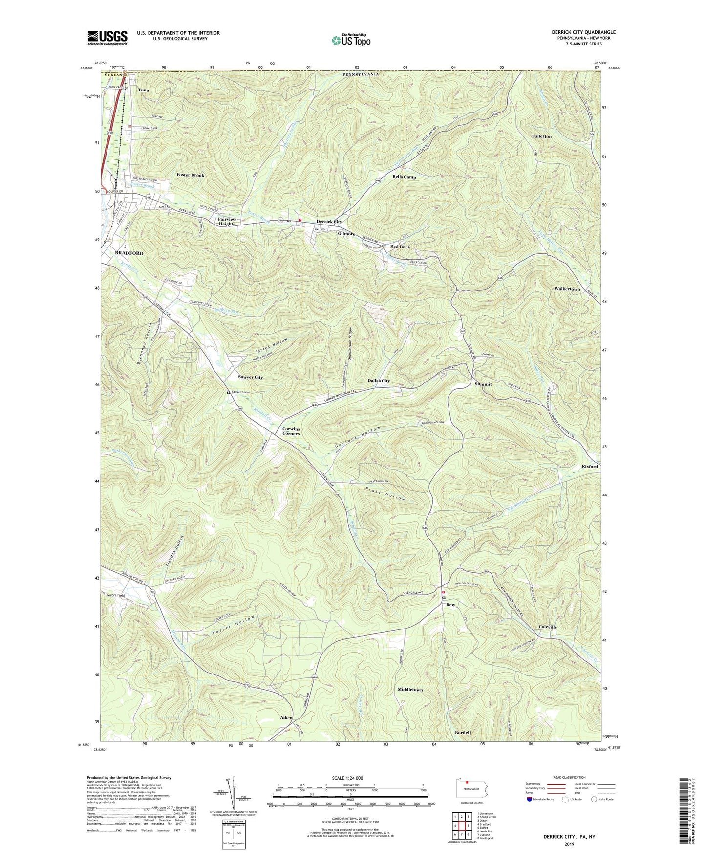
2019 topographic map quadrangle Derrick City in the states of Pennsylvania, New York. Scale: 1:24000. Based on the newly updated USGS 7.5' US Topo map series, this map is in the following counties: McKean, Cattaraugus. The map contains contour data, water features, and other items you are used to seeing on USGS maps, but also has updated roads and other features. This is the next generation of topographic maps. Printed on high-quality waterproof paper with UV fade-resistant inks.
Quads adjacent to this one:
West: Bradford
Northwest: Limestone
North: Knapp Creek
Northeast: Olean
East: Eldred
Southeast: Smethport
South: Cyclone
Southwest: Lewis Run
Contains the following named places: Aiken, Allen, Baker Run, Beechwood, Bells Camp, Bolivar Run, Bordell, Buchanan Hollow, Chamberlain Hollow, Coleville, Corwins Corners, Dallas City, Derrick City, Derrick City Elementary School, Derrick City Post Office, Derrick City Volunteer Fire Department Station 11 - 1, Driver School, Fairview Heights, Foster Brook, Foster Brook Census Designated Place, Foster Hollow, Foster Township Municipal Building, Foster Township Police Department, Fretz Junior High School, Fullerton, Garlock Hollow, Gilmore, Harrisburg Run, Lafferty Run, Lincoln School, Middletown, Minard Run School, Pennbrook Run, Pratt Hollow, Red Rock, Rew, Rew Census Designated Place, Rew Post Office, Rew Volunteer Fire Department - Station 8, Sawyer Cemetery, Sawyer Church, Sawyer City, Summit, Tibbitts Hollow, Totten Hollow, Township of Foster, Tuna, Walkertown, ZIP Code: 16727