MyTopo
Dover Pennsylvania US Topo Map
Couldn't load pickup availability
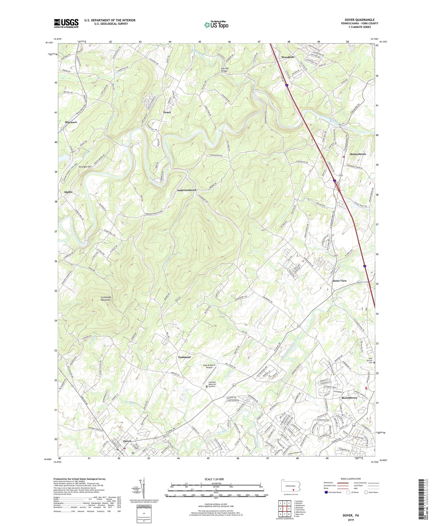
2023 topographic map quadrangle Dover in the state of Pennsylvania. Scale: 1:24000. Based on the newly updated USGS 7.5' US Topo map series, this map is in the following counties: York. The map contains contour data, water features, and other items you are used to seeing on USGS maps, but also has updated roads and other features. This is the next generation of topographic maps. Printed on high-quality waterproof paper with UV fade-resistant inks.
Quads adjacent to this one:
West: Wellsville
Northwest: Lemoyne
North: Steelton
Northeast: Middletown
East: York Haven
Southeast: York
South: West York
Southwest: Abbottstown
This map covers the same area as the classic USGS quad with code o40076a7.
Contains the following named places: Alpine, Andersontown, Aughenbaugh Church, Baney's Airport, Beaver Creek, Bennett Run, Bethany Church, Borough of Dover, Brandywine, Brookside Park, Cann-Edi-On Camp, Conewago Mountain, Conewago School, Country Club Estates, Country Club West, Dover, Dover Area Ambulance Club, Dover Area Elementary School, Dover Assembly Church of God, Dover Post Office, Eastmont, Emmanuel Church, Erney, Fox Run, Grace Church, Holy Saviour Cemetery, Kise Mill Bridge, Kise Mill Bridge Historic District, Laurel Run, Lazy B Ranch Airport, Manchester Township Fire Department, Maytown, Mount Gospel Mission Church, Mount Grove Church, Mount Washington Church, Northern York County Regional Police Department, Outdoor Country Club of York, Pinchot Lake Dam, Quickels Church, Rohlers Church, Roundtown, Roundtown Elementary School, Saint James Church, Stony Run, Strinestown, Strinestown Community Fire Company Station 26, Suburban Memorial Gardens, Susquehanna Speedway, Township of Conewago, Township of Dover, Township of Manchester, Union Fire and Hose Company 1 Station 6 Dover, Woodside, WRHY-FM (Starview), Zions View, ZIP Codes: 17315, 17370, 17404