MyTopo
Elliott Park Pennsylvania US Topo Map
Couldn't load pickup availability
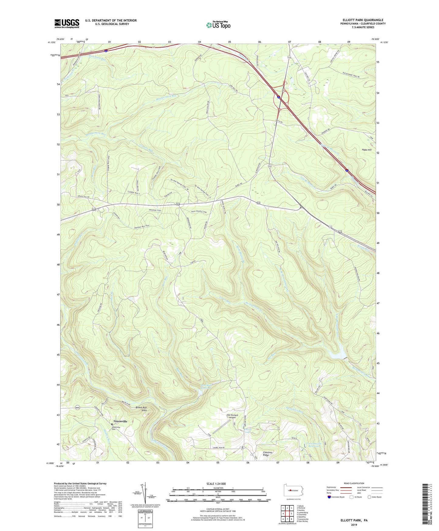
2019 topographic map quadrangle Elliott Park in the state of Pennsylvania. Scale: 1:24000. Based on the newly updated USGS 7.5' US Topo map series, this map is in the following counties: Clearfield. The map contains contour data, water features, and other items you are used to seeing on USGS maps, but also has updated roads and other features. This is the next generation of topographic maps. Printed on high-quality waterproof paper with UV fade-resistant inks.
Quads adjacent to this one:
West: Luthersburg
Northwest: Sabula
North: Penfield
Northeast: Huntley
East: Clearfield
Southeast: Glen Richey
South: Curwensville
Southwest: Mahaffey
Contains the following named places: Bailey Field, Bear Run, Bear Run Dam, Bear Run Reservoir, Blanchard Run, Bloom Run Vista, Burns Run, Chestnut Ridge, Chestnut Ridge School, Clearfield Reservoir, Clearfield State Tree Nursery, Coupler Run, Curwensville Reservoir, Glendale, Gordon Camp, Greenville, Greenville Cemetery, Greenville School, Hobo Hill, Hoover Farm, Horn Shanty Branch, Irvin Branch, Laurel Lake, Left Branch Moose Creek, Montgomery Dam, Montgomery Run, North Branch Montgomery Creek, Old Orchard Airport, Pleasant Grove Church, Right Branch Moose Creek, Rockton Fire Tower, S B Elliott State Park, Smith Fire Tower, Stone Palace Camp, Tar Run, Tinker Run, Township of Pine, Weilder Camp, West Branch Montgomery Creek, ZIP Code: 15856