MyTopo
Mahaffey Pennsylvania US Topo Map
Couldn't load pickup availability
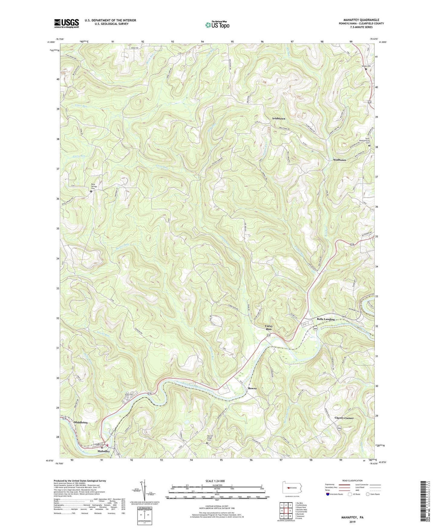
2023 topographic map quadrangle Mahaffey in the state of Pennsylvania. Scale: 1:24000. Based on the newly updated USGS 7.5' US Topo map series, this map is in the following counties: Clearfield. The map contains contour data, water features, and other items you are used to seeing on USGS maps, but also has updated roads and other features. This is the next generation of topographic maps. Printed on high-quality waterproof paper with UV fade-resistant inks.
Quads adjacent to this one:
West: McGees Mills
Northwest: Du Bois
North: Luthersburg
Northeast: Elliott Park
East: Curwensville
Southeast: Irvona
South: Westover
Southwest: Burnside
This map covers the same area as the classic USGS quad with code o40078h6.
Contains the following named places: Banner Ridge Cemetery, Banner Ridge Church, Bell Run, Bells Landing, Bells Landing Mine Station, Bower, Camp Corbly, Camp Meeting Grounds, Cherry Corner, Chest Creek, Community Volunteer Fire Department of Mahaffey Station 29, Curry Run, Daily Run, Fryor Run, Goffe School, Haslett Run, Hickory Number 1 Mine Station, Irish Run, Irishtown, Laurel Branch Run, Laurel Run, Mahaffey Junction Station, McCracken Run, Middleton, Miller Run, Nugent Mine Station, Poplar Run, Rock Springs Cemetery, Rowles, Sabin Cemetery, Saint Bonaventure Cemetery, State Game Lands Number 87, Township of Greenwood, Township of Penn, Walltown, Woods Cemetery, ZIP Code: 15757