MyTopo
Everett West Pennsylvania US Topo Map
Couldn't load pickup availability
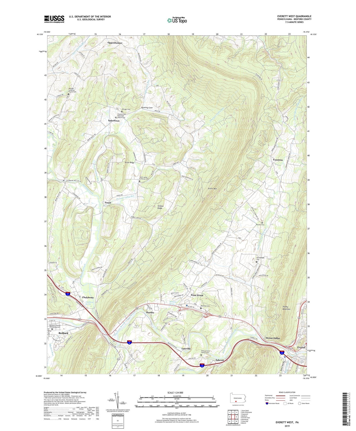
2019 topographic map quadrangle Everett West in the state of Pennsylvania. Scale: 1:24000. Based on the newly updated USGS 7.5' US Topo map series, this map is in the following counties: Bedford. The map contains contour data, water features, and other items you are used to seeing on USGS maps, but also has updated roads and other features. This is the next generation of topographic maps. Printed on high-quality waterproof paper with UV fade-resistant inks.
Quads adjacent to this one:
West: Bedford
Northwest: Alum Bank
North: New Enterprise
Northeast: Hopewell
East: Everett East
Southeast: Mench
South: Clearville
Southwest: Rainsburg
Contains the following named places: Albright Cemetery, Ashcom, Ashcom Quarry, Bald Hill Cemetery, Bald Hill Church, Bedford County, Bedford Middle School, Bedford Senior High School, Black Valley, Black Valley Creek, Bubbling Spring, Camp Sunshine, Chaltbeate Spring, Chalybeate, Cliffs, Cove Creek, Dunning Cove, Dunning Creek, Dutch Corner, Elks Country Club, Everett Volunteer Fire Company 32, Foreman, Friends Cove, Hartley, Hershberger Cemetery, Hughes, Ice Dale Lake Dam, Imlertown, Imlertown Run, Lutzville, Messiah Church, Messiah Lutheran Church Cemetery, Mount Dallas, Old Saint Thomas the Apostle Cemetery, Oppenheimer, Penn Wood, Pennsylvania State Police Troop T Everett Station, Pleasant Hill Reformed Church Cemetery, Pleasant Valley Run, Price Ridge, Ritchey Cemetery, Saint James Lutheran Cemetery, Shobers Run, Smouse Farm Family Cemetery, Snake Spring Elementary School, Snake Spring Valley Church, Snake Spring Valley Run, Stiffler Ridge, The Narrows, Township of Bedford, Township of Snake Spring, University of Pittsburgh Medical Center Bedford, Valley Mill, WAYC-AM (Bedford), Willow Grove, Yount