MyTopo
Fairview Pennsylvania US Topo Map
Couldn't load pickup availability
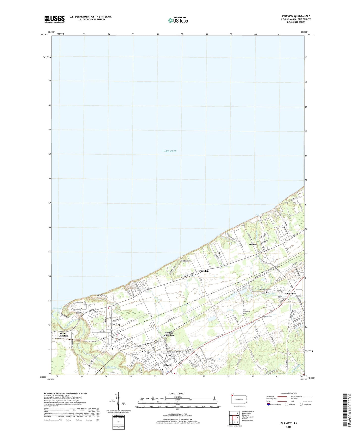
2023 topographic map quadrangle Fairview in the state of Pennsylvania. Scale: 1:24000. Based on the newly updated USGS 7.5' US Topo map series, this map is in the following counties: Erie. The map contains contour data, water features, and other items you are used to seeing on USGS maps, but also has updated roads and other features. This is the next generation of topographic maps. Printed on high-quality waterproof paper with UV fade-resistant inks.
Quads adjacent to this one:
West: Fairview SW
Northeast: Erie North OE W
East: Swanville
Southeast: Edinboro North
South: Albion
Southwest: East Springfield
This map covers the same area as the classic USGS quad with code o42080a3.
Contains the following named places: A F Dobler Hose and Ladder Company, Avonia, Avonia Census Designated Place, Battles Memorial School, Borough of Fairview, Borough of Girard, Borough of Lake City, Browns Farm, Byham Farms, Camp Caledon, Camp Sherwin, Crossing Gate Farms, Daggett Cemetery, Divine Word Seminary, Dudas Farms, Elk Creek, Erie County Infirmary, Fairplain, Fairplain Farm, Fairview, Fairview Cemetery, Fairview Census Designated Place, Fairview Post Office, Gieza Farms, Girard, Girard Cemetery, Girard Junction, Girard Post Office, Godfrey Run Farm, Goodwin Farms, Great Lakes Camp, Lake City, Lake City Fire Company Station 56, Lake City Fire Company Station 57, Lake City Police Department, Lake City Post Office, Lake Erie Community Park, Mason Farms, Old Almshouse Cemetery, Pangratz Fruit Farm, Rice Avenue Community Public Library, Rice Avenue Union High School, Ridgewood Farms, Saint Johns Cemetery, Shorewood Farm, Taylor Farms, The Mouth, Trout Run, Wallace Junction, West Ridge Sand and Gravel Pit, WGAE-FM (Girard), ZIP Code: 16423