MyTopo
East Springfield Pennsylvania US Topo Map
Couldn't load pickup availability
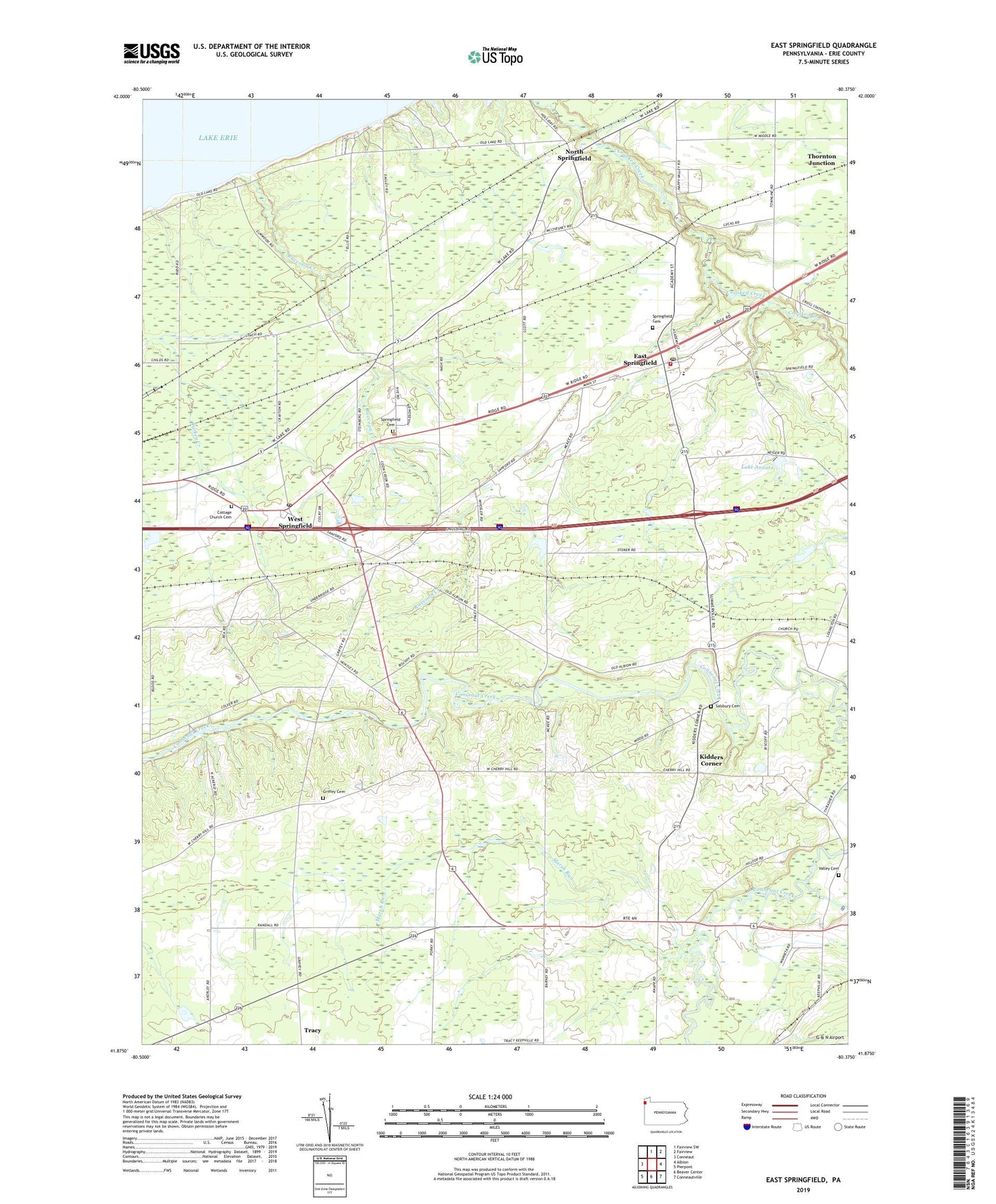
2023 topographic map quadrangle East Springfield in the state of Pennsylvania. Scale: 1:24000. Based on the newly updated USGS 7.5' US Topo map series, this map is in the following counties: Erie. The map contains contour data, water features, and other items you are used to seeing on USGS maps, but also has updated roads and other features. This is the next generation of topographic maps. Printed on high-quality waterproof paper with UV fade-resistant inks.
Quads adjacent to this one:
West: Conneaut
North: Fairview SW
Northeast: Fairview
East: Albion
Southeast: Conneautville
South: Beaver Center
Southwest: Pierpont
This map covers the same area as the classic USGS quad with code o41080h4.
Contains the following named places: Akerly, Bowmans Corners, Camp Lambec, Center Corner, Char Bi Mar Farms, Cherry Hill, Cottage Church Cemetery, Crayton Station, Cross, East Branch Conneaut Creek, East Springfield, East Springfield Post Office, East Springfield Station, Egley Corners, Griffey Cemetery, Hayes Tree Farm, Kidders Corner, Knapps Corners, Lake Annata, Lexington, Marcy Farm, Marsh Run, North Springfield, Raccoon Creek, Salsbury Cemetery, Springfield Cemetery, Springfield Elementary School, Springfield Volunteer Fire Department Station 64, Thornton Junction, Township of Conneaut, Township of Springfield, Valley Cemetery, West Springfield, West Springfield Post Office, West Springfield Station, ZIP Codes: 16401, 16411, 16443