MyTopo
Fannettsburg Pennsylvania US Topo Map
Couldn't load pickup availability
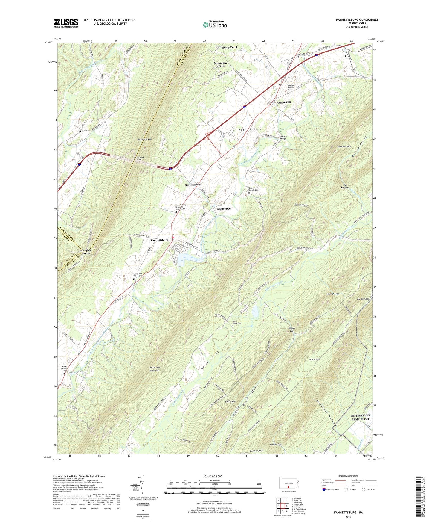
2019 topographic map quadrangle Fannettsburg in the state of Pennsylvania. Scale: 1:24000. Based on the newly updated USGS 7.5' US Topo map series, this map is in the following counties: Franklin, Huntingdon, Fulton. The map contains contour data, water features, and other items you are used to seeing on USGS maps, but also has updated roads and other features. This is the next generation of topographic maps. Printed on high-quality waterproof paper with UV fade-resistant inks.
Quads adjacent to this one:
West: Burnt Cabins
Northwest: Orbisonia
North: Shade Gap
Northeast: Doylesburg
East: Roxbury
Southeast: Chambersburg
South: Saint Thomas
Southwest: McConnellsburg
Contains the following named places: Bear Valley, Bear Valley Picnic Area, Berger Trail, Big Gap, Boggstown, Burnt Cabins Emergency Strip, Carrick Valley, Center School, Cradle Gap, Cree Cemetery, Decorum, Dothan Valley, Evert Farm Family Cemetery, Fannett-Metal High School, Fannettsburg, Fannettsburg Post Office, Fannettsburg Reformed Church Cemetery, Freestone, Fry Trail, Green Spring Trail, Hoovers Bridge, Hoovers Mill, Horse Valley Cemetery, Horse Valley Church, Keefer Church, Keefer Gap, Kittatinny Mountain, Kuhns Mill, Lehman Trail, Little Mountain Trail, Lookout Trail, Lower Path Valley Cemetery, Mackey Trail, Marshall Hollow, McKinley School, Metal Church, Metal Methodist Cemetery, Metal Township Fire and Ambulance Department - Company 21, Mountain Green, Mountain Lake, Mountain Lake Camp, Rexroth Trail, Shady Pine Church, Shetler Family Cemetery, Skinner Gap, Smith Trail, Springtown, Stenger, Stephanies Run, The Narrows, Thomas Trail, Township of Metal, Tuscarora Tunnel, Twomile Trail, W H Walker, Weaver Gap, Willow Hill, Willow Hill Post Office, ZIP Codes: 17221, 17265, 17271