MyTopo
Doylesburg Pennsylvania US Topo Map
Couldn't load pickup availability
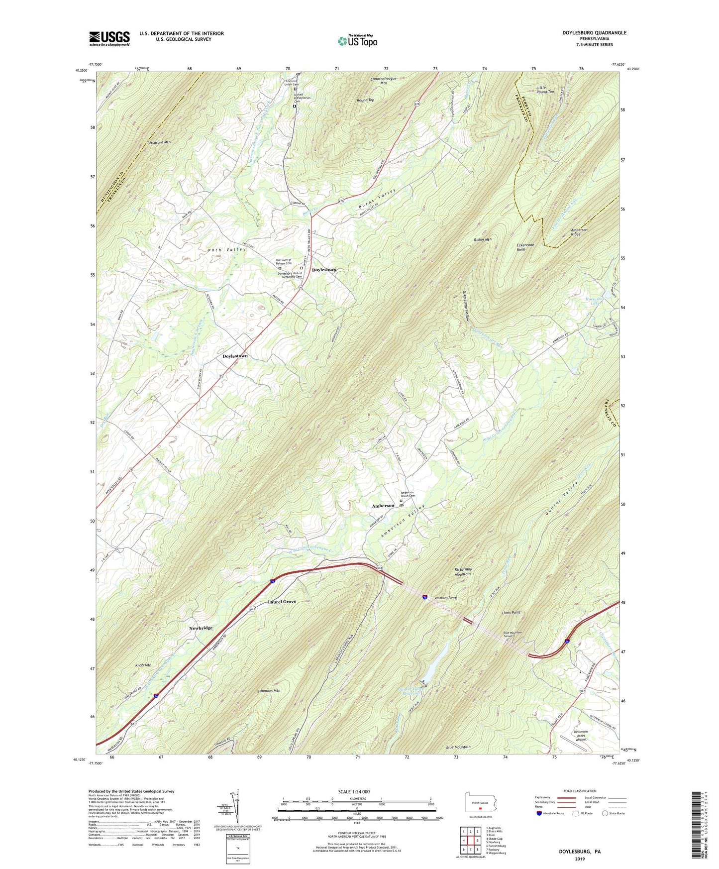
2023 topographic map quadrangle Doylesburg in the state of Pennsylvania. Scale: 1:24000. Based on the newly updated USGS 7.5' US Topo map series, this map is in the following counties: Franklin, Perry, Huntingdon, Cumberland. The map contains contour data, water features, and other items you are used to seeing on USGS maps, but also has updated roads and other features. This is the next generation of topographic maps. Printed on high-quality waterproof paper with UV fade-resistant inks.
Quads adjacent to this one:
West: Shade Gap
Northwest: Aughwick
North: Blairs Mills
Northeast: Blain
East: Newburg
Southeast: Shippensburg
South: Roxbury
Southwest: Fannettsburg
This map covers the same area as the classic USGS quad with code o40077b6.
Contains the following named places: Amberson, Amberson Post Office, Amberson Union Cemetery, Amberson Valley, Amberson Valley Estates, Barnhart Trail, Bear Pond Trail, Blue Mountain Tunnel, Burns Creek, Burns School, Burns Valley, Burns Valley Church, Catholic Path, Clay Hill School, Concord Post Office, Concord Union Cemetery, Doylesburg, Doylesburg United Methodist Cemetery, Doylestown, Doylestown Stream, Drillmore Acres Airport, Eckenrode Knob, Felty Stewart Run, Gunter Valley Dam, Gunter Valley Reservoir, Hayes School, Hemlocks Natural Area, Horseshoe Lake, Kittatinny Tunnel, Knob Mountain, Laurel Grove, Linns Point, Little Round Top, Mill Run School, Newbridge, Our Lady of Refuge Cemetery, Patterson Run Trail, Rising Mountain, Round Top, Saint Marys Church, Stewart Narrows Trail, Sugarcamp Hollow, Township of Fannett, Tuscarora Mountain, United Presbyterian Cemetery, Wolfe School, ZIP Codes: 17210, 17217, 17219, 17220, 17251, 17262