MyTopo
Fredonia Pennsylvania US Topo Map
Couldn't load pickup availability
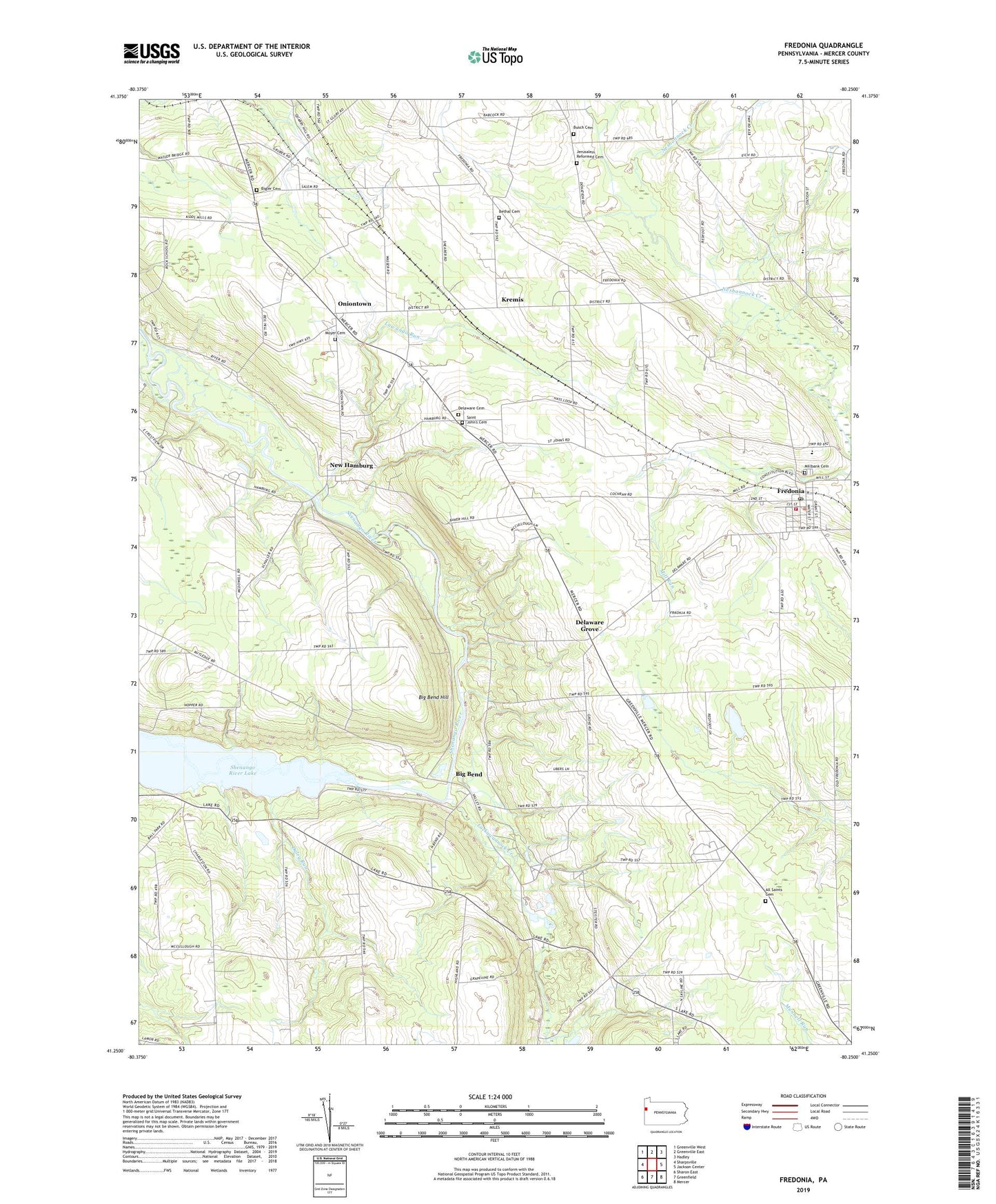
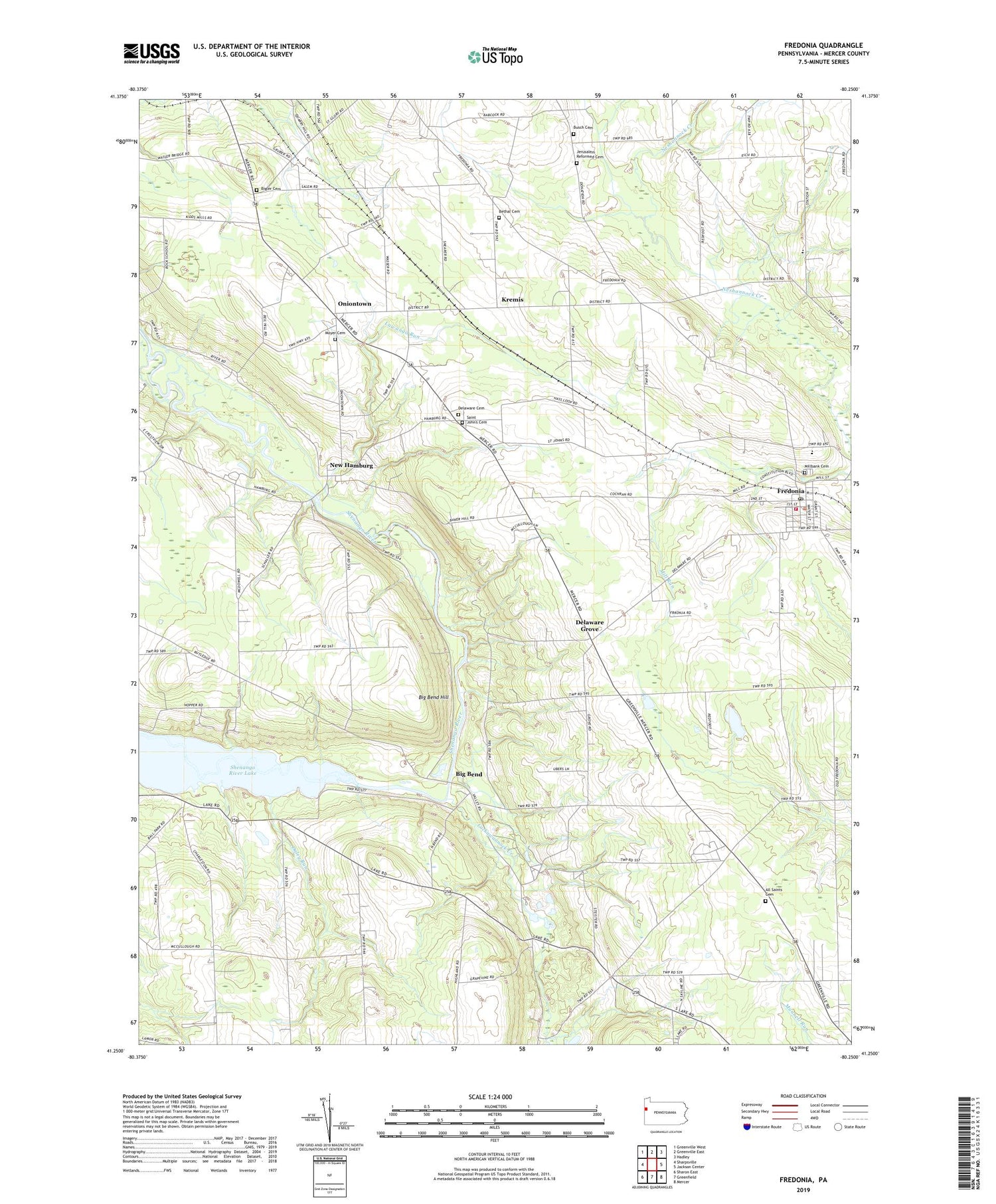
2019 topographic map quadrangle Fredonia in the state of Pennsylvania. Scale: 1:24000. Based on the newly updated USGS 7.5' US Topo map series, this map is in the following counties: Mercer. The map contains contour data, water features, and other items you are used to seeing on USGS maps, but also has updated roads and other features. This is the next generation of topographic maps. Printed on high-quality waterproof paper with UV fade-resistant inks.
Quads adjacent to this one:
West: Sharpsville
Northwest: Greenville West
North: Greenville East
Northeast: Hadley
East: Jackson Center
Southeast: Mercer
South: Greenfield
Southwest: Sharon East
Contains the following named places: All Saints Cemetery, All Saints Church, Bethal Cemetery, Big Bend, Big Bend Church, Big Bend Hill, Bigler Cemetery, Borough of Fredonia, Busch Cemetery, Caldwell School, Camp Kiondashawa, Daley Run, Deep Hollow School, Delaware Cemetery, Delaware Grove, Five Points, Fredonia, Fredonia Post Office, Fredonia Volunteer Fire Department Station 97, Fruit School, Homer School, Jerusalem Reformed Cemetery, Jerusalem Reformed Church, Kitches Corners, Kremis, Lackawannock Creek, Lawango Run, McCullough School, Mercer County, Mercer Public Golf Course, Millbank Cemetery, Moyer Cemetery, New Hamburg, Oniontown, Reichard School, Saint John's Cemetery, Saint Johns Church, Temple Grove Campground, Township of Delaware, Township of Jefferson, Ye Royal Strip, ZIP Code: 16124