MyTopo
Greenfield Pennsylvania US Topo Map
Couldn't load pickup availability
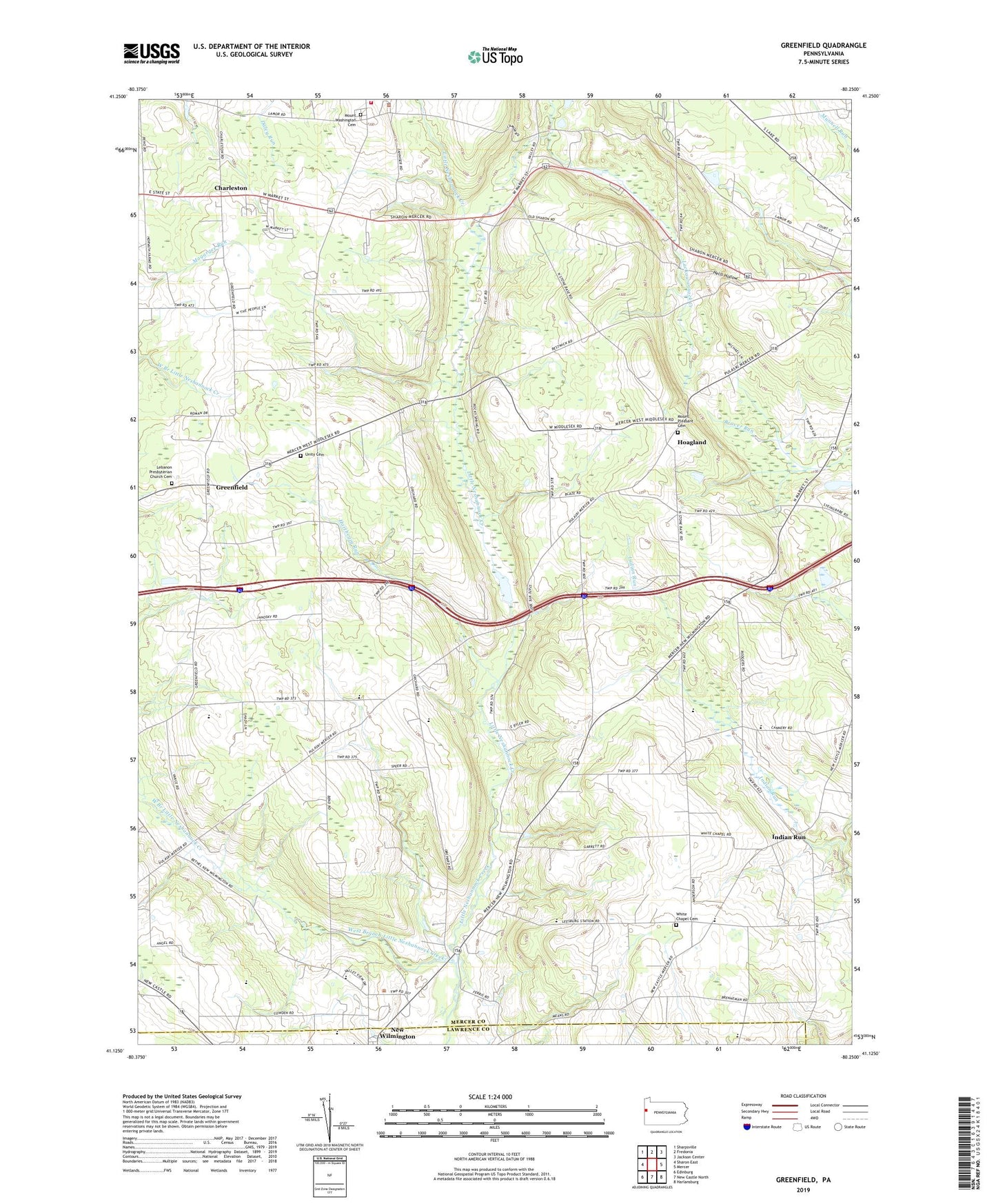
2023 topographic map quadrangle Greenfield in the state of Pennsylvania. Scale: 1:24000. Based on the newly updated USGS 7.5' US Topo map series, this map is in the following counties: Mercer, Lawrence. The map contains contour data, water features, and other items you are used to seeing on USGS maps, but also has updated roads and other features. This is the next generation of topographic maps. Printed on high-quality waterproof paper with UV fade-resistant inks.
Quads adjacent to this one:
West: Sharon East
Northwest: Sharpsville
North: Fredonia
Northeast: Jackson Center
East: Mercer
Southeast: Harlansburg
South: New Castle North
Southwest: Edinburg
This map covers the same area as the classic USGS quad with code o41080b3.
Contains the following named places: Charleston, Greenfield, Harthegig Run, Hells Hollow, Hoagland, Indian Run, Jefferson / Clark Regional Police Department, Jefferson Township Volunteer Fire Department Station 88, Lackawannock Airport, Lebanon Church, Lebanon Presbyterian Church Cemetery, Ligo School, Lyle, Mount Pleasant Cemetery, Mount Washington Cemetery, Township of East Lackawannock, Township of Lackawannock, Township of Wilmington, Unity Cemetery, Unity Church, West Branch Little Neshannock Creek, White Chapel, White Chapel Cemetery, White Chapel Church, WWIZ-FM (Mercer), Zuver School, ZIP Code: 16142