MyTopo
Frenchville Pennsylvania US Topo Map
Couldn't load pickup availability
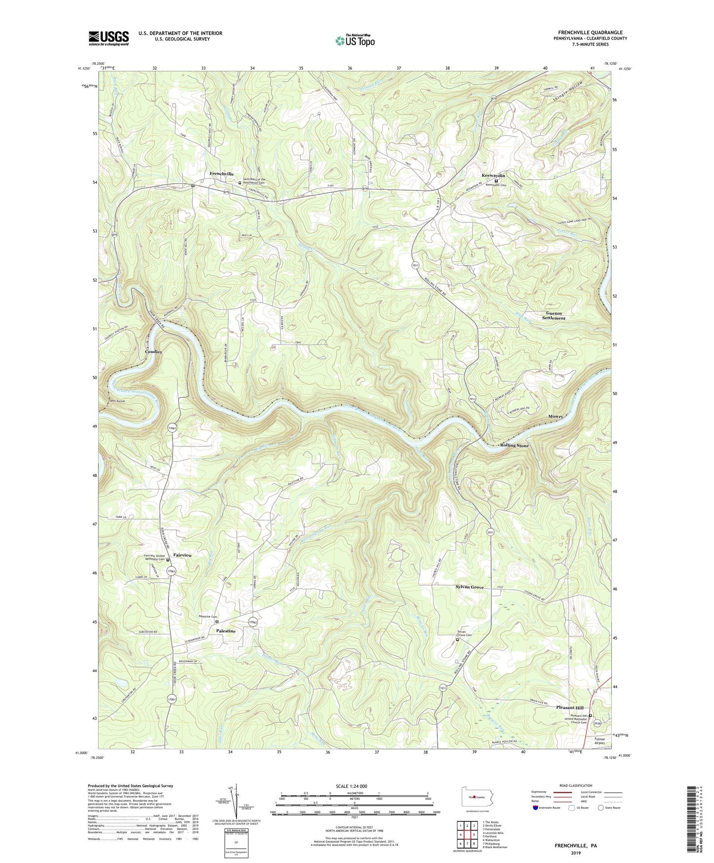
2023 topographic map quadrangle Frenchville in the state of Pennsylvania. Scale: 1:24000. Based on the newly updated USGS 7.5' US Topo map series, this map is in the following counties: Clearfield. The map contains contour data, water features, and other items you are used to seeing on USGS maps, but also has updated roads and other features. This is the next generation of topographic maps. Printed on high-quality waterproof paper with UV fade-resistant inks.
Quads adjacent to this one:
West: Lecontes Mills
Northwest: The Knobs
North: Devils Elbow
Northeast: Pottersdale
East: Karthaus
Southeast: Black Moshannon
South: Philipsburg
Southwest: Wallaceton
This map covers the same area as the classic USGS quad with code o41078a2.
Contains the following named places: Alder Run, Aurora Mine Station, Basin Run, Big Run, Browns Run, Buck Run, Buck Run School, Central Point, Coudley, Deer Creek, Deer Tunnel, Fairmont School, Fairview, Fairview Church, Fairview School, Fairview United Methodist Cemetery, Folmar Airport, Frenchville, Frenchville Post Office, Frenchville Station, Guenot Settlement, Hubler Run, Keewaydin, Keewaydin Cemetery, Kettle Spring Run, Mignot School, Mons Run, Mount Pleasant School, Mowry, Mowry Run, Mulsonburg School, Palestine, Palestine Cemetery, Palestine Church, Palestine School, Pleasant Hill, Pleasant Hill School, Pleasant Hill United Methodist Church Cemetery, Potter Run, River Hill Mine Station, Rolling Stone, Rolling Stone Run, Saint Johns Church, Saint Mary of the Assumption Cemetery, Sandy Creek, Shingle Hollow, Sylvan Grove, Sylvan Grove Cemetery, Sylvan Grove Church, Sylvan Grove School, Township of Graham, Willholm Run, ZIP Code: 16858