MyTopo
Galeton Pennsylvania US Topo Map
Couldn't load pickup availability
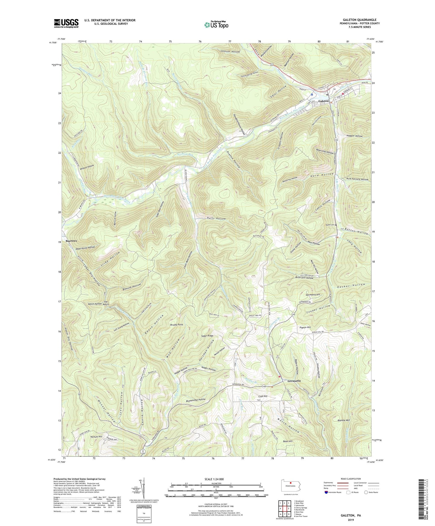
2023 topographic map quadrangle Galeton in the state of Pennsylvania. Scale: 1:24000. Based on the newly updated USGS 7.5' US Topo map series, this map is in the following counties: Potter. The map contains contour data, water features, and other items you are used to seeing on USGS maps, but also has updated roads and other features. This is the next generation of topographic maps. Printed on high-quality waterproof paper with UV fade-resistant inks.
Quads adjacent to this one:
West: Cherry Springs
Northwest: Brookland
North: West Pike
Northeast: Sabinsville
East: Marshlands
Southeast: Lee Fire Tower
South: Oleona
Southwest: Short Run
This map covers the same area as the classic USGS quad with code o41077f6.
Contains the following named places: Acid Factory Hollow, Bach Hollow, Baders Hollow, Bean Hill, Beech Flats Run, Bibiana Mountain, Birch Still Hollow, Blumenthal Hollow, Boedler Branch, Bohunk Hollow, Borough of Galeton, Brushy Point, Bull Tote Road Trail, Burrows, Butternut Hollow, Button Hollow, Byam Cemetery, Carter Camp, Clark Farm Trail, Club Hill, Cow Hill Trail, Crippen Hollow, Crippen Run, Dead Horse Hollow, Deer Lick Hollow, Egler Hollow, Falling Springs Hollow, Gale Hose Ambulance, Galeton, Galeton Borough Police Department, Galeton Dam, Galeton Lake, Galeton Post Office, Germania, Germania Bridge Trail, Germania Fire Company Station 19, Germania Hill, Germania Post Office, Germania Station, Goodyear Hose Company Station 10, Hartman Hollow, Hasker Hollow, Hensel Hollow, Hoppe Hollow, Huggler Hollow, Hults Hollow, Hurd Hollow, Indian Run, Ives Hollow, Johnson Hollow, Leech Hollow, Left Stony Hollow, Long Hollow, Louis Main Hollow, Lower Dry Hollow, Lyman Run, Lymans Run Station, Madison Hollow, Main Lot Hollow, Mosch Hollow, Mott Hill Hollow, Mud Hollow, New Bergen, Newcomb Hollow, Notch Hollow, Notch Trail, Osgood Hollow, Paul Hollow, Pigeon Hill, Reese Hollow, Right Branch Wetmore Run, Right Stony Hollow, Rock Run, Shotgun Trail, Slaughterhouse Hollow, Slide Hollow, South Branch Pine Creek, Stone Hollow, Straight Ridge Trail, Straley Hollow, Sugar Bush Hollow, Sugar Ridge, The Notch, Township of West Branch, Wenzel Hollow, West Branch Pine Creek, Wetmore Run, Wetmore Trail, Wheaton Hollow, Wildcat Hollow, Yeager Hollow, Yochum Hill, Zeorb Hollow, Zundel Hollow, ZIP Code: 16922