MyTopo
Oleona Pennsylvania US Topo Map
Couldn't load pickup availability
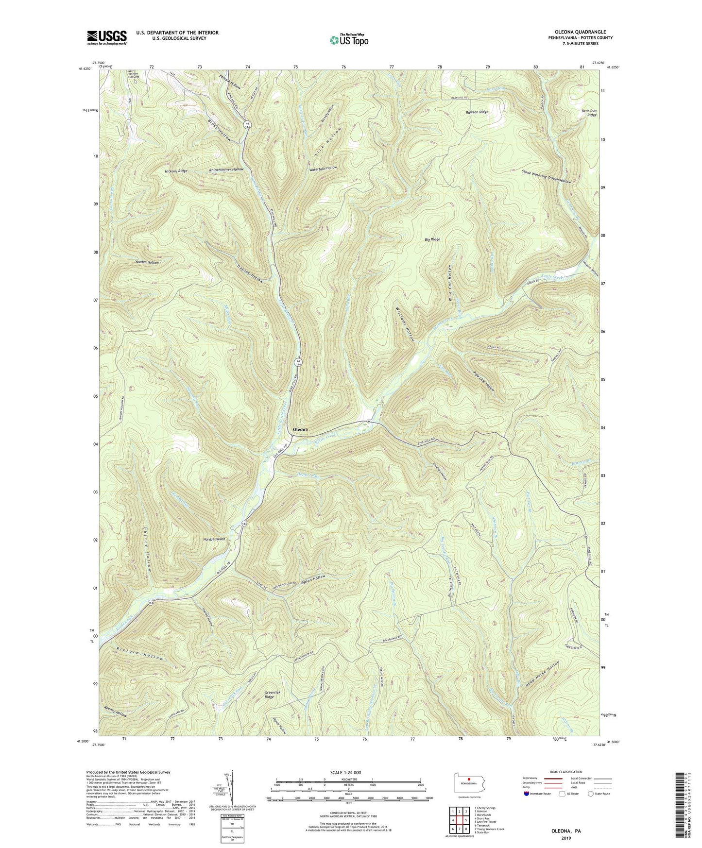
2023 topographic map quadrangle Oleona in the state of Pennsylvania. Scale: 1:24000. Based on the newly updated USGS 7.5' US Topo map series, this map is in the following counties: Potter. The map contains contour data, water features, and other items you are used to seeing on USGS maps, but also has updated roads and other features. This is the next generation of topographic maps. Printed on high-quality waterproof paper with UV fade-resistant inks.
Quads adjacent to this one:
West: Short Run
Northwest: Cherry Springs
North: Galeton
Northeast: Marshlands
East: Lee Fire Tower
Southeast: Slate Run
South: Young Womans Creek
Southwest: Tamarack
This map covers the same area as the classic USGS quad with code o41077e6.
Contains the following named places: Bear Run Ridge, Big Ridge, Big Trestle Run, Big Trestle Trail, Bloss Hollow, Bohunk Hollow, Bohunk Trail, Burnisky Hollow, Cherry Hollow, Cherry Hollow Trail, Dead Horse Hollow, Face Run, Germania Branch, Greenlick Ridge, Hartman Trail, Hickory Ridge, Hopper Run, Impson Hollow, Indian Run, Klondike Ridge Trail, Klondike Trail, Kortz Run, Layfield Hollow, Lechler Branch, Lick Hollow, Little Indian Run, Little Kettle Creek, Long Run, Long Run Trail, Miller Run, Miller Run Trail, Nordjeuskald, Ole Bull Castle, Ole Bull Run, Ole Bull State Park, Ole Bull Trail, Oleona, Pigs Ear Branch, Pike-Whitman Trail, Pipe Line Hollow, Pritchard Hollow, Rawson Ridge, Rhinehimmer Hollow, Rhinehimmer Trail, Rixford Hollow, Rob Horse Trail, Sawmill Run, Sawmill Trail, Silver Run, Stone Watering Trough Hollow, Straight Run, Swartwood Trail, Township of Abbott, Township of Stewardson, Traplog Hollow, Warpath Hollow, Waterfalls Hollow, Welch Ridge Trail, Whitman Branch, Wild Cat Hollow, Williams Hollow, Yaudes Hollow, Yochum Hill Cemetery, Yochum Trail, ZIP Code: 17729