MyTopo
Gillett Pennsylvania US Topo Map
Couldn't load pickup availability
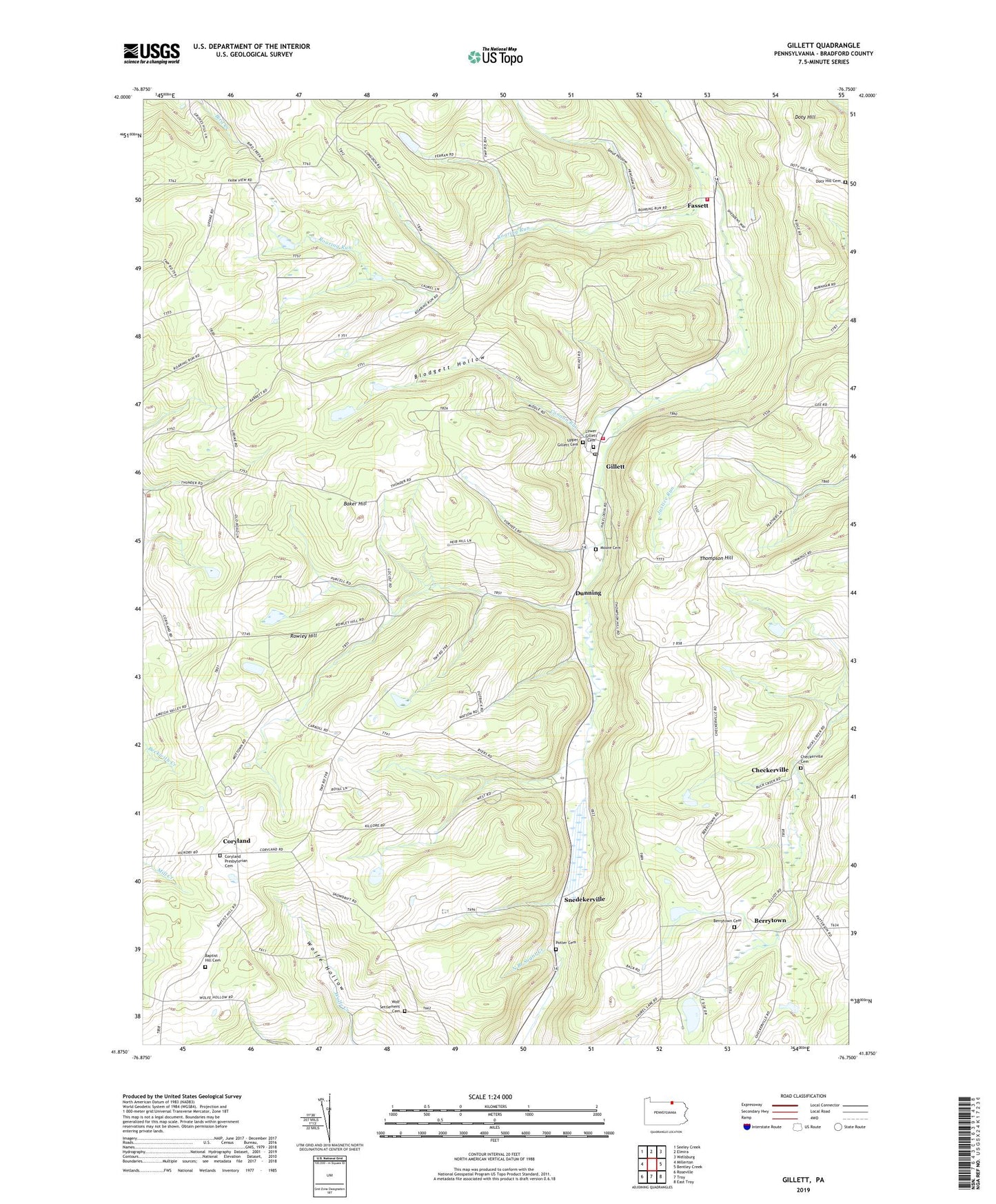
2019 topographic map quadrangle Gillett in the state of Pennsylvania. Scale: 1:24000. Based on the newly updated USGS 7.5' US Topo map series, this map is in the following counties: Bradford. The map contains contour data, water features, and other items you are used to seeing on USGS maps, but also has updated roads and other features. This is the next generation of topographic maps. Printed on high-quality waterproof paper with UV fade-resistant inks.
Quads adjacent to this one:
West: Millerton
Northwest: Seeley Creek
North: Elmira
Northeast: Wellsburg
East: Bentley Creek
Southeast: East Troy
South: Troy
Southwest: Roseville
Contains the following named places: Baker Hill, Baptist Hill Cemetery, Baptist Hill Church, Berrytown, Berrytown Cemetery, Blodgett Hollow, Canaan Run, Checkerville, Checkerville Cemetery, Coryland, Coryland Presbyterian Cemetery, Doty Hill, Doty Hill Cemetery, Dunning, Fassett, Gillett, Gillett Post Office, Lower Gillett Cemetery, Moore Cemetery, Potter Family Cemetery, Roaring Run, Rowley Hill, Smut Hollow, Snedekerville, South Creek Volunteer Fire Department Station 12, South Creek Volunteer Fire Department Station 2, Steinhauer Dam, Thompson Hill, Township of South Creek, Township of Wells, Upper Gillett Cemetery, Virtus, Waterloo, Wolf Settlement Cemetery, ZIP Code: 16925