MyTopo
Millerton Pennsylvania US Topo Map
Couldn't load pickup availability
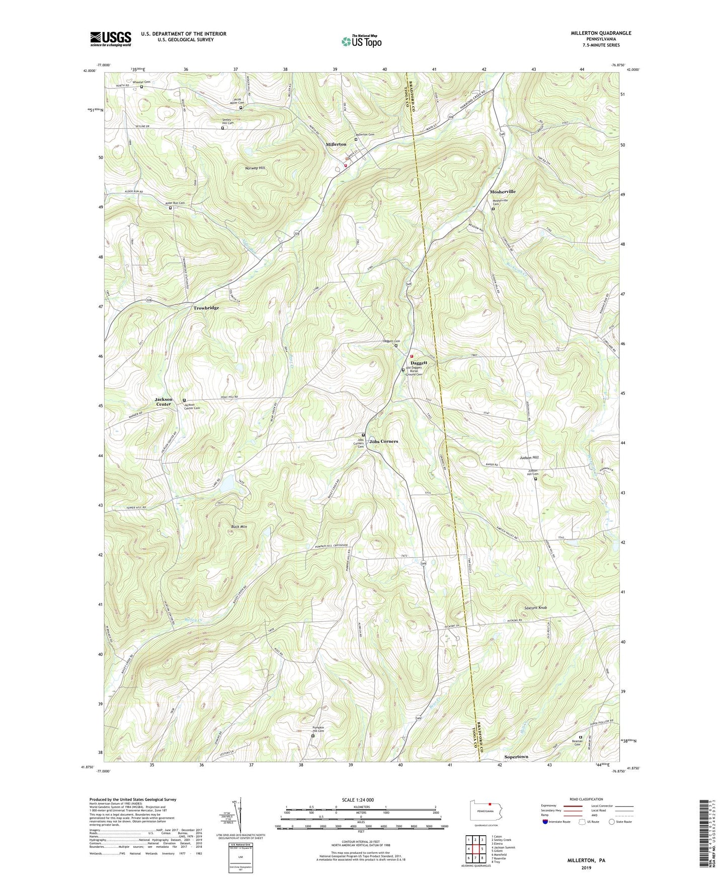
2023 topographic map quadrangle Millerton in the state of Pennsylvania. Scale: 1:24000. Based on the newly updated USGS 7.5' US Topo map series, this map is in the following counties: Tioga, Bradford. The map contains contour data, water features, and other items you are used to seeing on USGS maps, but also has updated roads and other features. This is the next generation of topographic maps. Printed on high-quality waterproof paper with UV fade-resistant inks.
Quads adjacent to this one:
West: Jackson Summit
Northwest: Caton
North: Seeley Creek
Northeast: Elmira
East: Gillett
Southeast: Troy
South: Roseville
Southwest: Mansfield
This map covers the same area as the classic USGS quad with code o41076h8.
Contains the following named places: Alder Run, Alder Run Cemetery, Aspinwall Corners, Beaman Cemetery, Bear Creek, Beckwith Creek, Big Elm Volunteer Fire Department, Buck Mountain, Daggett, Daggett Cemetery, Edsallville Post Office, Hammond Creek, Jackson Center, Jackson Center Cemetery, Jobs Corners, Jobs Corners Cemetery, Judson Hill, Judson Hill Cemetery, Miller Cemetery, Millerton, Millerton Cemetery, Millerton Census Designated Place, Millerton Post Office, Millerton Volunteer Fire Department, Mosherville, Mosherville Cemetery, Norway Hill, Old Daggett Burial Ground, Old Hickory Post Office, Pumpkin Hill Cemetery, Saxtons Knob, Sbarbaro Ranch Airport, Seeley Hill Cemetery, Sopertown, Township of Jackson, Township of Rutland, Trowbridge, West Jackson Church, Wheeler Cemetery, ZIP Code: 16936