MyTopo
Troy Pennsylvania US Topo Map
Couldn't load pickup availability
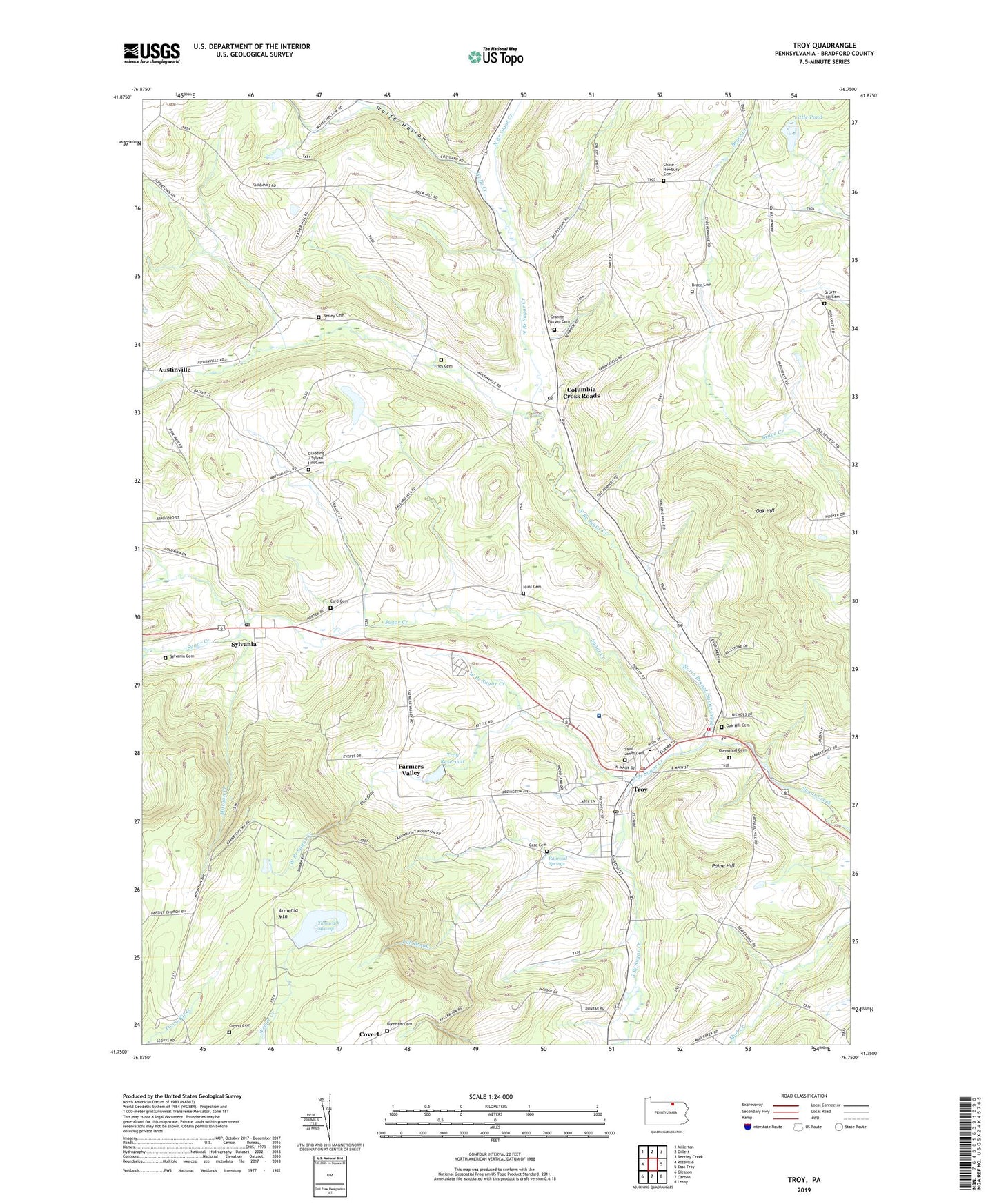
2023 topographic map quadrangle Troy in the state of Pennsylvania. Scale: 1:24000. Based on the newly updated USGS 7.5' US Topo map series, this map is in the following counties: Bradford. The map contains contour data, water features, and other items you are used to seeing on USGS maps, but also has updated roads and other features. This is the next generation of topographic maps. Printed on high-quality waterproof paper with UV fade-resistant inks.
Quads adjacent to this one:
West: Roseville
Northwest: Millerton
North: Gillett
Northeast: Bentley Creek
East: East Troy
Southeast: Leroy
South: Canton
Southwest: Gleason
This map covers the same area as the classic USGS quad with code o41076g7.
Contains the following named places: Alparon Park, Austinville, Borough of Sylvania, Borough of Troy, Brace Cemetery, Burnham Cemetery, Card Cemetery, Case Cemetery, Case Glen, Chase - Newbury Cemetery, Columbia Cross Roads, Columbia Cross Roads Post Office, Columbia Valley Cemetery, Covert Cemetery, Croman School, Fall Brook, Farmers Valley, Fries Cemetery, Glenwood Cemetery, Grover Hill Cemetery, Hunt Cemetery, Little Pond, Lloyd School, McClure Airport, Morgan Creek, North Branch Sugar Creek, Oak Hill, Oak Hill Cemetery, Paine Hill, Parsons - Gernert Cemetery, Pomery Memorial Dam, Railroad Springs, Saint Johns Cemetery, South Branch Sugar Creek, Spring Creek, Sylvan Hill Cemetery, Sylvania, Sylvania Cemetery, Sylvania Post Office, Tamarack Swamp, Taylor School, Township of Columbia, Township of Troy, Troy, Troy Community Hospital, Troy Post Office, Troy Reservoir, Troy Volunteer Fire Department Station 16, West Branch Sugar Creek, Western Alliance Emergency Services Station 16, WJOZ-AM (Troy), Wolfe Creek, Wolfe Hollow, ZIP Codes: 16914, 16947