MyTopo
East Troy Pennsylvania US Topo Map
Couldn't load pickup availability
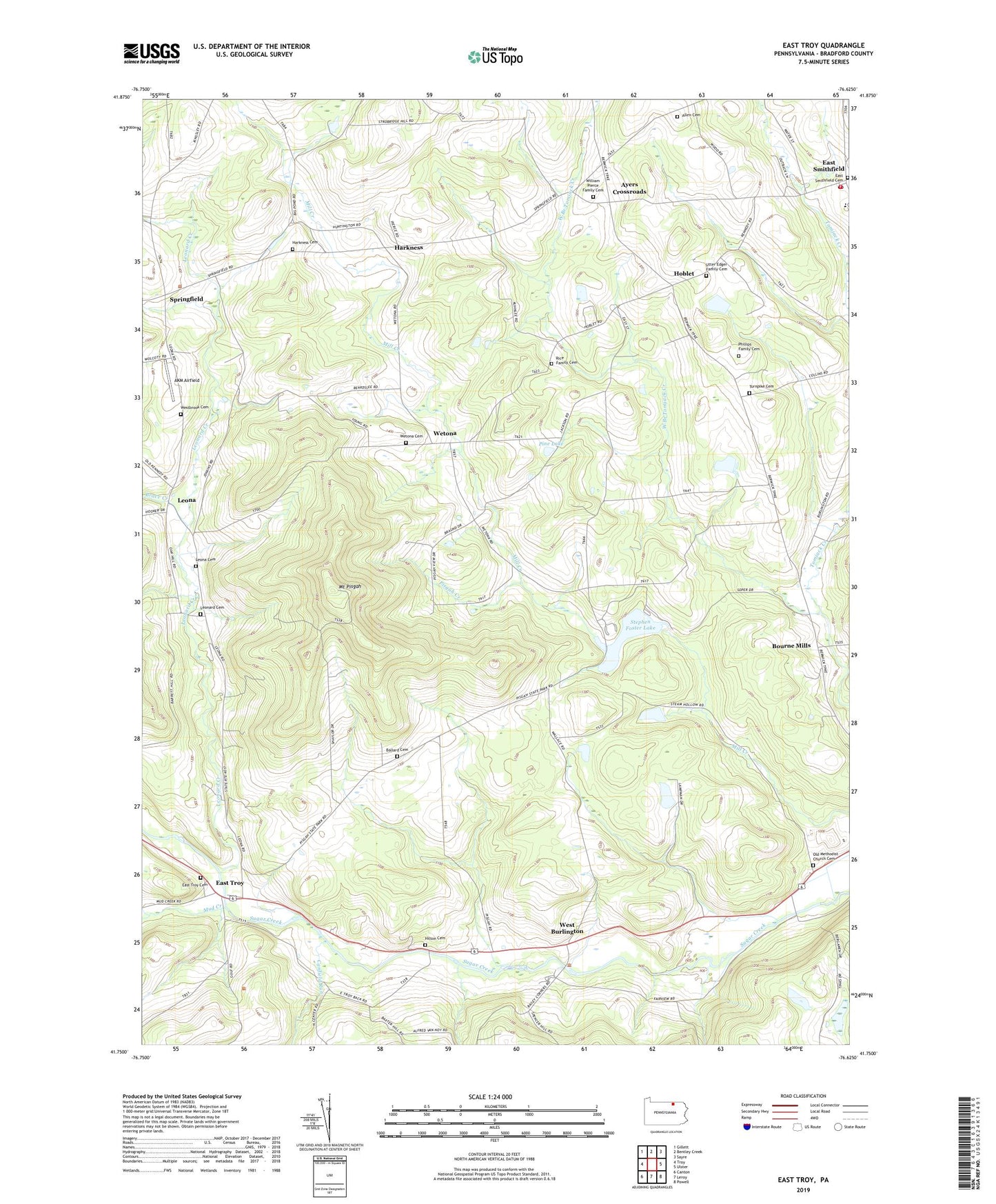
2023 topographic map quadrangle East Troy in the state of Pennsylvania. Scale: 1:24000. Based on the newly updated USGS 7.5' US Topo map series, this map is in the following counties: Bradford. The map contains contour data, water features, and other items you are used to seeing on USGS maps, but also has updated roads and other features. This is the next generation of topographic maps. Printed on high-quality waterproof paper with UV fade-resistant inks.
Quads adjacent to this one:
West: Troy
Northwest: Gillett
North: Bentley Creek
Northeast: Sayre
East: Ulster
Southeast: Powell
South: Leroy
Southwest: Canton
This map covers the same area as the classic USGS quad with code o41076g6.
Contains the following named places: AKM Airfield, Allen Cemetery, Ayers Crossroads, Ballard Cemetery, Bourne Mills, Brace Creek, Canfield Run, East Smithfield, East Smithfield Cemetery, East Smithfield Post Office, East Troy, East Troy Cemetery, Harkness, Harkness Cemetery, Harkness School, Hilton Cemetery, Hoblet, Leona, Leona Cemetery, Leonard Cemetery, Leonard Creek, Mount Pisgah, Mount Pisgah State Park, Mud Creek, Old Methodist Church Cemetery, Phillips Family Cemetery, Pine Lake, Pisgah Creek, Rice Family Cemetery, Smithfield Township Volunteer Fire Department, Springfield, State Game Lands Number 289, Stephen Foster Dam, Stephen Foster Lake, Township of Springfield, Township of West Burlington, Turnpike Cemetery, Utter Edger Family Cemetery, West Burlington, Westbrook Cemetery, Wetona, Wetona Cemetery, William Pierce Family Cemetery, ZIP Code: 18817