MyTopo
Honey Brook Pennsylvania US Topo Map
Couldn't load pickup availability
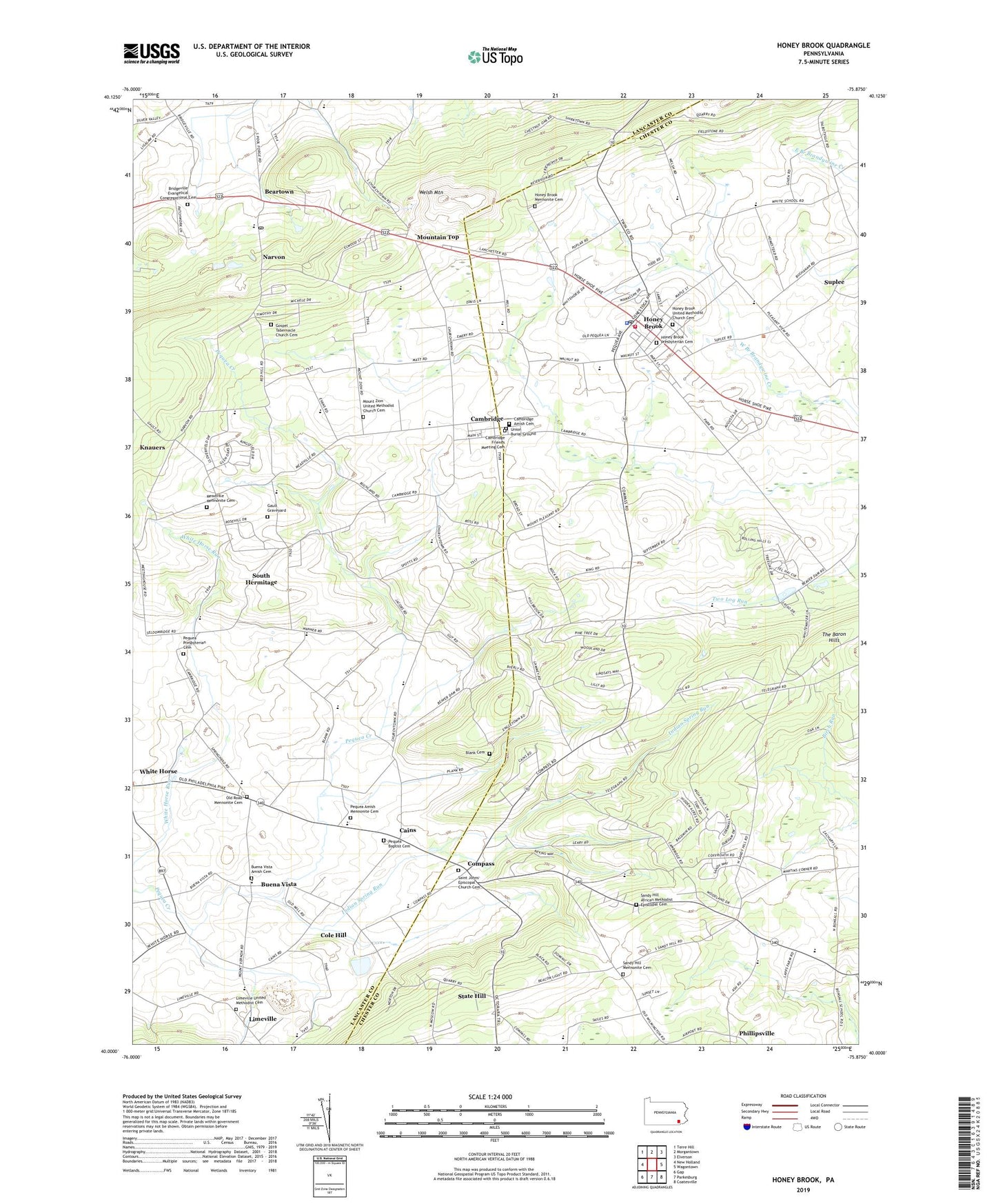
2023 topographic map quadrangle Honey Brook in the state of Pennsylvania. Scale: 1:24000. Based on the newly updated USGS 7.5' US Topo map series, this map is in the following counties: Chester, Lancaster. The map contains contour data, water features, and other items you are used to seeing on USGS maps, but also has updated roads and other features. This is the next generation of topographic maps. Printed on high-quality waterproof paper with UV fade-resistant inks.
Quads adjacent to this one:
West: New Holland
Northwest: Terre Hill
North: Morgantown
Northeast: Elverson
East: Wagontown
Southeast: Coatesville
South: Parkesburg
Southwest: Gap
This map covers the same area as the classic USGS quad with code o40075a8.
Contains the following named places: Beartown, Beartown Post Office, Blank Cemetery, Borough of Honey Brook, Bridgeville Church, Bridgeville Evangelical Congregational Cemetery, Buchland School, Buena Vista, Buena Vista Amish Cemetery, Cains, Cains Post Office, Cambridge, Cambridge Amish Cemetery, Cambridge Friends Meeting Cemetery, Cambridge Meeting Cemetery, Cambridge Post Office, Cole Hill, Compass, Compass School, Gault Graveyard, Gospel Tabernacle Church Cemetery, Honey Brook, Honey Brook Ambulance, Honey Brook Borough Police Department, Honey Brook Fire Company Station 33, Honey Brook Mennonite Cemetery, Honey Brook Post Office, Honey Brook Presbyterian Cemetery, Honey Brook Quarry, Honey Brook United Methodist Church Cemetery, Indian Spring Run, Lanchester Landfill, Lapps, Limeville, Limeville United Methodist Cemetery, Meadville, Meadville Mennonite Cemetery, Meadville School, Mount Hope School, Mount Pleasant School, Mount Zion Church, Mount Zion United Methodist Church Cemetery, Mountain Top, Narvon, Narvon Post Office, Old Road Church, Old Road Mennonite Cemetery, Pequea Amish Mennonite Cemetery, Pequea Baptist Cemetery, Pequea Church, Pequea Post Office, Pequea Presbyterian Cemetery, Phillipsville, Pine Grove School, Saint Johns Church, Saint Johns Episcopal Church Cemetery, Sandy Hill African Methodist Episcopal Cemetery, Sandy Hill Church, Sandy Hill Mennonite Cemetery, Sandy Hill School, Seldomridge Farm, South Hermitage, South Hermitage Post Office, State Hill, Suplee, Tel-Hai Camp, The Baron Hills, Township of Honey Brook, Township of Salisbury, Township of West Caln, Union Burial Ground, Waterloo School, Welsh Mountain, White Hall School, White Horse, White School, ZIP Codes: 17527, 17555, 19344