MyTopo
Karthaus Pennsylvania US Topo Map
Couldn't load pickup availability
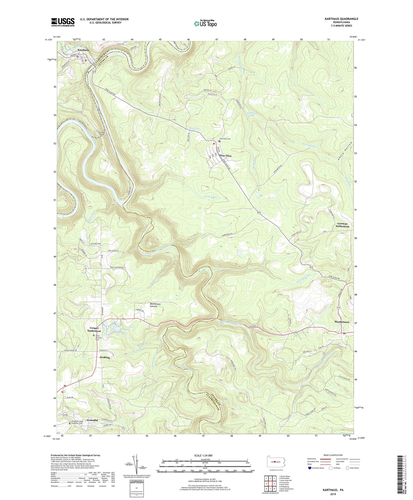
2019 topographic map quadrangle Karthaus in the state of Pennsylvania. Scale: 1:24000. Based on the newly updated USGS 7.5' US Topo map series, this map is in the following counties: Centre, Clearfield. The map contains contour data, water features, and other items you are used to seeing on USGS maps, but also has updated roads and other features. This is the next generation of topographic maps. Printed on high-quality waterproof paper with UV fade-resistant inks.
Quads adjacent to this one:
West: Frenchville
Northwest: Devils Elbow
North: Pottersdale
Northeast: Snow Shoe NW
East: Snow Shoe
Southeast: Bear Knob
South: Black Moshannon
Southwest: Philipsburg
Contains the following named places: Akely Hollow, Ames Run, Belford Number 3 Mine Station, Big Sterling Spring, Black Moshannon Creek, Boake Run, Confer Quarry, Cooper Settlement, Crawford Run, Curleys Run, Drifting, Drifting Post Office, German School, German Settlement, German Settlement School, Grassflat, Grassflat Census Designated Place, Grassflat Lanse Lutheran Cemetery, Grassflat Volunteer Fire Company Station 19, Karthaus, Karthaus Ambulance Service Station 20, Karthaus Post Office, Karthaus Tunnel, Karthaus Volunteer Fire Company Station 20, Laurel Run, Laurel Run School, Lower Star School, Miles Run, Moshannon, Moshannon Census Designated Place, Moshannon Creek, Moshannon Post Office, Moshannon Summit, Mosquito Creek, Mount Carmel Number 2 Mine Station, Mountain Top Airport, Old Star School, Pine Glen, Pine Glen Cemetery, Pine Glen Census Designated Place, Pine Glen Volunteer Fire Company 17, Redlick Run, Rock Run, Rupley Run, Saint Severins Cemetery, Sevenmile Run, State Game Lands Number 100, Township of Cooper, Weber Run, ZIP Codes: 16834, 16839, 16845, 16859