MyTopo
Bear Knob Pennsylvania US Topo Map
Couldn't load pickup availability
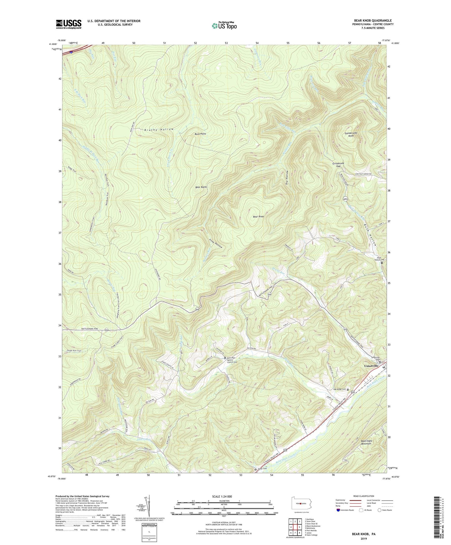
2023 topographic map quadrangle Bear Knob in the state of Pennsylvania. Scale: 1:24000. Based on the newly updated USGS 7.5' US Topo map series, this map is in the following counties: Centre. The map contains contour data, water features, and other items you are used to seeing on USGS maps, but also has updated roads and other features. This is the next generation of topographic maps. Printed on high-quality waterproof paper with UV fade-resistant inks.
Quads adjacent to this one:
West: Black Moshannon
Northwest: Karthaus
North: Snow Shoe
Northeast: Snow Shoe SE
East: Bellefonte
Southeast: State College
South: Julian
Southwest: Port Matilda
This map covers the same area as the classic USGS quad with code o40077h8.
Contains the following named places: Bear Knob, Bear Rocks, Belleview School, Birch Lick Run, Borough of Unionville, Brushy Hollow, Buck Point, Bush Hollow Cemetery, Bush Hollow Church, Dicks Run, Dick's Run Advent Church Cemetery, Dicks Run Church, Dry Hollow, Eagle Creek, Eagle Creek Census Designated Place, Eagle Ridge Gliderport, Fleming Post Office, Foxy Hollow, Ganderstep Knob, Grindstone Gap, Julian Cemetery, North Branch Wallace Run, Oak Ridge Cemetery, Rattlesnake Mountain Farm, Ridge Soaring Airport, Rock Cabin Run, State Game Lands Number 103, Township of Union, Unionville, Unionville Cemetery, WGMR-FM (Tyrone), Whetstone Run, ZIP Codes: 16835, 16844, 16874