MyTopo
Kingwood Pennsylvania US Topo Map
Couldn't load pickup availability
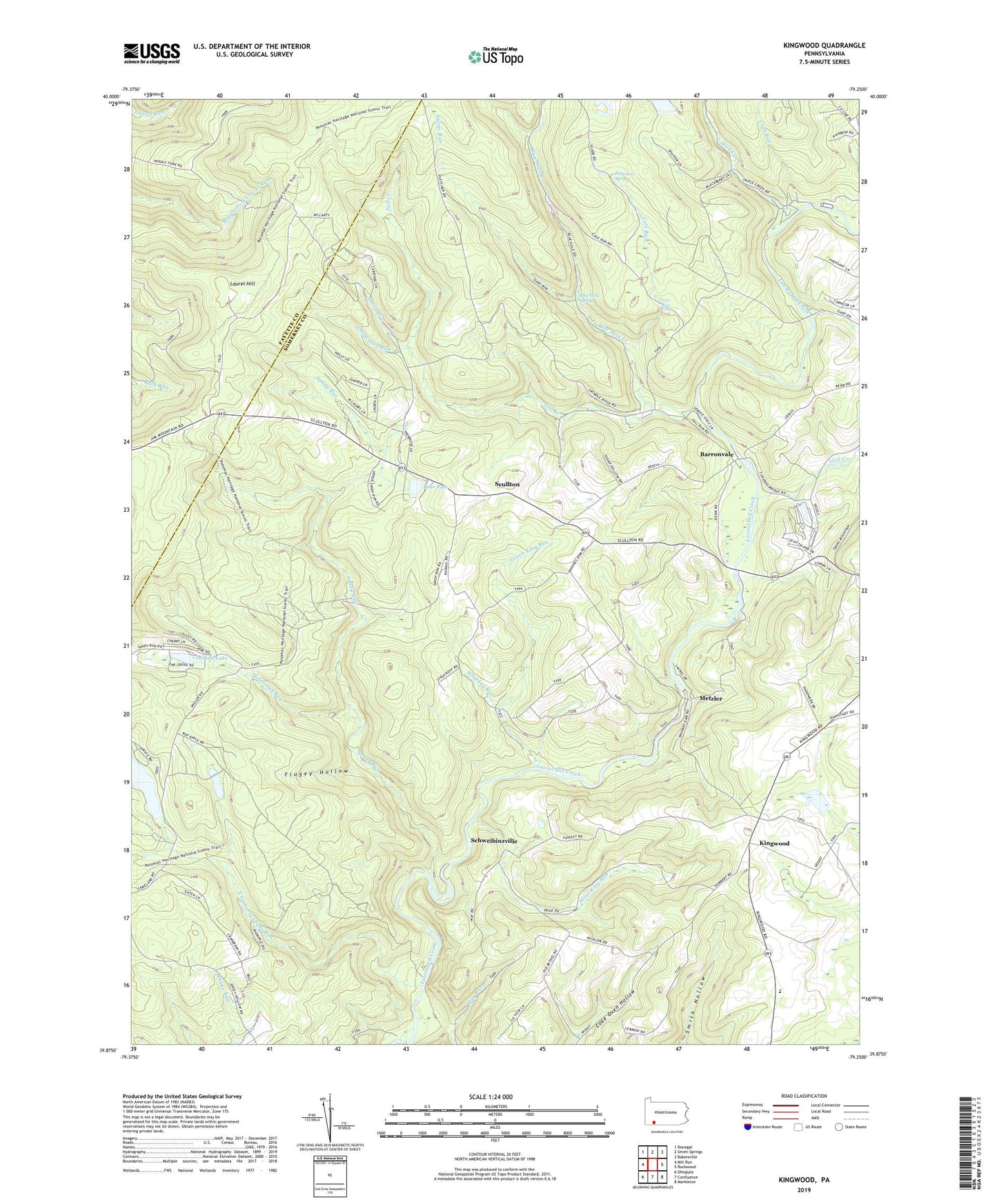
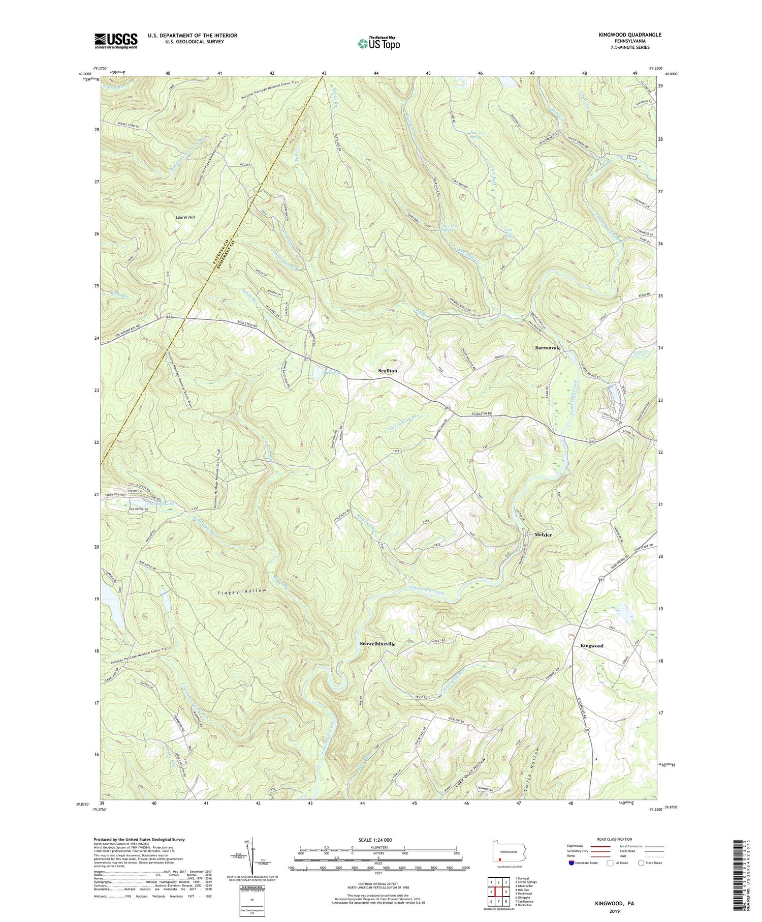
2019 topographic map quadrangle Kingwood in the state of Pennsylvania. Scale: 1:24000. Based on the newly updated USGS 7.5' US Topo map series, this map is in the following counties: Somerset, Fayette. The map contains contour data, water features, and other items you are used to seeing on USGS maps, but also has updated roads and other features. This is the next generation of topographic maps. Printed on high-quality waterproof paper with UV fade-resistant inks.
Quads adjacent to this one:
West: Mill Run
Northwest: Donegal
North: Seven Springs
Northeast: Bakersville
East: Rockwood
Southeast: Markleton
South: Confluence
Southwest: Ohiopyle
Contains the following named places: Allen Creek, Ansell Run, Barron Church, Barronvale, Blue Hole, Blue Hole Creek, Blue Hole Spring, Clairton Lake, Cole Run, Cole Run Falls, Crab Run, Cranberry Glade Dam, Cranberry Glade Lake, Cranberry Glade Run, Fall Creek, Flugey Hollow, Garys Run, Green King Run, Harbaugh Run, Harbaugh School, Hillview Church, King School, Kings Bridge, Kings Mountain Country Club, Kingwood, Kingwood School, Lake Pyle, Laural Ridge State Park, Lost Creek, Metzler, Mose King Run, Old Bethel Church, Paterson Spring, Sandy Run, Schweibinzville, Scullton, Showman Run, Township of Middlecreek, Township of Upper Turkeyfoot, Wesley Chapel, Whipkey Dam, Whipkey Run