MyTopo
Ohiopyle Pennsylvania US Topo Map
Couldn't load pickup availability
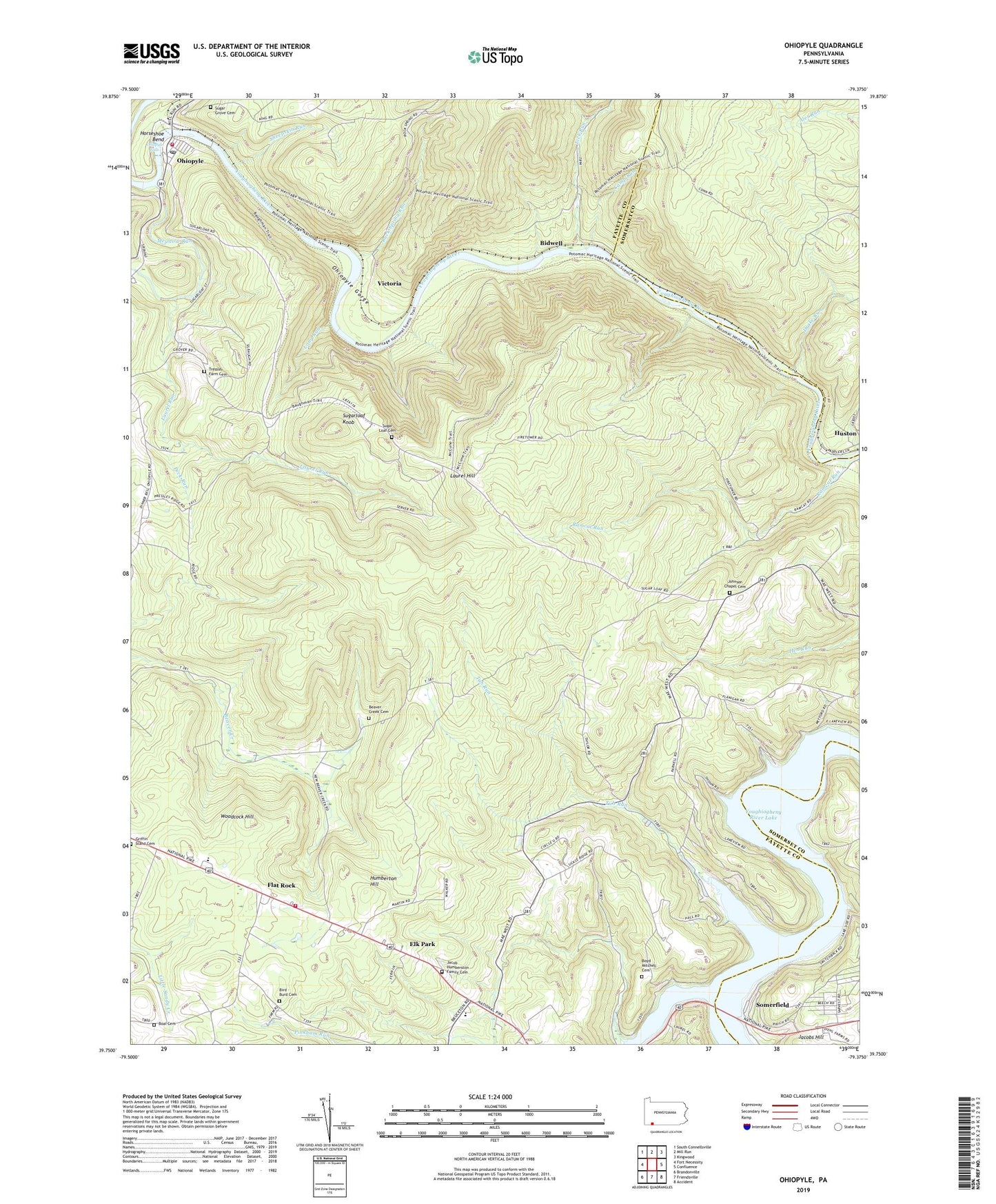
2023 topographic map quadrangle Ohiopyle in the state of Pennsylvania. Scale: 1:24000. Based on the newly updated USGS 7.5' US Topo map series, this map is in the following counties: Fayette, Somerset. The map contains contour data, water features, and other items you are used to seeing on USGS maps, but also has updated roads and other features. This is the next generation of topographic maps. Printed on high-quality waterproof paper with UV fade-resistant inks.
Quads adjacent to this one:
West: Fort Necessity
Northwest: South Connellsville
North: Mill Run
Northeast: Kingwood
East: Confluence
Southeast: Accident
South: Friendsville
Southwest: Brandonville
This map covers the same area as the classic USGS quad with code o39079g4.
Contains the following named places: Beaver Creek Cemetery, Beaver Creek School, Bidwell, Bidwell Station, Bidwell Station Run, Bird - Burd Cemetery, Boal Cemetery, Boal School, Borough of Ohiopyle, Boyd Mitchell Cemetery, Camp Run, Drake Run, Elk Park, Flanigan School, Flat Rock, Grace Church, Griffin Stand Cemetery, Hall Run, Horseshoe Bend, Humberton Hill, Huston, Jacob Humberston Family Cemetery, Jacobs Hill, Johnson Chapel, Johnson Chapel Cemetery, Laurel Run, Lick Run, Long Run, Marclay Community Ambulance Service, Marclay School, Markleysburg Henry Clay Volunteer Fire Department Station 27 Substation, Meadow Run, Oak Grove School, Ohiopyle, Ohiopyle Falls, Ohiopyle Gorge, Ohiopyle Post Office, Ohiopyle State Park, Ohiopyle Stewart Volunteer Fire Department Station 31, Peck Run, Pike School, Ramcat Run, Rock Spring Run, Rock Spring School, Rockville School, Sheepskin Run, Sickle Ridge School, Somerfield, State Game Lands Number 111, State Game Lands Number 265, Sugar Grove Cemetery, Sugar Loaf Cemetery, Sugarloaf Chapel, Sugarloaf Fire Tower, Sugarloaf Knob, Township of Henry Clay, Tressler Farm Cemetery, Tub Run, Union Chapel, Victoria, Woodcock Hill, ZIP Code: 15459