MyTopo
Kunkletown Pennsylvania US Topo Map
Couldn't load pickup availability
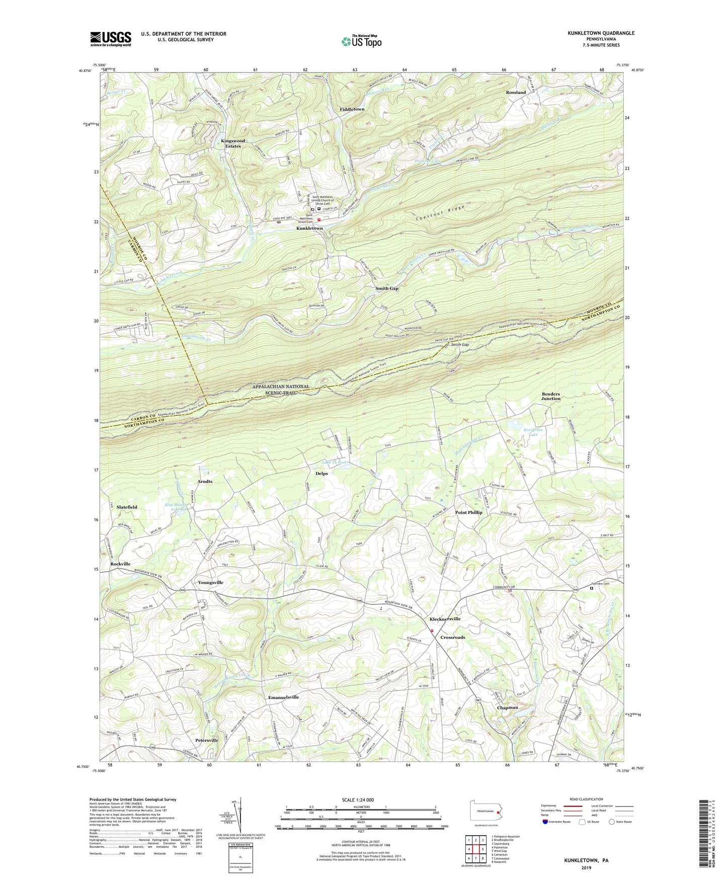
2019 topographic map quadrangle Kunkletown in the state of Pennsylvania. Scale: 1:24000. Based on the newly updated USGS 7.5' US Topo map series, this map is in the following counties: Northampton, Monroe, Carbon. The map contains contour data, water features, and other items you are used to seeing on USGS maps, but also has updated roads and other features. This is the next generation of topographic maps. Printed on high-quality waterproof paper with UV fade-resistant inks.
Quads adjacent to this one:
West: Palmerton
Northwest: Pohopoco Mountain
North: Brodheadsville
Northeast: Saylorsburg
East: Wind Gap
Southeast: Nazareth
South: Catasauqua
Southwest: Cementon
Contains the following named places: Arndts, Barlietz School, Benders Junction, Blue Mount Lake, Borough of Chapman, Castle Garden, Chapman, Chapple Creek, Chestnut Ridge, Christ Church, Christmans School, Crossroads, Delps, Eldred Township Elementary School, Emanuelsville, Evergreen Lake, Fairview Cemetery, Fiddletown, Frantz School, Frantzs Creek, Kingswood Estates, Klecknersville, Klecknersville Rangers Volunteer Fire Company Station 48, Kunkletown, Kunkletown Post Office, Kunkletown Volunteer Fire Company Station 28, Lake Tu Peek, Moore Township Elementary School, Peters School, Petersville, Pine Creek, Plainview Park, Point Phillip, Princess Lake, Princess Run, Rockville, Rossland, Saint Joseph School, Saint Matthews Church, Saint Matthews Union Cemetery, Saint Matthews United Church of Christ Cemetery, Salem Church, Schall School, Siegfried School, Slatefield, Smith Gap, Smith Gap School, State Game Lands Number 168, Steckel School, Summit, Township of Eldred, Township of Moore, Water Supply Dam, Youngsville, Zion Church, ZIP Codes: 18014, 18038