MyTopo
Laceyville Pennsylvania US Topo Map
Couldn't load pickup availability
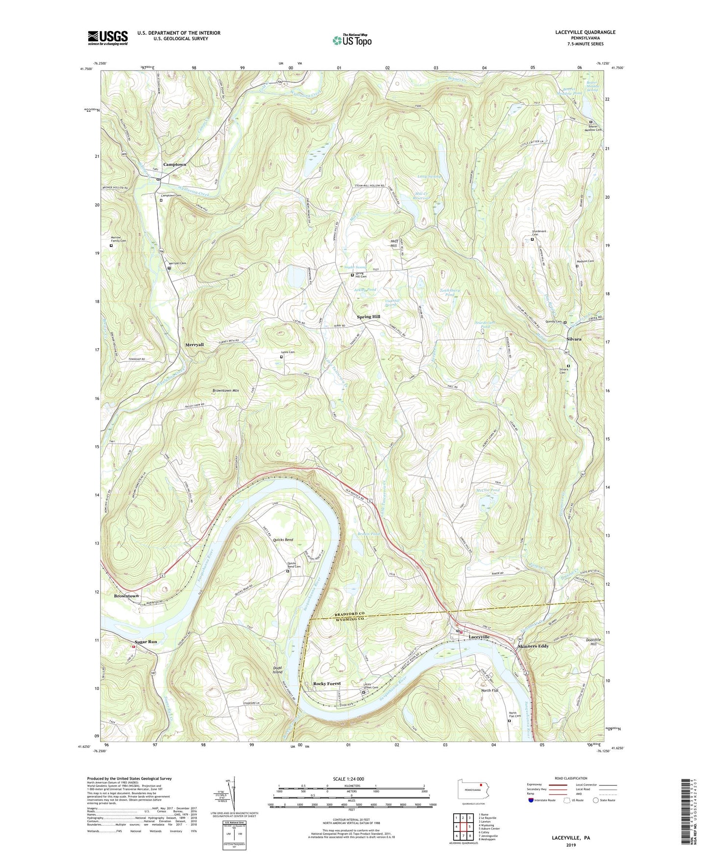
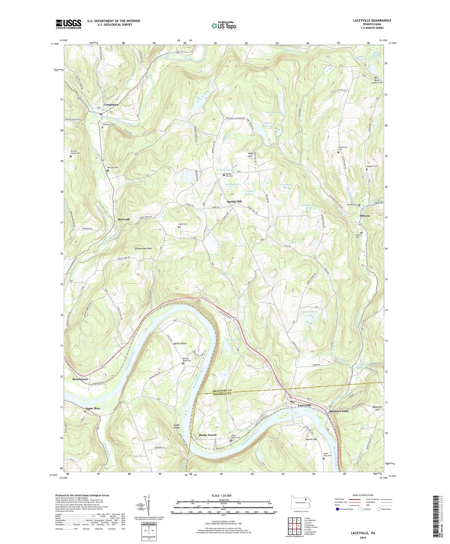
2019 topographic map quadrangle Laceyville in the state of Pennsylvania. Scale: 1:24000. Based on the newly updated USGS 7.5' US Topo map series, this map is in the following counties: Bradford, Wyoming. The map contains contour data, water features, and other items you are used to seeing on USGS maps, but also has updated roads and other features. This is the next generation of topographic maps. Printed on high-quality waterproof paper with UV fade-resistant inks.
Quads adjacent to this one:
West: Wyalusing
Northwest: Rome
North: Le Raysville
Northeast: Lawton
East: Auburn Center
Southeast: Meshoppen
South: Jenningsville
Southwest: Colley
Contains the following named places: Ackley Pond, Beaver Meadow Cemetery, Beaver Meadow Pond, Beaver Meadow Swamp, Bennet Creek, Billings Creek, Borough of Laceyville, Brown Pond, Browntown, Browntown Mountain, Camps Creek, Camptown, Camptown Cemetery, Camptown Post Office, Chamberlain Pond Dam, Cold Creek, Dodd Island, Doolittle Hill, Dug Road Creek, Edingers School, Fargo Creek, Goodwill Fire Company Number 5, Huff Hill, Lacey Street Cemetery, Laceyville, Laceyville Post Office, Little Tuscarora Creek, Long Swamp, Lyons Cemetery, Madison Cemetery, McCloe Pond, Merryall, Merryall Cemetery, Mill Creek, Mill Creek Dam, Mill Creek Reservoir, Morrow Family Cemetery, North Flat, North Flat Cemetery, Patton Creek, Quicks Bend, Quicks Bend Cemetery, Quimby Cemetery, Rocky Forest, Rocky Forest Creek, Silvara, Silvara Cemetery, Skinners Eddy, Snyder Swamp, Spring Hill, Spring Hill Cemetery, Spring Hill School, Sturdevant Cemetery, Sturdevant Pond, Sugar Run, Sugar Run Creek, Tewksbury Pond, Township of Braintrim, Township of Tuscarora, Transue Creek, Tuscarora Creek, Underhill Swamp, Wilmot Fire Company Station 27, ZIP Code: 18623