MyTopo
Wyalusing Pennsylvania US Topo Map
Couldn't load pickup availability
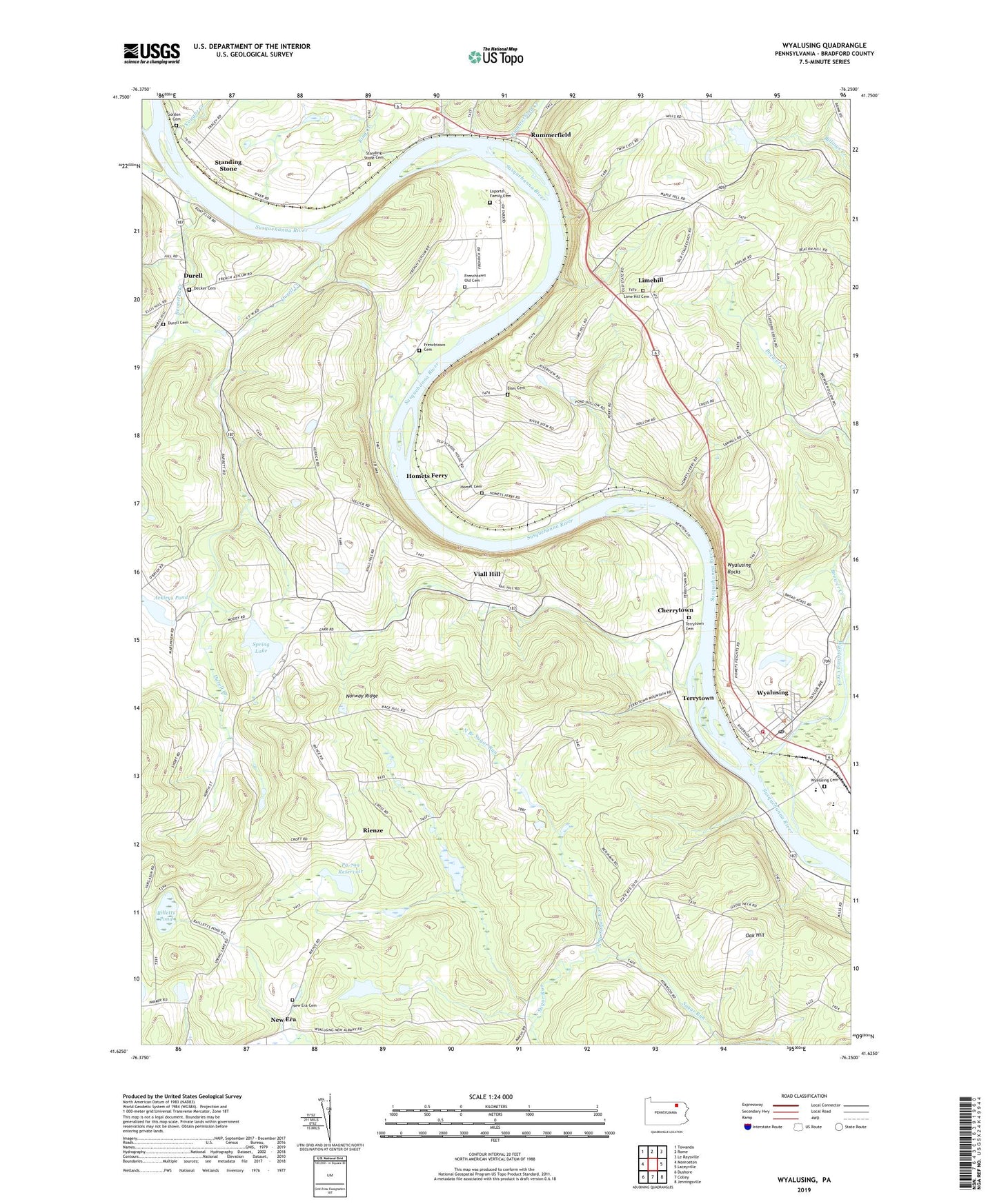
2023 topographic map quadrangle Wyalusing in the state of Pennsylvania. Scale: 1:24000. Based on the newly updated USGS 7.5' US Topo map series, this map is in the following counties: Bradford. The map contains contour data, water features, and other items you are used to seeing on USGS maps, but also has updated roads and other features. This is the next generation of topographic maps. Printed on high-quality waterproof paper with UV fade-resistant inks.
Quads adjacent to this one:
West: Monroeton
Northwest: Towanda
North: Rome
Northeast: Le Raysville
East: Laceyville
Southeast: Jenningsville
South: Colley
Southwest: Dushore
This map covers the same area as the classic USGS quad with code o41076f3.
Contains the following named places: Ackleys Pond, Asylum, Bennetts Creek, Biles Cemetery, Billetts Pond, Borough of Wyalusing, Brewer Creek, Cherrytown, Decker Cemetery, Durell, Durell Cemetery, Durell Creek, Ellis Creek, French Asylum Church, French Azilum, French Azilum Overlook, Frenchtown Cemetery, Frenchtown Old Cemetery, Gordon Cemetery, Homet Cemetery, Homets Ferry, King Creek, Laporte Family Cemetery, Lime Hill Cemetery, Limehill, New Era, New Era Cemetery, North Branch Sugar Run, Norway Ridge, Norway Ridge School, Oak Hill, Oak Hill School, Pa-798 Reservoir, Pa-799 Reservoir, Rienze, Rummerfield, Rummerfield Creek, Scriven Dam Number One, Spring Lake, Spring Lake School, Standing Stone, Standing Stone Cemetery, Standing Stone Church, State Game Lands Number 237, State Game Lands Number 250, Sugar Run Dam Number 103, Terrytown, Terrytown Cemetery, Towanda Gun Club, Township of Asylum, Township of Terry, Township of Wyalusing, Viall Hill, Vought Creek, Wellstown School, Wyalusing, Wyalusing Cemetery, Wyalusing Creek, Wyalusing Post Office, Wyalusing Rocks, Wyalusing Station, Wyalusing Valley Volunteer Fire Department, ZIP Code: 18853