
MyTopo
Lewis Run Pennsylvania US Topo Map
Couldn't load pickup availability
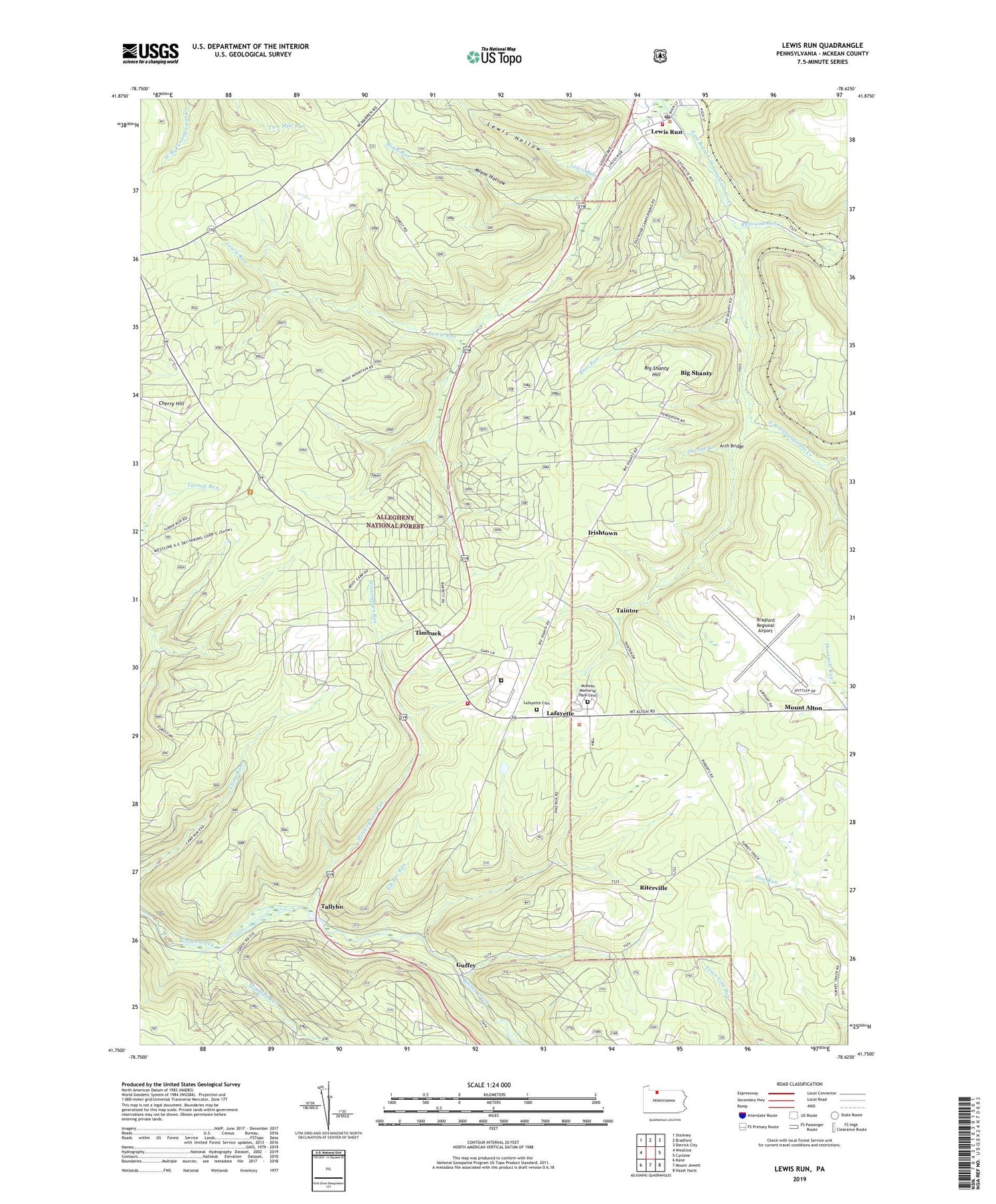
2019 topographic map quadrangle Lewis Run in the state of Pennsylvania. Scale: 1:24000. Based on the newly updated USGS 7.5' US Topo map series, this map is in the following counties: McKean. The map contains contour data, water features, and other items you are used to seeing on USGS maps, but also has updated roads and other features. This is the next generation of topographic maps. Printed on high-quality waterproof paper with UV fade-resistant inks.
Quads adjacent to this one:
West: Westline
Northwest: Stickney
North: Bradford
Northeast: Derrick City
East: Cyclone
Southeast: Hazel Hurst
South: Mount Jewett
Southwest: Kane
Contains the following named places: Arch Bridge, Bear Run, Big Shanty, Big Shanty Hill, Big Shanty Station, Borough of Lewis Run, Bradford Regional Airport, Cherry Hill, Crawford Junction, Droney Run, Elk Bar Run, Federal Correctional Institution McKean, Guffey, Irishtown, Kennedy Springs Picnic Area, Lafayette, Lafayette Cemetery, Lafayette Township Volunteer Fire and Rescue Station - 21, Lewis Hollow, Lewis Run, Lewis Run Oil Field, Lewis Run Post Office, Lewis Run Volunteer Fire Department - Station 6, Marshburg Oil Field, McKean Memorial Park Cemetery, Miam Hollow, Miam Run, Mount Alton, Music Mountain Oil Field, Olivedale, Orange Creek, Pine Acres Golf Course, Pine Run, Railroad Run, Riderville Station, Riterville, Ryan School, School Number 3, State Game Lands Number Sixty Two, Taintor, Tallyho, Taylor, Timbuck, Town Line Run, Township of Lafayette, Windfall Run, Wintergreen Run, ZIP Code: 16738


