MyTopo
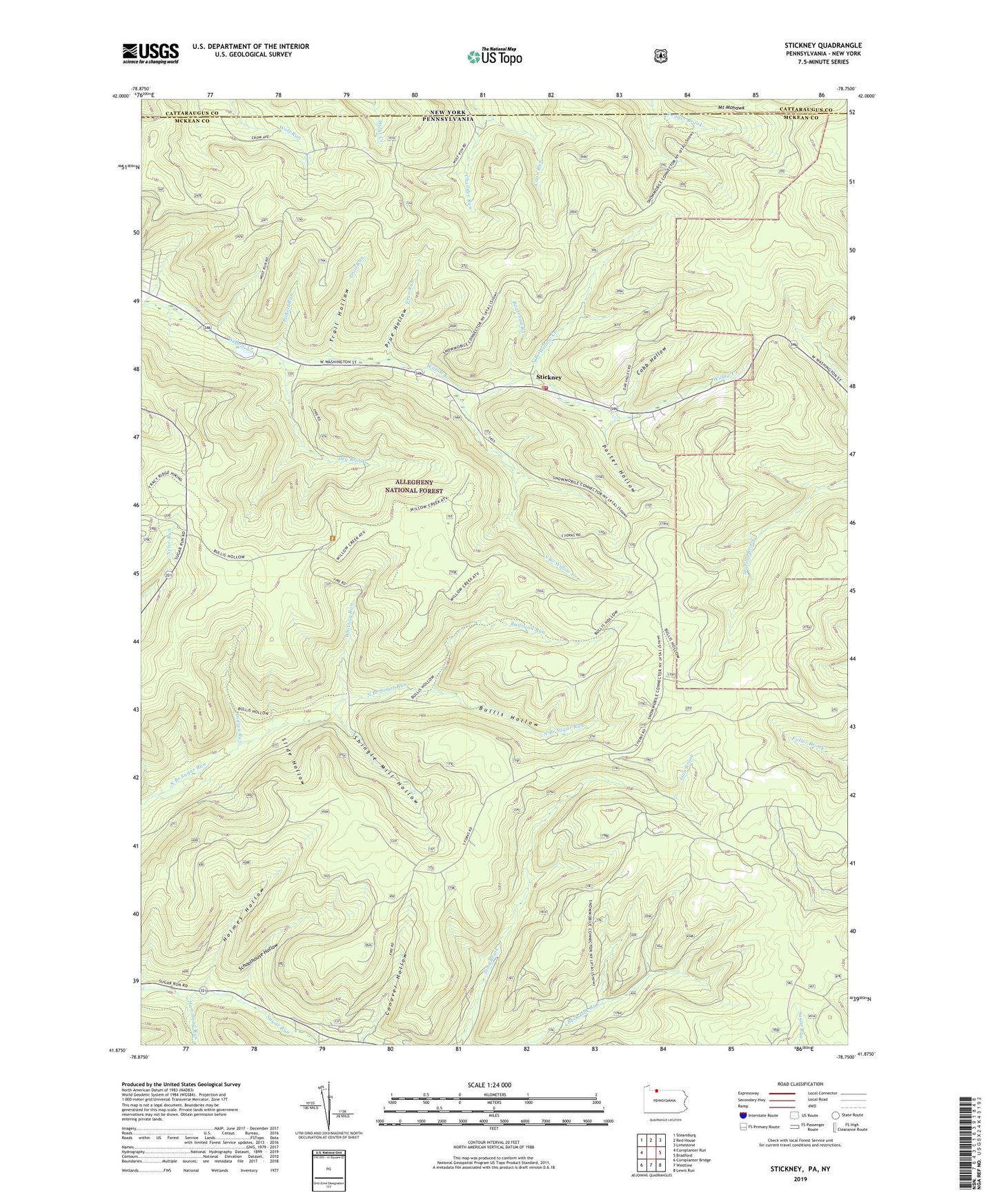
Stickney Pennsylvania US Topo Map
Couldn't load pickup availability
Also explore the Stickney Forest Service Topo of this same quad for updated USFS data
2023 topographic map quadrangle Stickney in the state of Pennsylvania. Scale: 1:24000. Based on the newly updated USGS 7.5' US Topo map series, this map is in the following counties: McKean, Cattaraugus. The map contains contour data, water features, and other items you are used to seeing on USGS maps, but also has updated roads and other features. This is the next generation of topographic maps. Printed on high-quality waterproof paper with UV fade-resistant inks.
Quads adjacent to this one:
West: Cornplanter Run
Northwest: Steamburg
North: Red House
Northeast: Limestone
East: Bradford
Southeast: Lewis Run
South: Westline
Southwest: Cornplanter Bridge
This map covers the same area as the classic USGS quad with code o41078h7.
Contains the following named places: Boatroad Run, Bullis Hollow, Chander Run, Cobb Hollow, Conover Hollow, Corydon Township Volunteer Fire Department - Station 19, Dry Brook, Hammond Run, Holmes Hollow, Indian Run, North Branch Willow Creek, Pickett Run, Porter Hollow, Prue Hollow, Prue Run, Railroad Run, Schoolhouse Hollow, Shingle Mill Hollow, Slide Hollow, South Branch Willow Creek, Stickney, Township of Corydon, Trail Hollow, Trail Run, Whitney Run, ZIP Code: 16701