MyTopo
Litchfield Pennsylvania US Topo Map
Couldn't load pickup availability
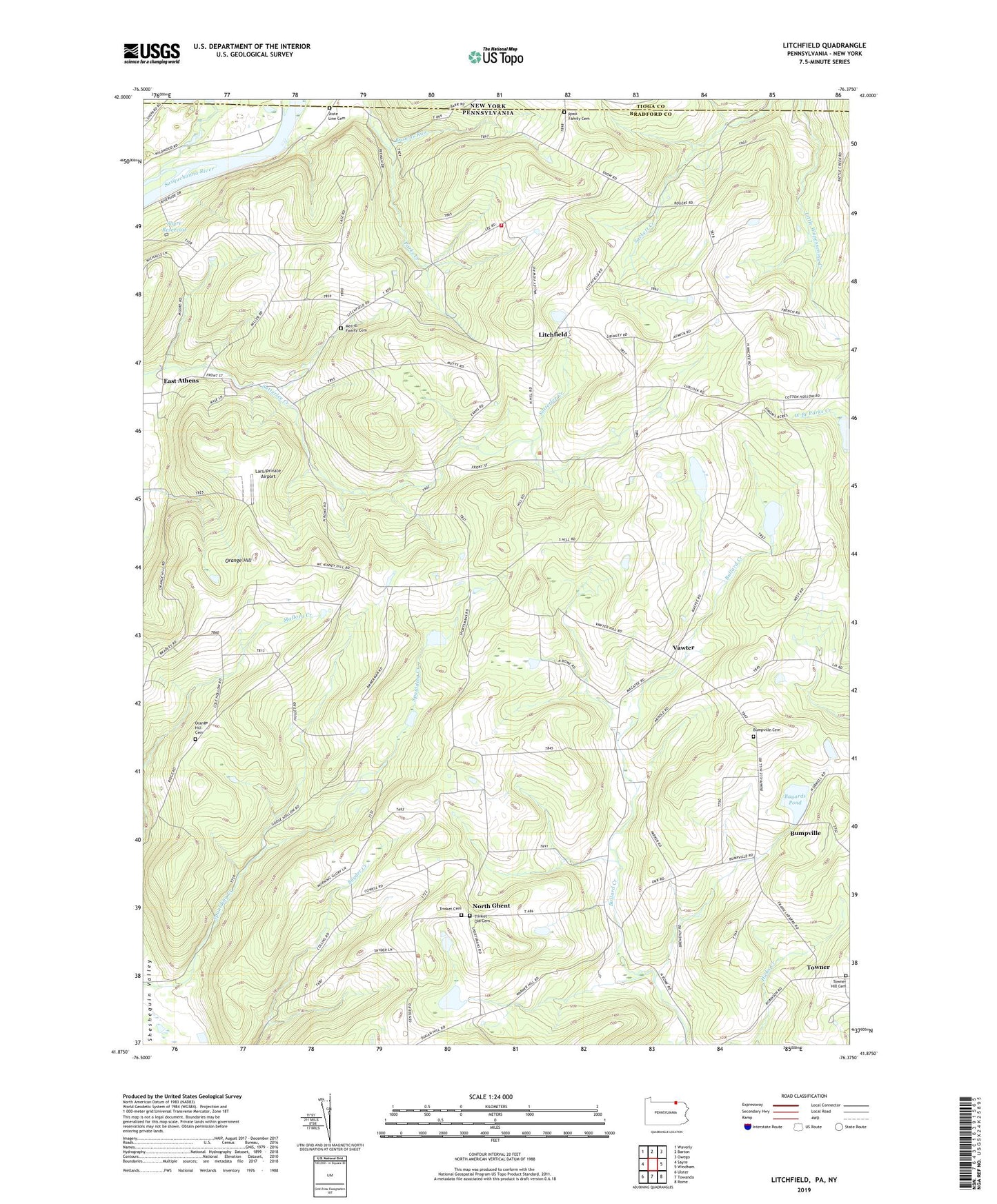
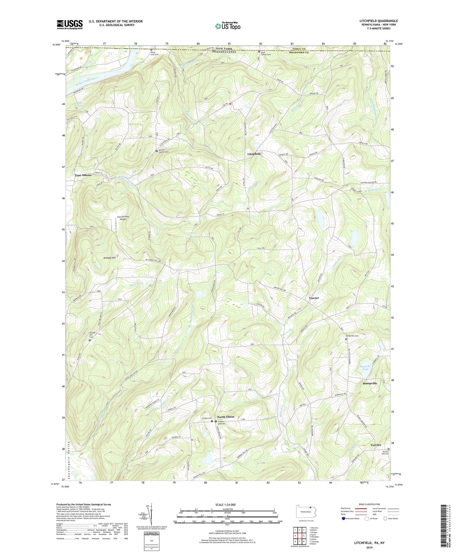
2019 topographic map quadrangle Litchfield in the state of Pennsylvania. Scale: 1:24000. Based on the newly updated USGS 7.5' US Topo map series, this map is in the following counties: Bradford, Tioga. The map contains contour data, water features, and other items you are used to seeing on USGS maps, but also has updated roads and other features. This is the next generation of topographic maps. Printed on high-quality waterproof paper with UV fade-resistant inks.
Quads adjacent to this one:
West: Sayre
Northwest: Waverly
North: Barton
Northeast: Owego
East: Windham
Southeast: Rome
South: Towanda
Southwest: Ulster
Contains the following named places: Bayards Pond, Browns Run, Bumpville, Bumpville Cemetery, Campbell School, Chapman School, Cottonhollow School, Cottons Corners, Flower Creek, Lars/Private Airport, Litchfield, Litchfield Township Volunteer Fire Company Station 26, Merrill Family Cemetery, Merrill School, North Ghent, Orange Hill, Orange Hill Cemetery, Perry School, Randolph School, Rossi Family Cemetery, Sayre Reservoir, State Line Cemetery, Tioga Valley, Towner, Towner Hill Cemetery, Township of Litchfield, Trinket Cemetery, Trinket Old Cemetery, Vawter, White School