MyTopo
Windham Pennsylvania US Topo Map
Couldn't load pickup availability
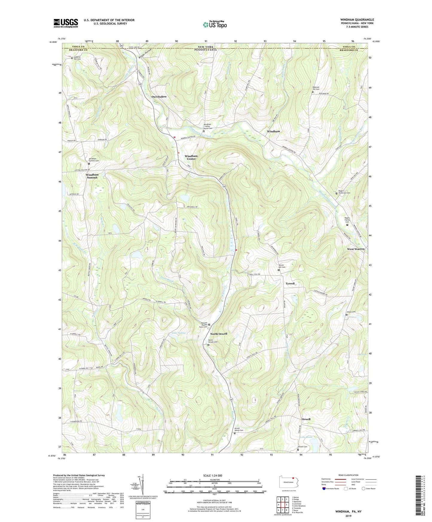
2023 topographic map quadrangle Windham in the states of Pennsylvania, New York. Scale: 1:24000. Based on the newly updated USGS 7.5' US Topo map series, this map is in the following counties: Bradford, Tioga. The map contains contour data, water features, and other items you are used to seeing on USGS maps, but also has updated roads and other features. This is the next generation of topographic maps. Printed on high-quality waterproof paper with UV fade-resistant inks.
Quads adjacent to this one:
West: Litchfield
Northwest: Barton
North: Owego
Northeast: Apalachin
East: Little Meadows
Southeast: Le Raysville
South: Rome
Southwest: Towanda
This map covers the same area as the classic USGS quad with code o41076h3.
Contains the following named places: Babcock Hill Cemetery, Babcock Run, Bixby Corner, Briggs Hollow, Cold Brook, Gooseberry Run, Jillson Cemetery, Lake Bonin, Lake Nadine, Little Falls Creek, North Orwell, North Orwell Cemetery, Orwell, Orwell Cemetery, Orwell Valley Cemetery, Osborne Hill Cemetery, Owl Hollow, Prince Hollow Run, Ransom School, Rogers - Dickerson Cemetery, Rogers Family Cemetery, Roswell Russell Farm Cemetery, Russell Run, Russellville, Spring Run, State Game Lands Number 219, Township of Windham, Trout Brook, Trout Stream, Tyrrel School, Tyrrell, Tyrrell Hill Cemetery, Union Valley Church, Valley Home Cemetery, West Branch Parks Creek, West Warren, Windham, Windham Ambulance Association, Windham Center, Windham School, Windham Summit, Windham Summit Cemetery, Windham Township Volunteer Fire Company Station 19, ZIP Code: 18837