MyTopo
Ulster Pennsylvania US Topo Map
Couldn't load pickup availability
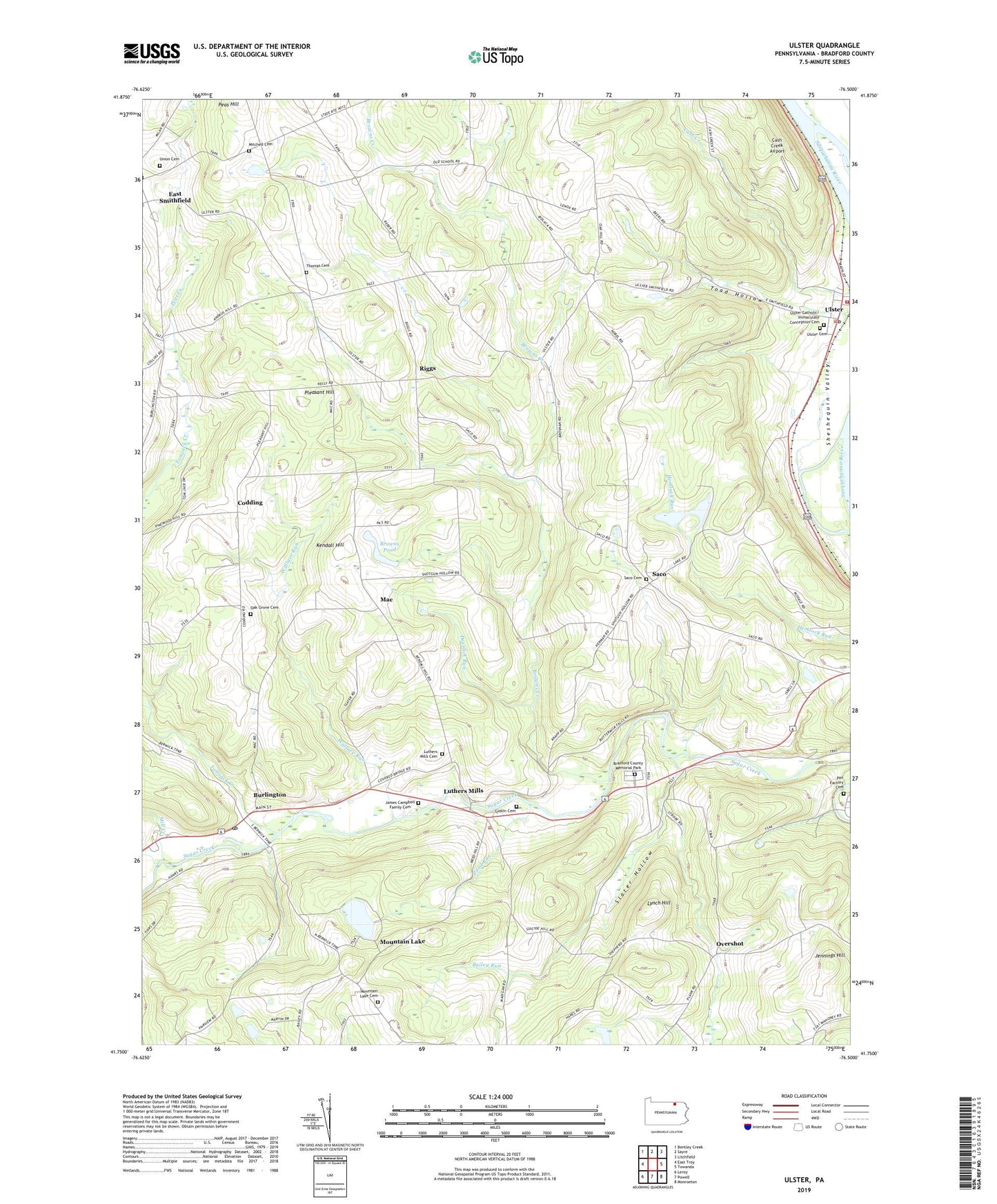
2023 topographic map quadrangle Ulster in the state of Pennsylvania. Scale: 1:24000. Based on the newly updated USGS 7.5' US Topo map series, this map is in the following counties: Bradford. The map contains contour data, water features, and other items you are used to seeing on USGS maps, but also has updated roads and other features. This is the next generation of topographic maps. Printed on high-quality waterproof paper with UV fade-resistant inks.
Quads adjacent to this one:
West: East Troy
Northwest: Bentley Creek
North: Sayre
Northeast: Litchfield
East: Towanda
Southeast: Monroeton
South: Powell
Southwest: Leroy
This map covers the same area as the classic USGS quad with code o41076g5.
Contains the following named places: Bailey Run, Borough of Burlington, Bradford County, Bradford County Home, Bradford County Memorial Park, Browns Creek, Browns Pond, Burlington, Burlington Post Office, Cash Creek Airport, Codding, Deerlick Run, Gustin Cemetery, James Campbell Family Cemetery, Jennings Hill, Kendall Hill, Luthers Mills, Luthers Mills Cemetery, Lynch Hill, Mac, Mill Creek, Mitchell Cemetery, Mountain Lake, Mountain Lake Cemetery, Mountain Lake Church, Oak Grove Cemetery, Oscoluwa Engine and Hose Company Station 2, Overshot, Pail Factory Cemetery, Peas Creek, Peas Hill, Pleasant Hill, Pond Run, Riggs, Riggs Church, Saco, Saco Cemetery, Slater Hollow, Spaulding Creek, Thomas Cemetery, Toad Hollow, Tomjack Creek, Totem Park, Township of Burlington, Township of Smithfield, Township of Ulster, Ulster, Ulster Catholic Cemetery, Ulster Cemetery, Ulster Fire Department Station 17, Ulster Post Office, Union Cemetery, Wallace Run, West Branch Tomjack Creek, ZIP Code: 18814