MyTopo
Mexico Pennsylvania US Topo Map
Couldn't load pickup availability
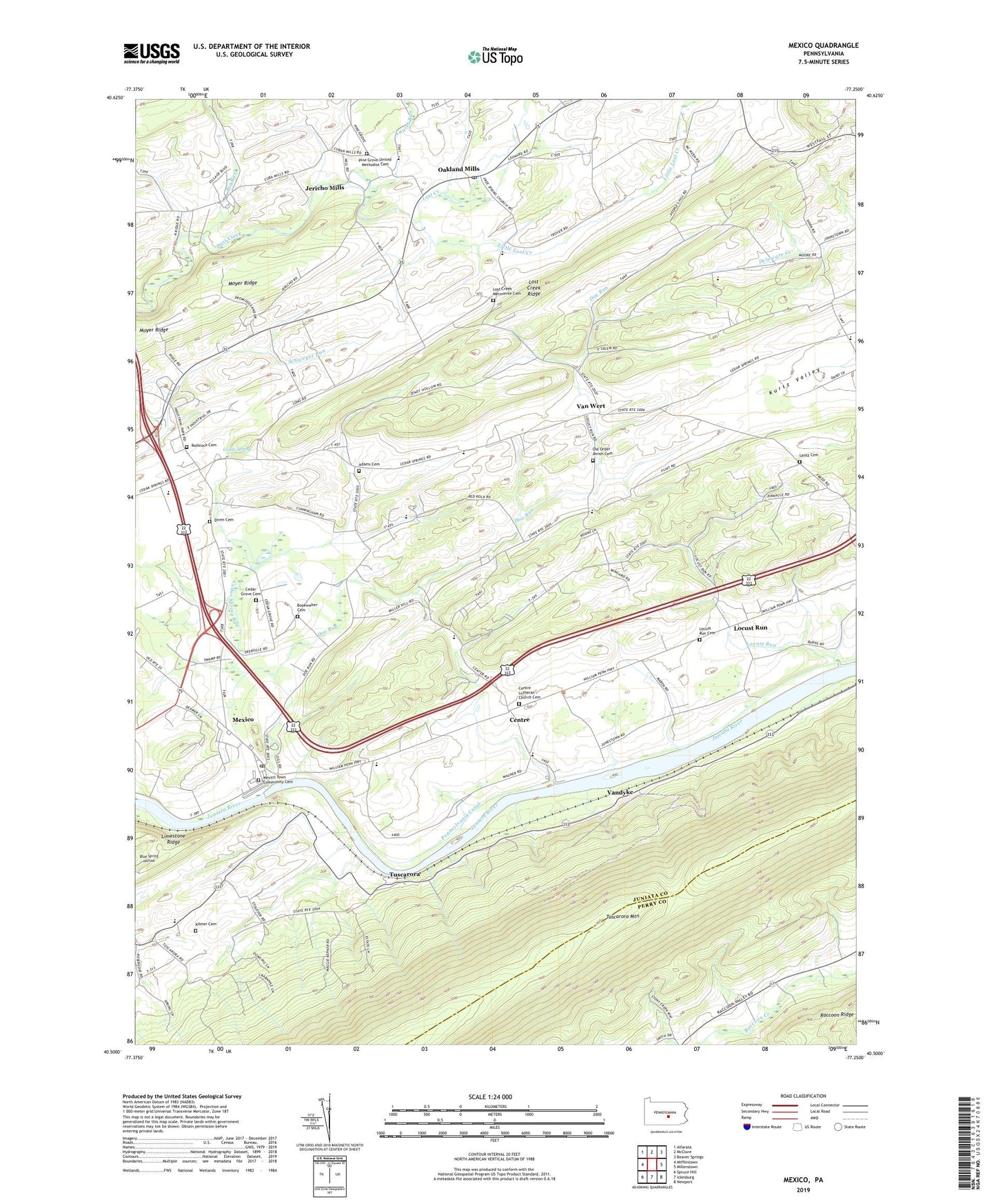
2019 topographic map quadrangle Mexico in the state of Pennsylvania. Scale: 1:24000. Based on the newly updated USGS 7.5' US Topo map series, this map is in the following counties: Juniata, Perry. The map contains contour data, water features, and other items you are used to seeing on USGS maps, but also has updated roads and other features. This is the next generation of topographic maps. Printed on high-quality waterproof paper with UV fade-resistant inks.
Quads adjacent to this one:
West: Mifflintown
Northwest: Alfarata
North: McClure
Northeast: Beaver Springs
East: Millerstown
Southeast: Newport
South: Ickesburg
Southwest: Spruce Hill
Contains the following named places: Adams Cemetery, Allen Grove Camp, Big Run, Big Run School, Bookwalter Cemetery, Cedar Grove Cemetery, Cedar Grove Church, Cedar Spring, Cedar Spring Run, Centre, Centre Lutheran Church Cemetery, Delaware School, Diven Cemetery, Doe Run, Free Spring Church, Free Spring School, Jericho Mills, Kilmer Cemetery, Kurtz Valley School, Lantz Cemetery, Laurel Run, Little Lost Creek, Locust Run, Locust Run Cemetery, Lost Creek Church, Lost Creek Golf Course, Lost Creek Mennonite Cemetery, Lost Creek Ridge, Mexico, Mexico Census Designated Place, Mexico Post Office, Mexico Town Community Cemetery, Mount Hope School, Moyer Ridge, Oakland Mills, Oakland Mills Post Office, Old Order Amish Cemetery, Olive Branch School, Pennsylvania Canal, Pine Grove Church, Pine Grove United Methodist Cemetery, Red Rock School, Rothrock Cemetery, The Pinnacle, Township of Walker, Tuscarora, Tuscarora Church, Van Wert, Vandyke, WJUN-AM (Mexico), ZIP Codes: 17056, 17076