MyTopo
Spruce Hill Pennsylvania US Topo Map
Couldn't load pickup availability
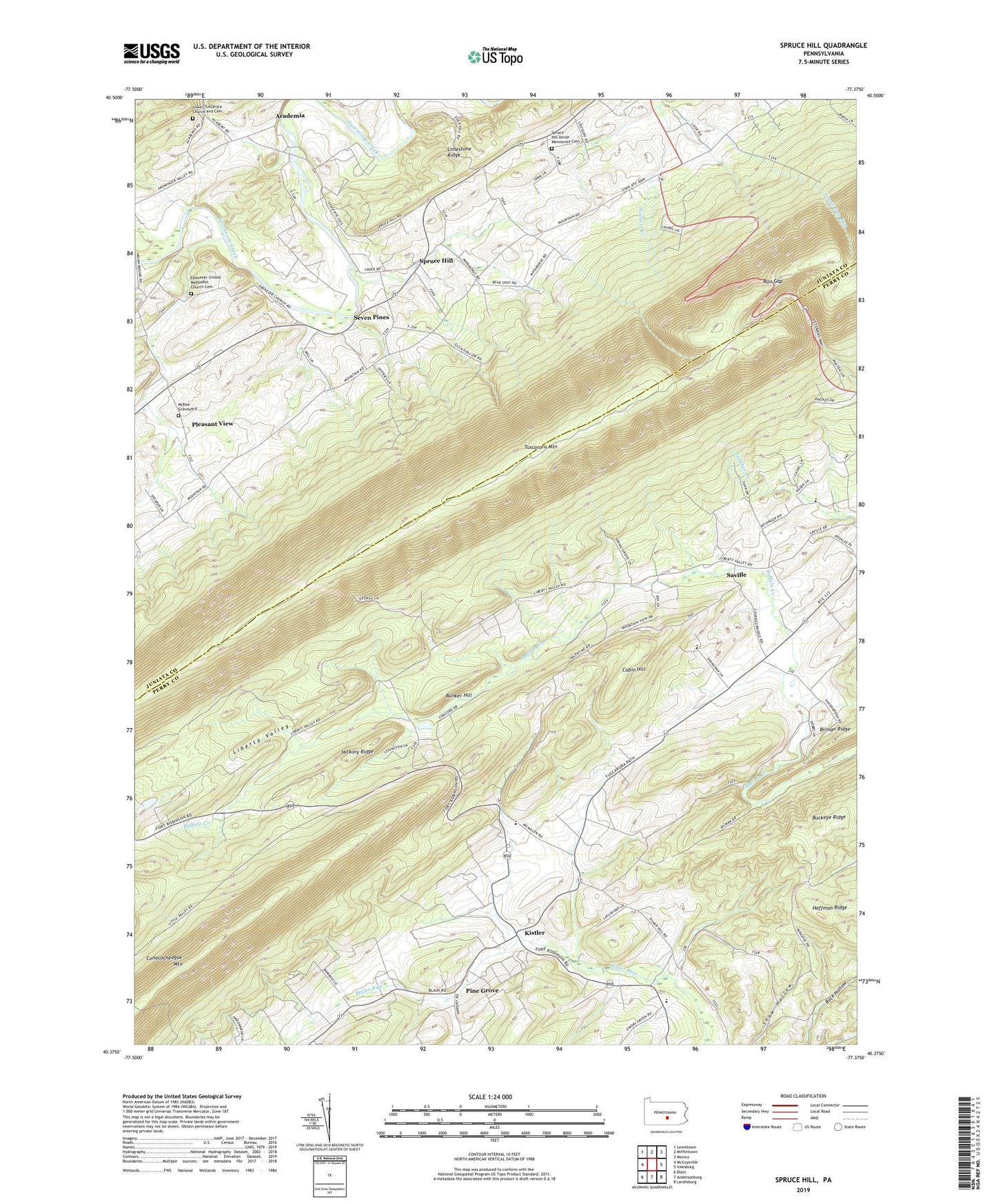
2023 topographic map quadrangle Spruce Hill in the state of Pennsylvania. Scale: 1:24000. Based on the newly updated USGS 7.5' US Topo map series, this map is in the following counties: Perry, Juniata. The map contains contour data, water features, and other items you are used to seeing on USGS maps, but also has updated roads and other features. This is the next generation of topographic maps. Printed on high-quality waterproof paper with UV fade-resistant inks.
Quads adjacent to this one:
West: McCoysville
Northwest: Lewistown
North: Mifflintown
Northeast: Mexico
East: Ickesburg
Southeast: Landisburg
South: Andersonburg
Southwest: Blain
This map covers the same area as the classic USGS quad with code o40077d4.
Contains the following named places: Academia, Academia School, Brethren in Christ Chapel, Buckeye Ridge, Bunker Hill, Cabin Hill, Center School, Doyle Run, Ebenezer Church, Ebenezer United Methodist Church Cemetery, Emanuals Reformed Church, Emory Green School, Freedom School, Hickory Ridge, Hoffman Ridge, Irvine School, Jinnie Gap Run, Kistler, Lagrange School, Liberty Valley, Lower Liberty School, Lower Tuscarora Church and Cemetery, Matamoras School and Church, McKee Graveyard, Pine Grove, Pleasant View, Run Gap, Saville, Seven Pines, Spruce Hill, Spruce Hill Amish Mennonite Cemetery, Spruce Hill School, Township of Northeast Madison, Township of Spruce Hill, Trinity Church, Tuscarora Academy Historic Site, Walsingham School, Wisdom School, Yohn Trail, ZIP Codes: 17037, 17047, 17082